I have written many pieces over the years, many of them for RPS Group Plc between 2007 and 2020. My writing has covered an incredible range of subjects - often centred around planning, construction, engineering, transport, energy, healthcare, historic conservation, safety or ecology. Some ongoing projects are ones I have returned to regularly including the Heads of the Valleys dualling project, Belfast's Titanic development, Tree Aid's revegetation projects, and Hornsea wind farm.
A few of my favourite written pieces produced for corporate promotions appear below.
A few of my favourite written pieces produced for corporate promotions appear below.

Virtual heaven as Wonderland tours joins store tomorrow (September 2020)
Imagine a virtual reality Wonderland, just ready to take you away to meet new faces and delight at eccentricities, and all without grabbing a face mask and leaving your house. This was written as an application piece. I'm very sorry to add the disclaimer that this is indeed all fantasy - just an imagined experience based on Lewis Carroll's classics. All names are fictional, but I couldn't resist including a couple of famous nods in this by mentioning a Tolkien and a Dodgson!
From tomorrow morning we can all enjoy a world of wonder as Alice’s Tours becomes live for download. Launched by White Rabbit Holidays Inc., the new app takes us down the rabbit hole and right into the heart of Wonderland.
The tour is enriched with all our favourite characters from the book and animations, and includes a range of special interactive features from Lewis Carroll’s original works. The full croquet pitch is ready – just grab your flamingo and you’re away. You can stroll along the glittering sand beside the sea of tears, visit the duchess and her porcine infant, then drop in on the Mad Hatter for tea.
Perhaps one of our most exciting features is the Drink Me section where innovative scaling technology works with your camera app to immerse you in a genuinely huge, ants-eye view of the forest where you can follow the caterpillar’s smoke trail to meet the incredible appearing and disappearing Cheshire cat.
Three years in the making, this innovative game was the brainchild of John Tolkien even before he joined White Rabbit, and was a key factor of his employment by White Rabbit CEO Uri Dodgson. Working with leading graphic designer Emilia Hyde and experience host Amal Patek the creation of Wonderland was visualised and took form, in inescapable detail for an unbeatable experience.
Visit us here for a preview of the Drink Me Shrink Me section, led by popular games expert Dexter Minegem.
Check out our dedicated review section on YouTube here.
Check out our dedicated review section on YouTube here.

Paint by numbers: RPS is first accredited to test for Chromium VI (2017)
Testing for chromium VI is not an unnecessary luxury in the inspection of engineering works.
Testing for chromium VI is not an unnecessary luxury in the inspection of engineering works.
The law does not currently require chromium VI exposure testing to be performed by an accredited laboratory. However, increasingly more clients are explicitly expressing their preference for this. RPS is the first company in the Netherlands to be accredited by the Dutch Accreditation Council for the determination of chromium VI in paint. As a result, the quality of these procedures will also be guaranteed in the future by independent external parties.
Chromium VI in the paint industry
Chromium VI has been used in the paint and steel industry for decades. This produced variant of natural chromium easily binds to all types of metals and can be processed in wood, paint, and plastic, among other things. It offers extra firmness and protection against corrosion. It is not harmful in solid form, but when it is released as a substance, even a small amount can be carcinogenic. Companies working on old metal coated with chromium VI-based paint are especially at risk.
Prohibition
The EU restricts the use of chromium VI in metal treatment; use is subject to authorisation. This will significantly reduce the quantity of chromium VI-treated products and objects on the market. However, the industry will continue to be confronted by the challenges that old chromium VI-based coatings present in the decades to come.
Companies are advised to determine whether chromium VI-based coatings have been applied to the object. RPS analysts can test samples in their own laboratories to determine the concentration of this toxic substance. Based on the results, a personal protection regime can then be put in place.
Occupational exposure
Clients who work with accredited companies are assured of proper compliance with the measurement protocols used in the exposure test. In addition to accreditation for testing for chromium VI in paint, RPS already has an accreditation for chromium VI analysis in air. An overview of the accredited operations is available at www.rva.nl (Dutch link, English language optional) under registration number L192. The limit for occupational exposure to chromium VI was reduced by a factor of 10 on 1 March 2017. This requires rigorous focus on the concentration of chromium VI in the workplace. Some of the tested workplaces, for example, must be retested against the current requirements.
Chromium VI has been used in the paint and steel industry for decades.
Publication of health effects
The National Institute for Public Health and the Environment (RIVM) has published the scientific literature review (Dutch language document) of the effects of chromium VI on human health. The RIVM examined, among other things, the diseases that are likely to be caused by chromium VI. This is an important step towards clarity for all concerned.

Desert treasure
(2011, appeared in Edie magazine - client and consultant names removed).
(2011, appeared in Edie magazine - client and consultant names removed).
[The consultant] has been working in Libya from the outset of the most recent oil and gas boom in the country, providing specialist technical advice to the international oil companies.
There are no formal guidelines for historic environment management and protection in the oil and gas industry, and Libya’s heritage boasts a complex mix of unrecorded ancient settlements and military inheritance from large scale conflict during WWII.
[The client's] seismic teams discovered a wide expanse of ancient stone structures in the Sirte Basin desert area in central northern Libya in 2007, and appointed [the consultant] to advise their exploration department on the identification, significance and sensitive handling of archaeological sites as well as specialist explosive remnants of war (ERW - landmines and unexploded ordnance) issues during operations.
The first challenge was to compile a broad overview of archaeological sensitivities using desk-based sources. In the absence of previous recorded data- remote sensing was employed using high-resolution satellite imagery to identify ancient domestic, military and trade settlements. This was just one of a number of areas where [the consultant's] archaeological and ERW teams found they were able to share technical resources to achieve their very different objectives.
[The client] had taken GPS readings and photographs in the desert to the south of the coastal belt which identified objects too small to show on the satellite imagery –including remains of prehistoric stone tools, water vessels (ostrich shells) and campfires.
Specialist geomorphologists from the Universities of Reading and London prepared a detailed reconstruction of hydrological, environmental and landscape change in the area over the past two million years to help identify these less visible sites, revealing evidence of ancient historic periods, over 5,000 years ago, when the Sirte Basin was savannah land due to higher rainfall and different drainage patterns. The information from these combined sources was put together to create 'risk maps', to guide the seismic teams.
An intensive 3D seismic survey was conducted in localised parts of the Basin during 2008-9, with [the consultant] commissioned to carry out focused assessments –informed by ground-truthing visits it made working with the Libyan Department of Antiquities (DoA), and with specialists from [the consultant's] Explosives E
ngineering team to ensure the safety of the field operations.
Conducting these surveys has meant that over 2000 archaeological sites are now recorded, where only a few had previously been observed. Traces of powerful ancient Libyan tribes described by Herodotus - such as the Nasamones and the Macae - have been recognised for the first time. Even the probable site of a 'lost' ancient town - Digdida - has been identified.
When surveying ‘Area 89’ the ERW team advised on safety matters as it was crossed by main-line WWII Italian-German defenses –containing belt minefields, barbed wire, trenches and artillery positions. RPS’ ERW expertise ensured the safety of surveyors covering the area, and the work was followed by archaeological monitoring of the 3D survey by DoA archaeologists, which identified hundreds of new sites in this area.
The assessments, and [the client's] desire to apply international environmental standards to their Libyan operations, have shown both the archaeological importance of apparently low sensitivity archaeological landscapes such as the Sirte Basin and the need for oil companies to have appropriate and proportionate strategies for identifying and minimising operational impact risks. It is an excellent example of best practice in the industry - using the latest technology, and leading the way in setting new standards.
Note: A paper presenting the results of the surveys has now been published in 'Libyan Studies' (November 2010), disseminating these results to a wider audience.


Aerial view of mountain ranges with turbines. Image by Free-Photos from Pixabay
When wind farms present a challenge (2013)
Working with nature and communities to sustain a balance of natural environment and sustainable greener energy.
[The consultant's] significant track record in expert environmental and surveying services for wind farm development in Australia is well seated – with a key project portfolio including Windy Hill: Queensland, Box Hill: Highfields, Liverpool Range: Liverpool Plains, Black Springs and the Ben Lomond and Ben Lomond North wind farms in New South Wales, Waverley wind farm in New Zealand, the World’s End farm in South Australia. Clients include Energreen, Macquarie, Allco, Epuron and RATCH[1].
[The consultant's] significant track record in expert environmental and surveying services for wind farm development in Australia is well seated – with a key project portfolio including Windy Hill: Queensland, Box Hill: Highfields, Liverpool Range: Liverpool Plains, Black Springs and the Ben Lomond and Ben Lomond North wind farms in New South Wales, Waverley wind farm in New Zealand, the World’s End farm in South Australia. Clients include Energreen, Macquarie, Allco, Epuron and RATCH[1].
Since its appointment to provide detailed survey, planning and environmental services for Windy Hill, Queensland’s first wind farm in the early 2000’s, [the consultant] is securely established as a key member of the team for a number of significant renewable energy projects in the State. As the State’s first wind farm, RATCH’s 12MW 20-turbine development presented a number of complex issues to identify and answer in terms of efficiency, environmental impact, visual effect and potential noise concerns especially.
[The consultant's] surveying services helped to determine the correct locations for each turbine at Windy Hill and arrange easements and leases, as well as inform the preparation of the lease plans – such as road closures. Its team advised on planning strategy for the wind farm and prepared the Development Application, coordinating a sub-team advising on traffic, cultural heritage and noise impacts. Together with thorough ecological field investigations and an assessment for possible transmission lines, the quality and attention to detail of these services successfully resulted in the $20m wind farm’s construction in 2009.
Located near Ravenshoe on the Atherton Tablelands, Windy Hill remains Queensland’s largest existing operational wind farm, and its privately owned site continues to operate as a dairy farm – much as it did before the wind farm’s development. Windy Hill is open to the public and attracts numerous visitors from enthusiasts to families, school trips to business visits every year.
[The consultant] is currently advising on the Mt Emerald and High Road wind farms for RATCH. The 75 turbine[2] Mt Emerald development will generate enough power to cover the annual energy usage of more than 75,000 North Queensland homes (225MW), on a 2422ha rough plateau site at Springmount near Mareeba, stretching between the towns of Walkamin and Tolga and bordered by active farmland to the north and east. For the farmland, agricultural impacts must be considered carefully, as well as potential effects from turbulence on aerial spraying operations.
The location is on the boundary of Einasleigh Uplands and the Wet Tropics Bioregions, both of which are characterized by high levels of bioregional endemic fauna species.
On site there are endangered Northern Quoll and micro/mega bat for which [the consultant] is employing detailed methodologies including collision risk modelling and habitat utilisation estimating.
The team has recently completed a detailed Environmental Protection & Biodiversity Conservation (EPBC) referral[3] and is carrying out detailed flora/fauna field investigations to establish the exact vegetation and habitats on site in wet and in dry seasons, to plan for their safe conservation, and are providing sub-consultant management, planning, survey and LiDAR mapping services to the client including discussions with the State Government to resolve tenure matters and obtain the necessary permits and access permissions.
Working with an expert GIS team, an appropriate layout has been achieved to suit the complexities of the site, and they are using the latest fauna monitoring technology to inform the environmental impact studies. A further team has carried out a necessary UXO contamination report for the site.
The proposed High Road wind farm comprises 17 2-3MW turbines to be installed between Tumoulin Road and the Kennedy Highway at Ravenshoe. In total, the wind farm’s power output would be up to 50MW – connected to the existing Ergon transmission network.
[The consultant] has assisted with survey and mapping services, obtaining permits (road crossings and permits to occupy), and providing planning, environment and landscape advice, including co-ordination of sub-consultants for noise, traffic[4] and cultural heritage advice.
As with Mt Emerald it is not a straightforward application. The proposed location covers six freehold sites and the matter of issuing land leases is complicated by State legislation prohibiting leases for land areas below 60ha. Furthermore is the concern that the State Government has no noise policy as yet that is specific to wind farms and the standard State noise policy was thought to be inadequate when applied to the proposals. [The consultant] has worked closely with landowners and the Council to ensure all freeholders’ and Council terms are met fairly, and the conditions of the planning approval are in discussion and with the client’s and Council’s separately contracted noise consultants.
Notes:
[1] Previously Transfield Services
[2] Comprising 75 x 2-3MW turbines.
[3] Essential for planned development in matters of National Environmental Significance (NES).
[4] Traffic issues are particularly complex: restrictions are applied to road movement for load-bearing traffic. The restrictions require police escorts to be booked for larger load-bearing traffic - affecting the initial transportation of the turbine parts. The permits add additional project costs, and restrictions vary between states – e.g. Queensland’s maximum load length is 25m or above, and vehicles exceeding 4.5t.


Portfolio note: This piece was produced for technical marketing to include with presentation packs for clients and at www.rpsgroup.com. Preparation for the article was through reading the paper, EC reporting, and conversation with RPS consultant scientists in the Netherlands to ensure final overview for technical accuracy. Technical journalism for professional readership.
EC publishes RPS research on allergenic chemicals in textiles
RPS’ recently completed evaluation on the casual links between chemicals used in the manufacture of and remaining on finished textile products and allergic reactions for the European Commission is now published on the EC website.
This study is commissioned by the EC regarding Article 25 (and recital 27) of the Regulation 1007/2011/EU [1] which requires the Commission to assess hazardous substances used in textile products; in particular to carry out a study to evaluate whether there is a causal link between allergic reactions and chemical substances or mixtures used in textile products in order to prepare, where appropriate, legislative proposals in the context of existing EU legislation.
There are several substances with hazardous properties, whose concentration in textile products such as clothing, footwear and domestic textiles is not consistently and widely reported. Substances of concern include carcinogens, mutagens, those containing reproductive or endocrine disruptors, those that can cause allergic reactions through skin contact or inhalation, and those that may be hazardous to the environment.
RPS’ research (focusing specifically on substances that may cause allergic reactions) used available scientific literature, epidemiological information and information obtained via direct consultation with the textile industry and reviewed existing related EC regulations. A lack of current information on the use concentrations of allergenic chemicals in finished textile products in the textile industry and a lack of standard testing method on allergies related to textiles created a barrier to establishing any solid conclusive links.
The study was able to conclude that allergic reactions can be induced by textile dyes, finish resins and some other chemicals such as flame retardants and biocides, and has been successful in informing a three-category priority list of sensitising and irritating substances for the EC to consider setting up risk management measures for under the EC Classification, Labelling and Packaging of Substances and Mixtures Regulation (CLP), where it is found to be appropriate. The categories are:
*Substances with classification of sensitisers included in classification and labelling (C&L) Inventory and intended to remain on finished products.
*Substances with harmonised classification of sensitiser which, though not intended to remain, do remain on finished textile products and cause textile allergies (e.g. through impurity or component in formulation).
*Substances with harmonised classification of irritant and intended to remain on finished textile products.
Resulting from the research, the study proposes that three different types of regulatory and non-regulatory actions are considered:
*To provide new consumer information requirements under existing legislation
*To combine non-regulatory and further harmonisation of control procedures of the presence of sensitisers against information on labels
*Derivation and harmonisation of limit values based on quantative risk assessment methods
*Further analysis for possible regulatory actions especially for chemicals in category 2
*Further investigation on exposure and risk assessment of allergenic chemicals used in textiles.
A recent letter [3] submitted to EU Commissioners by the Swedish Minister of Environment also highlights a need for more ‘coherent legislation’ and ‘common rules’ to simplify requirements and benefit trade outside the EU (where many European consumer textile products are manufactured) as well as within it to reduce risk and in long-term human health and environmental interests.
A report for the feasibility of implementing an origin labelling scheme will be submitted by the EC to the European Parliament by September that is to be based on the findings of RPS’ study. The scheme would give consumers “accurate information on the country of origin and additional information ensuring full traceability of textile products” and could potentially be accompanied by a legislative proposal [2]. When it is necessary, the proposed actions will be considered.
Notes:
[1] The new regulation for labelling was brought in on 27 September 2011, stating that: The labelling and marking of textile products must be “durable, legible, visible and accessible”; Labels must be firmly fixed; Name and percentage in weight of all fibres in the item must be listed in descending order. Fibres that are less than 5% of the total product weight, or together with other fibres are less than 15% of total product weight can be listed as ‘Other fibres’. Textile products made by independent tailors do not need to comply with the labelling regulation.
[2] European Parliament press release 20110510IPR19126
[3] Available to view on the Government Offices of Sweden webpage at: http://www.regeringen.se/content/1/c6/20/17/22/0f714de2.pdf

RPS Netherlands extends its REACH (2012)
EU regulation stipulates that chemicals used in industry should be registered, evaluated and authorised (REACH) so that harmful substances can be identified and appropriate measures taken to ensure that they do not pose a threat to health or the environment. Legislation also requires chemicals to be classified, labelled and packaged in the correct way (CLP).
Not only has RPS Netherlands been engaged in support activities in this regard for European Commission projects on an on-going basis, but it is also leading a consortium, which provides expert advice to the Netherlands National Health Institute (RIVM).
An important, but as yet largely un-investigated issue within the field of Occupational Health is the correlation between chemicals in textile products and allergic reactions. RPS Advies-en Ingenieursbureau has been asked on behalf of the European Commission to evaluate the causal link between the two. A team of toxicological and textile experts will lead a study to support a proposal for Appropriated Risk Management Measures within the context of existing EU legislation.
The evaluation will be carried out with the help of occupational skin and allergy databases and will take into consideration existing restrictions on consumer goods, uses/functions of textile products and quantity of chemicals used. Desk research will establish a list of potential allergenic chemicals in textile products. Consultation will take place via interviews and surveys using computational tools.
In order to select appropriate chemicals to be tested, allergic reactions and substances and mixtures, which could cause allergic reactions, will be defined, relevant existing legislation will be looked at and existing literature and epidemiological data will be reviewed. Furthermore, market analysis of substances used in textile products will be carried out.
Other activities, which have been carried out by the team in The Netherlands includes the analysis of a chemical inventory published by the European Chemicals Agency (ECHA) to determine the potential risks of certain chemicals.
The fact that the Netherlands team has now been called upon to facilitate the delivery of the specific requirements of the REACH and CLP frameworks in individual EU countries, is a sure sign of the esteem with which it is held in this field.

Adding trees to muddy waters (2013)
Advising on the re-vegetation of a number of ‘red mud lakes’ on former Jamaican mining sites.
[The consultant] is providing ongoing specialist geotechnical, environmental and on-site engineering services to [the client] for its Excluded Assets Remediation Project in Jamaica, where up to eight full time consulting staff have been deployed on call basis since their appointment a number of years ago.
Remediation of former mining sites is a complex process taking a number of years to ensure the optimum clean-up results are achieved, and [the consultant] is appointed to deliver a range of consultancy services for a number of waste bauxite dump sites on Jamaica belonging to [the client].
The main feature of the sites when [the consultant] was initially contracted to advise on remediating them was a significant quantity of red mud – a mixture of caustic liquor and fine earth material or ‘tailings’ left from the bauxite refining process (for the production of alumina) once the mineral concentrate has been extracted using the Bayer Process. The ‘tailings’ had been traditionally filled into mined out pits forming “mud ponds”, however in the case of the largest site being remediated in Jamaica, Mt Rosser, this was a purpose built dam. Over time the mud surface dries forming a dry crust but in many cases water remains ponded on the surface adding further challenges to the remediation process.
[The consultant] delivered project management, geotechnical consultancy, wastewater treatment design and operation, site management, environmental management and maintenance of Health, Safety & Quality systems on site for the works. As topsoil is a rare product on Jamaica, the sites were remediated using a “topsoil free” remediation plan – focusing on stabilising and replanting the mud surfaces of the sites.
Mount Rosser Pond tailing facility in the St Catherine Parish, however, has been the most challenging site to address and [the consultant's] work on-site there continues. The 40ha[1] site is located in a mountainous region and has a 53m high limestone rock embankment. It contains around 11 million cubic metres of mud tailings, up to 90m deep. For a period of over 30 years between the 1960s and 1990s the tailings – made up of around 80% water and 20% solids; had been pumped into the ‘pond’ as a slurry[2] from the refinery about 5km away.
As a result of consolidation of the deep muds, the centre of the dam had become a pond: holding around one and a half million cubic metres of water with an alkaline pH and some caustic content. Consequently, the water has to be pumped and then treated to make it suitable to carefully discharge as groundwater which is a long process.
[The consultant] has worked closely with [the client] with the assistance of [a university] in the use of a solution composed of gypsum (a sulphate mineral quarried in large quantities in eastern Jamaica) and organic, decomposable matter, which is being used in the remediation of the soil on site, to help boost nutrient retention and CO2 absorption in the soil.
Sulphuric acid is being used to control the pH of the water, and when water removal is complete, the mud is to be regraded using specialised dredging techniques to create a free-draining surface – with the surface muds to be dried and stabilised so that the site can be sustainably re-vegetated. An amphibious extractor has been specifically imported to help with this stage which is currently in process. Many of the other sites [the consultant] has been contracted to for the client are now re-vegetated ready to be returned to government ownership.

Reformation of prison: the Crumlin Road gaol frontage redevelopment (2007)
[The consultant] is acting as project manager and landscape architect for the £1m Crumlin Road gaol environmental improvements scheme as part of a CPD Framework Agreement. Whilst taking the project through from design to completion, it has also been responsible for the related landscaping work and the planning application. The design was completed in conjunction with [-] (Architects) and [-] (M&E Consultants).
The Crumlin Road gaol was built between 1843 and 1845 to replace the previous Carrickfergus prison and is part of a thirteen-acre site, which now adjoins the Mater Hospital, and Girdwood Barracks (also earmarked for redevelopment). Designed by MP and architect Sir Charles Lanyon in 1841, it was based on the Pentonville Prison in London, and using a radial cellular system inspired by the Eastern State Penitentiary in Philadelphia: whereby its 640 cells, arranged across four wings and over four storeys (centrally –the wings are three storeys high), radiated from a central core, all opening onto landings. The gaol also boasted a large pentagonal stone wall around the perimeter, and an underground tunnel accessing it from the courthouse, as well as integrated sanitation in the women’s wing.
It was a modern innovation of Victorian architecture when it opened in 1845, but went on to gain a sad notoriety as a central feature during the troubled history of the area between the 1960s and 1990s during which time the gaol served as a political remand centre. The gaol closed in March 1996 and has been empty since. It currently stands in a state of dereliction.
The gaol is built from black basalt and sandstone (from Belfast, and Scotland respectively). As part of the environmental improvements to the frontage, the listed façade of the gaol will be restored to its original state, as it was in 1845. The cast iron railings surrounding the building will be repaired and replaced, the natural stone paving will be replaced, and the stonework of the listed gatehouse will be repaired and repointed. Decorative lighting will be installed in the grounds, and a programme of tree planting will be undertaken. High quality stone soffits and slab paving have been incorporated into the design in response to the imposing gaol building. The new trees are formal and trimmed in form: introducing a contemporary aspect to the gaol frontage.
Though the gaol is not located in a designated conservation area, this aspect of the redevelopment is being treated as vital to the sensitive and positive regeneration of the site, and a Conservation Management Plan was produced in 2006 setting out policies for the historical and environmental preservation of the site –specifying the necessity of retaining its character and cultural significance, whilst developing the entire site to benefit the area and community.
A steering group has been set up to research and determine future usage of the gaol, though the OFMDFM (Office for the First Minister and Deputy First Minister) have considered housing and tourism options –the nearby courthouse is to be redeveloped as a five-star hotel. The ultimate objective of the project is to ‘work… closely with local people to ensure that these sites can help create new jobs, new opportunities and deliver real benefits to the communities of North Belfast’ (North Belfast Community Action Group. Gaol Times. 1st edition).
The urban regeneration of the Crumlin Ward is identified as an essential movement for the economic progress of an area where there is high-deprivation and the entire project is anticipated to take 10-15 years to realise completion. David Hanson, the Minister for Social Development has explained the visions that the OFMDFM hold for the site are: ‘to create an urban regeneration project of international significance which brings maximum economic, social and environmental benefits to the community'…"[The gaol has] been part of life in Belfast, for a long time symbolizing the period of conflict, [but] can become the engine for economic and social regeneration …The future development of the site will be subject to a master planning approach and full consultation with community and other local interests. I am confident that this can lead to decisions on the future development of the site which ha[s] the full support of the whole community."

Over one million take to the skies as festive flights increase (2018)
London Luton Airport’s recent £15m design & build project recently completed in time to meet the increased winter footfall as the airport saw over one million passengers in November 2017 – marking a steady 44 months of consecutive growth.
RPS was appointed as designer by Whitemountain Quarries Ltd to deliver the LOT 1 Landside Civil Engineering works project for the contract which was completed in summer 2017; and as principal designer by London Luton Airport Holdings directly.
London Luton Airport is one of six international airports serving the London area and is the UK’s fifth largest passenger airport:currently used by 10 million passengers per annum. Landside civil engineering works, designed to improve access, circulation and parking facilities at the airport were required to support the airport expansion plans and to improve passenger facilities at the airport. The wider development strategy also includes improvements to airside facilities with the provision of new taxiways and the construction of a new multi storey car park to enable the Airport to expand capacity to 18 million passengers per annum.
The project involved the following:
*widening of the existing single carriageway airport access road to dual carriageway
*improvements to circulation and public transport areas adjacent to the Terminal including coach and taxi drop-off zones
*reconfiguration and rehabilitation of the short-term car park and circulatory access route
*extension of the mid-term car park
*provision of new goods-in access roads
*construction of a new enclosed pedestrian overbridge to provide safe access from car parks to the Terminal
A key objective of the project was to ensure all works were carried out whilst minimising disturbance to the everyday running of the airport and the movement of its staff and passengers. As a result, construction phasing and programming were critical and were carefully planned and monitored to minimise disturbance and ensure key milestones were consistently met.

A quality finish that shines as client acquires leading international tile business (2018)
RPS’ transaction advisory team has recently advised Keraben and its parent company Victoria plc on its €96.7m acquisition of Cerámica Saloni S.A.U. ('Saloni'), a Spanish manufacturer of ceramic and porcelain tile.
Established in 1971 and based in San Juan de Moró (Castellón), Saloni is a leading manufacturer of mid to high-end ceramic and porcelain tiles. With operations in over 100 countries and a workforce of 500 employees, the company owns high-tech production facilities of over 270,000 square meters.
Keraben is a well-established leading designer and developer of quality tiling employing 600+ staff providing tiled interiors to homes and businesses in more than 120 countries. Key clients have included the Aeon Shopping Centre in Bình Dương, Vietnam and the iconic Harley Davidson showroom in Girona.
Victoria Plc is the UK’s largest and Australia’s second largest carpet manufacturer. The UK listed business has been operating for over 120 years, under Queen’s Royal Warrant since 2013, and provides a range of mid to high-end flooring materials and accessories.
The completion of this transaction reinforces RPS’ credentials as a trusted adviser in the building products sector following Keraben Grupo, S.A’s 2014 acquisition by US-based investor Tensile Capital Management LLC and earlier transactions involving Ambion Brick, Calder Group and Expamet International.

Flying high for underground mine expansion (2013)
Ecologists in Newcastle, New South Wales have proved themselves high-fliers as part of a project set in Australia’s Western Blue Mountains.
The two year appointment to provide baseline ecology data for Centennial Coal’s Airly Underground Mine Expansion project has taken them well above ground as part of the mine site lies underneath the mountainous Mugii Murum-ban State Conservation Area in the Capertee Valley.
Mugii Murum-ban became a State Conservation Area in 2011 and is known for its outstanding sandstone features with sheer cliffs and deep canyons. It is a particularly biologically diverse site and is home to over 340 plant species: amongst them the endangered Genowlan Point Dwarf Sheoak Heathland and a Critically Endangered plant named Pultenaea sp. Genowlan Point, which is found within just a 250m2 area on the very tip of Genowlan Point and nowhere else in the world.
As a National Park it covers 3,650ha and includes Airly Mountain, Black Mountain and Genowlan Mountain, as well as the sheer cliffs of Point Hatteras, Airly Turret and the Old Diamond Mine. Oil shale mining took place beneath the reserve between 1895 and 1912. Centennial Coal provides 40% of New South Wales’ coal-fired energy, and has mined at the site since 1993.
Much of the site is inaccessible and therefore largely untouched, whilst a good deal of what is accessible is a long trek on foot! To resolve both of these issues – getting at the inaccessible points, and doing things within a practicable timescale – the team commissioned a local helicopter pilot.
This allowed the ecologists to get an aerial view of the site – particularly the inaccessible parts, and to reach a number of rocky ridge tops in efficient time. The aerial viewpoint enabled the team to capture the site on GPS: noting areas of ecological interest and importance and access points. These areas that were accessible were subsequently ground-truthed by them.
They are working closely with Centennial Coal, who is seeking approval from the NSW and Australian Governments to extend its mining operations. The proposal would use the low subsidence, minimal impact partial extraction mining method to mine coal seams lying beneath the site.
The team will continue to collect seasonal baseline ecological data from the site throughout 2013 and early 2014 to ensure that sufficient information is available to assess possible impacts to the satisfaction of government authorities, as well as collect pre-mining baseline data, which can be used to inform the results of future monitoring of the site during operations.

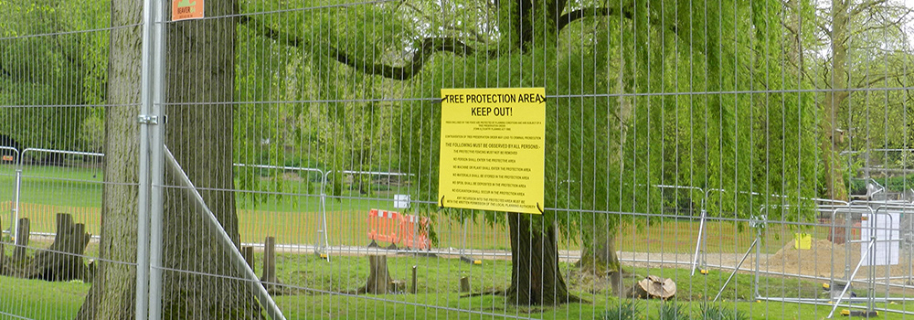
A Tree Preservation Order is in place for these trees in Oxford's Christ Church meadows.
Planning for protection: Ancient Woodland guidance (2018)
The UK Forestry Commission and Natural England have recently updated their standing guidance to planning authorities on the protection of Ancient Woodland and Veteran Trees, which could have impacts upon planning and development in the UK. Understanding where these important features of our landscape exist on or near sites, and appreciating the potential constraints they may pose to development is a key strength of RPS’ ecology and arboricultural teams.
Although the guidance remains intrinsically the same as earlier versions of the document in 2017, 2014 and 2012 there have been various minor adjustments to place more emphasis upon the importance of valuing and accounting for ancient woodland and veteran trees appropriately within planning applications.
Ancient woodland is any site that has been continuously wooded since 1600AD. More obviously, this will include heritage-listed ancient wood pastures, however, it also covers ancient semi-natural woodland which mostly consist of established commercial plantations on ancient woodland sites that retain some of the original features such as ground flora and undisturbed soil. Veteran trees concern aged trees with cultural, historical, landscape and nature conservation value, either individually or as a group. Both groups are protected equally under the National Planning Policy Framework.
RPS Technical Director David Cox has 16 years’ experience of working on a diverse range of especially complex planning applications which have required specialist ecological advice on woodland: "The central and resounding consideration with ancient woodland and veteran trees is that they are unique and irreplaceable and the latest version of the standing guidance reflects that.
Historically, it has sometimes been too easy to assume a straight-forward replacement is a suitable mitigation. This can be a huge risk because it misses the established natural populations and soil quality of an ancient woodland which has grown-up and sustained itself over hundreds of years. The guidance does not only affect veteran trees that sit within a development site but also stresses the need to respect and consider ancient woodland and veteran trees upon adjoining sites that may be impacted.
Notably, it places more onus upon developers, land-owners and local authorities to ensure they absolutely cover all necessary environmental surveys and impact assessments thoroughly and can deliver a robust plan."
[1] Note also that the November 2017 update introduced a 50m buffer to mitigate effects from pollution and trampling in addition to the already existing 15m buffer zone to protect tree roots. The 50m buffer specification was removed in January 2018 following feedback to Natural England and the Forestry Commission and is presently under review.


Response confirms asbestos safety after major Dutch blaze (2015)
RPS has been able to speed up the process of reliable asbestos analysis in the Netherlands with the deployment of the mobile electron microscope (SEM / EDX) – recently completing analysis in less than 24 hours for businesses in the centre of Roermond, Limburg following the major blaze at Het Steel marina that destroyed two boat sheds and dozens of yachts occurring around 2200h on December 16. The structural fabric of the boat sheds contained asbestos: fibres of which were released and spread by the wind across the centre of Roermond.
The area was transformed into a ghost town as it was shut down during investigations and clean-up operations. Downtown shops and schools were closed, and several thousand local residents were quarantined – having to go through decontamination procedures before leaving the affected area. Trains could not stop at the city and the main access roads were closed. Asbestos inspectors from RPS carried out the risk assessment on a Thursday night, and the analysis was complete – confirming that the buildings were asbestos free – the next day.
RPS analysed the air and adhesive samples that were taken on the Friday on location, inside a van with a sensitive mobile electron microscope in the protected area: allowing the inspectors and ultimately the client fast access to the analysis results. The client lost minimal business hours and was able to open the premises to the public again during that day. The causes of the fire remain uncertain at time of press.
Asbestos was widely-used in the mid twentieth-century until the 1990s due to its excellent fire retardant and insulating qualities – notably in internal and external building cladding, ceiling tiles, insulation, ventilation flues, fire doors and soffit boards. Short or long-term sustained exposure to asbestos fibres can present serious long-term health hazards. Mesothelioma (arising from sustained exposure to toxic fibres such as asbestos) is noted as the single largest cause of work-related fatalities in the developed world. However, provided that materials containing asbestos are not damaged, structures that incorporate asbestos in their fabric do not pose a risk.

Gas below ground in Longtown (2008)
Initial exploration indicates reserves of methane gas trapped in coal seams beneath Longtown in Cumbria. Between 300 and 1500m below ground level, these reserves could supply gas for up to 25 years if they prove commercially viable. Whilst new in the UK, Coal Bed Methane (CBM) is common in the US and Europe where it makes a valuable contribution to overall energy supplies.
Although the wellheads would not need manning, the reserves would create up to a dozen new engineering positions within a new service centre. Methane could either be pumped straight into the gas supply network, or could be used to generate electricity for distribution into the National Grid. The sites are suitably distant from residential developments and there will therefore be no unacceptable impact on local residents.
The reserves were discovered during test drilling across a 16m² area between Longtown and Canonbie carried out in 2007. RPS, acting as the client’s agent, has produced site selection reports and prepared the necessary planning and EIA submissions. Further tests, subject to planning permissions, are intended for three more sites nearby – two sites near Longtown, and one near Canonbie. If results from these are promising, more tests may be planned at other sites in the region.

Restoration of Gobbins completes soon (2015)
The iconic Gobbins Cliff path in Islandmagee, Co Antrim is nearing completion after a £6.4m path restoration and visitor centre building project.
The Gobbins is an area of basalt sea cliffs, up to 60m in height, on the east coast of Northern Ireland.
The Gobbins path was originally designed by visionary engineer Berkeley Dean Wise and built in 1902, and in its heyday attracted more visitors than the Giant’s Causeway but fell into disrepair following the Second World War and was closed to the public in 1954. It is being reinstated at a cost of £4.2m, with an associated visitor centre that is combined with a local community centre built at a cost of £2.2m. Larne Borough Council provided more than half of the funding for the scheme, the balance is grant funding from EU INTERREG IV and Ulster Garden Villages. RPS were appointed by Larne Borough Council to lead an Integrated Consulting Team to undertake the project management, design, planning application, procurement, environmental monitoring and contract administration of the two construction contracts for the reconstruction of the Gobbins Coastal Path and construction of the visitor centre.
The name ‘Gobbins’ comes from the Irish 'An Gobain', meaning 'the points of rock'. Legends associated with the Gobbins include mythical figures such as Gobbin Saor, a terrifying giant who lived in the cliffs. The project will revive the original Gobbins cliff path, installed in 1902 by Berkeley Dean Wise, and consists of a series of spectacular bridges and gantries.
The concept design for the Gobbins project was completed by RPS’ Mark McConnell and Sinead Henry which involved the restoration of a 750m long coastal path, including the provision of approx. 23 stainless steel structures incorporating bridges which range from 5m to 35m in span, hand railing and walkway structures inside a cave known as The Tunnel. The team sympathetically designed the iconic 17m Hoop Bridge at the Man'O'War sea stack site and also the suspension bridge at Gordon's Leap to replicate the original 1902 Berkeley Dean Wise designs. During the design and construction stage RPS engineers utilised their Unmanned Aerial Vehicle (UAV) to capture video and photography which enabled them to carry out cost effective site inspections.
The project is located within The Gobbins ASSI (Area of Special Scientific Interest) that is designated due to the maritime plant communities, the large seabird colonies and the unique geology found at the cliffs. Working within an ASSI- RPS Planning Director Raymond Holbeach and his team completed detailed ecological surveys and liaised closely with NIEA to ensure the proposed works did not impact on the qualifying features of the Gobbins ASSI. Mitigation measures were agreed with NIEA in advance of the submission of the planning application. Such measures included limited works along the path between March-August to avoid any impact on the breeding seabird colony (including kittiwakes and razorbills of which 1.6% and 1.1% of the Ireland population are found at the Gobbins Cliffs), no netting of the cliffs, and controlled scaling of the cliff face with an ornithologist present.
One of the key challenges was access explains Project Manager, Morgan Haylett– “the coastal path is located in a remote coastal environment, at the base of 60m high cliffs. The shallow water depths and exposed location precluded the use of marine plant for the project. Therefore the design of the structures and handrailing facilitates segmental/lightweight construction where possible and minimises the number of heavy lifts required over the cliff edge”.
The Gobbins Coastal path is one of two RPS projects that have been shortlisted for the UK wide British Construction Industry Award, Civil Engineering Project of the Year – the awards are to be held in London this coming October.
Tourism NI’s Kathleen McBride said: “It showcases the shoreline, it showcases the people of Northern Ireland and it is just a great facility and a great new attraction to have, it complements what we already have on the Causeway Coastal route. We have the Giants Causeway, we have Carrick-a-rede, we have the shore road and the coastal road.”
“This is a fantastic facility in Islandmagee and a fantastic attraction.”
The Gobbins Coastal Path is scheduled for completion in summer 2015.

Cereal deal for Big Bear (2007)
As part of Big Bear Group’s acquisition of popular cereal brand Sugar Puffs, the Honey Monster has returned after a six-year holiday during PepsiCo’s ownership of the cereal. Advising on due diligence, RPS assisted Big Bear Group in completing a deal believed to be valued at up to £30m, when it acquired the iconic Sugar Puffs from Quaker (PepsiCo). Sugar Puffs have been a household name in the UK since the 1950s and also have a significant presence in the Scandinavian market.
RPS carried out a detailed environmental audit of the operational activities at the site in Southall, Middlesex, together with a contaminated land investigation. Based on its risk assessment and recommendations, the Big Bear Group was confident that it was not acquiring an environmental liability, and the transaction was completed successfully.
The site has been used for cereal production since the 1930s and the acquisition means that well-known products such as Sugar Puffs and the Harvest Cereal Bar will continue to be produced at this location.
RPS also assisted the Big Bear Group in undertaking an environmental compliance audit for a Midlands factory acquired in 2003, which is used to produce Fox’s Confectionery products including Fox's Glacier Mints, Payne's Poppets, Just Brazils and XXX Mints.
Project in Brief:
Project name:The Big Bear Group Ltd acquisition
Location:South East of England (and compliance audit in the Midlands)
Client: The Big Bear Group Ltd
Date commenced: July 2006
Completion: Latter half of 2006


MeyGen Tidal Stream Array wins Outstanding Project Award (2017)
The latest Scottish Green Energy Awards were held on 30 November, organised and hosted by Scottish Renewables and headline-sponsored by EDF Energy. Trophies were awarded across eleven categories at the Edinburgh event recognising the achievements of 26,000 working in Scotland to deliver incredible new innovations across the renewable energy industry.
Outstanding Project Award went to Atlantis Resources for the MeyGen tidal stream array that is the largest of its kind internationally and is currently being trialled in the Pentland Firth off the Orkney. Islands. Winners were chosen by the judges panel from a shortlist of 40 entries across the categories.
Chief Executive of Scottish Renewables, Claire Mack said: “This year’s Scottish Green Energy Award winners are helping Scotland change the way it thinks about energy .. They’re creating the organisations, projects and mindsets that we’ll need ...They’re .. developing the exportable skills and tools which will set Scotland at the forefront of the global fight against damaging carbon emissions. Our industry is incredibly proud of what these inspirational people and organisations are achieving.”
"It was a fantastic evening in Edinburgh with the renewables industry out in force" says RPS Director Andrew Walters who presented the Outstanding Project Award "As sponsor, we were incredibly impressed with the ambition, innovation and passion shown by the people at MeyGen, for its well-recognised – and now award winning - tidal stream array project exporting electricity to the grid with a world record output of 700MW hours in 2017."


Design is childsplay! (2010)
One of sixteen all-abilities playgrounds being built across Queensland as part of QAAPP (Queensland All-Abilities Playground Project): the $4.6m partnership between the Queensland Government and regional councils, the recently opened Thuringowa Central is an innovative and impressive result of community involvement –at work and at play.
Funded by a grant from Disability Services Queensland, the project is part of the Australian Government’s Best Start – Supporting Families in the Early Years initiative, and works to break down the access barriers that children with restricted mobility, in particular, come up against in outdoor recreational play. The keypoint of the project is that the playgrounds are openly accessible for all children to play together – whether they have a disability or not.
The RPS Landscape Design team in Townsville and the local community worked closely with Townsville City Council Parks Service to deliver the hugely popular playspace at Riverway, Townsville. More than 250 local residents took part in designing and planning the 400m² playground with multi-level turtle sand pit, obstacle course, sensory garden, sound play area with giant musical posts and xylophone, and a ramp-accessible tree house with binoculars and game boards.
Situated in the vibrant Riverway precinct, beside the Ross River, the park is smoothly integrated with the existing riverway lagoons, and is created to encourage nature-based and imaginative play by inspiring the senses, using fun learning games and providing attractive challenges. In this way the park helps to aid co-ordination and learning development through play for a wide range of children’s abilities.
Significant insight for the playground’s layout was inputted by local children and families, key stakeholders including The Umbrella Network (a group centred around families with children with disabilities: ‘families supporting families’), disability and focus groups, and health specialists across a range of difficulties including physiotherapists, occupational therapists and speech therapists.
The playground was officially opened by Disability Services Minister Annastacia Palaszczuk, with a ‘Turtles Picnic’ themed family fun day. RPS Principal Landscape Architect, Glen Power says the opening event was a celebration not only of the playspace but of the effort and input of hundreds of stakeholders of all ages with the common goal of providing a safe, fun and inclusive play environment.
This type of play space had never been attempted in Townsville. The local communities understanding of what a playground was included a fairly standard off-the-shelf equipment based play area where you have a slide, some platforms and a swing. This park was breaking new ground, using nature based play and imaginative play providing a space that is accessible to all - something new for the city.
Developing a play space to inspire the senses, encourage learning, provide challenges and still make it all fun required innovation. The development of the park around the theme of the Ross River enabled us as designers, both Council and RPS, to think outside the standard playground format. This involved developing wheel chair accessible play solutions such as the tree house that allows children to have a different perspective on the world, and a multi-leveled turtle sand pit that allowed children of all ages and abilities to get their hands dirty and build sand castles.
The Townsville All Abilities Playground is the latest completed project in RPS’ impressive portfolio of outdoor recreational amenities which includes the multi-award winning Northshore Riverside Park which transformed a former car-shipping yard into an all-age leisure area featuring space for ball games, landscaped walks, playgrounds, and barbecue/picnic facilities. Northshore Riverside Park won awards from Parks and Leisure Australia and the Queensland representation of the Australian Institute of Landscape Architects in 2009.
It is now listed for key trade magazine World Architecture News’ Urban Design Awards, the winner of which will be announced on 19 October 2010.

Parkour reaches apex in park link (2012)
It was an ambitious project to transform a long stretch of steeply sloping riverbank into a community hub linking a public park with a local community centre. As stage three of a grand four-stage redevelopment programme to revitalise a popular area, the Riverway Upper Ross Community Hub is no small project. The project was officially opened by Townsville City Mayor, Les Tyrell OAM, and Minister for Regional Australia, Simon Crean.
As one of the city’s highest growth areas, the intention of the scheme was to ultimately create a new centre for civic life in the area – led by the local community and businesses. Alongside providing an attractive public space filled with educational and leisure features, the project is targeted to encourage continuing commercial and private investment, securing the long term economic growth and vitality of the region.
Following great successes with similarly complex projects including Greenspine A at Northshore (Townsville) and Tyto Wetlands (Ingham), not to mention the award–winning All-Abilities playground also at Riverway, RPS was appointed lead consultant for the project by Townsville City Council and provided all landscape architectural services.
The riverside location presented a number of environmental and structural sustainability issues including flooding, which have been answered with a carefully planned layout to suit the landscape, while linking the newly updated Apex Park and surrounding Allambie Lane precinct. The completed development delivers a much improved topography, with safer access and visibility from the road, and a 3.5m raised walkway linking to the Park. Other features include an amphitheatre, a Parkour zone, recreational pontoon and jetty, and picnic areas. Educational elements include outdoor classroom areas, and interpretative signage throughout, to highlight the area’s history.
The $5m project was funded by the Townsville City Council Better Regions Program, and the Queensland Department of Communities, State and Federal Government. Speaking on the project, RPS Landscape Architecture Manager, Martin Wilshire said: "It was a fast-paced project that threw up plenty of challenges from river topography to local demographics; but what made it unique was the local authorities trust in allowing us to come up with a truly customised design for Parkour elements and artwork items – made by local manufacturers all within a natural riverbank environment with mature trees and great outlook." The project has been entered for the UDIA Public Open Space Award.


Twenty years as Number One (2017)
RPS Group Plc has now achieved a straight twenty years at the top of the annual UK Planning Consultancy Survey’s overall fee income results. The annual Planning Survey is published in Planning magazine.
The newly released 2017 Planning Survey notes “RPS once again tops the overall table, retaining the position since the fee income survey began 20 years ago. [RPS’ total Planning & Development related] income for 2016/17 was £93.3 million, up three per cent from £90.6 million. It also topped the tables in seven of the ten biggest earning market sectors, showing about five per cent fee income growth in its most profitable sectors – transport, energy, retail and householder developments.” Overall, RPS' fee income rose by 3% during 2017, with private sector planning fee income up 5%.
In addition to topping the main planning table by fee income for two decades this year, RPS leads the 2017 sector tables for:
*Householder Planning
*Brownfield Housing/Mixed-use Commercial & Industrial
*Retail & Town Centres
*Leisure Planning
*Energy Planning
*and Waste Planning
RPS ranked in the top three for the remaining three sector categories: rising to second place for Transport Planning, in third for Greenfield Housing and third for Education Facilities.
Based on the number of UK-based RTPI Chartered Planners, RPS came sixth with 111 (compared to 108 in 2016). RPS topped the poll for the total number of Planning fee earners increasing that number by 34 to 722 this year. RPS Managing Director of Planning and Environment, David Cowan, based in the consultancy's Oxford office, says that RPS’ growth has been steady across the board, and particularly notable in work related to roads. “Last year, the volume of work undertaken by RPS in the UK in several key sectors continued to grow apace” says David “further building on our high levels of achievement in previous years.There are now more projects on which RPS has acted under construction than at any time in our company history.”
RPS has consistently ranked top in the majority of planning market sectors for many years always occupying the top spot for overall planning fees throughout the last twenty years. Although there have been minor changes in category titles over the years, reflecting market trends, the categories have reliably retained their main themes, and it has continued to rank mostly as number one or highly ranked in each sector of Housing and Mixed-use Development, Commercial and Industrial, Retail and Town Centres, Leisure, Sport and Tourism, Transport, Energy, Water, Waste and Education Facilities over recent years.


RPS in ethical fund’s Top 10 holdings (2007)
Jupiter’s Ecology Fund is benefiting from its inclusion of RPS.
Jupiter Ecology Fund’s lead manager, Charlie Thomas says: “An increasing number of people are.. investing in ethical funds. I believe these are long-term trends, and we’re investing in companies that will benefit the most.”
The fund invests internationally, focusing on six key themes of clean energy, water management, waste management, sustainable living, environmental services, and green transport. RPS works across all of these fields and counts for 3.14% of its top 10 holdings.
Stock selection has been a demanding choice for the fund as there are so many companies to choose from, and careful investment decisions must be made. “Ten years ago there were 250 companies .. in areas that matched our investment themes. Today there are thousands” Thomas explains.
The fund selects stock based on quality of management, viability of business model and the technology or service that it provides. As environmental regulations increase and corporate companies invest more in green products and technologies, ethical investment funds are thriving, and providing more focus for greener finances.
RPS’ integrated approach to a committed focus on environmental sustainability makes it an ideal stock for such holdings, and its position in such formative funds as the Jupiter Ecology Trust in turn benefits RPS shareholders and the sustained development of the company in environmental fields.

Norwegian National Police Emergency Response Centre (2017)
RPS’ Metier and OEC businesses in Norway have led the Front-End Engineering Design (FEED) phase for the Norwegian National Police Emergency Response Centre since April 2017.
The Centre will gather the police emergency response units – Delta-force, Crisis & hostage negotiators, Bomb-group and Helicopters - in one place (with their necessary training facilities) reducing response time and increasing response quality and capacity.
The FEED-project is a pilot project and an ordered success from the Norwegian Government. After experiencing large cost increases during FEED in similar projects over several years, Metier was engaged to deliver a good project within a given budget. Thus design-to-cost has been the guiding principle.
The project is now expected to be approved in parliament this autumn after 18 months of work - a record time for comparable projects, and with project-estimate within the given budget with necessary contingency. Key personnel will now continue in the execution phase. We start early contractor involvement phase in August 2017 with construction start scheduled for March 2018. Steady state operation of the Centre is due from December 2020.
About 150 people have been involved in the realisation of the project including 20 RPS staff, all together with the police, architects, engineers, advisors and others. Central processes in the FEED phase included: user specifications, engineering, user equipment planning, procurement and contracting, zoning plan and stakeholder management, security planning, land acquisition, operation and maintenance planning, cost estimation and schedule planning.

Collaboration completing the circle of care (2017)
RPS is collaborating with a number of other leading businesses to ensure the most cost-effective delivery of a vital community feature: what will be the first children’s hospice building in north and central London.
Its London Cannon Street office has been providing pro-bono advisory services to Noah’s Ark Children’s Hospice since 2015 as it works to achieve the realisation of a physical hospice facility in Barnet. The organisation has already established a valuable ‘hospice-at home’ service in Barnet, Camden, Enfield, Haringey, Hertsmere and Islington supporting children with life-limiting and life-threatening illnesses and their families within the comfort of their own homes since 2006. It is currently supporting around 200 families in their homes within north and central London where more than 1,200 babies, children and young people are living with such illnesses. Once the building is completed then Noah’s Ark expect to be able to provide care for 450 children and their families on-site, as well as significantly expanding their service delivery capability off-site.
Noah’s Ark invested in the site in 2010 with a vision to provide the hospice building. It started consulting with a wide range of people from families using its ‘hospice-at-home’ service to local residents, healthcare professionals and the construction industry to formulate the ambitious development plan and the effective path to realise it. Main contractor 8build is seeking partners both within its existing supply chain and others it has not worked with before, asking businesses to offer their services to help the project. The entire project cost would be over £7m, but a combination of freely donated service input offered by several keen supporting companies and a strong organising team working hard to get the best from the project is ensuring more can be achieved and within a lower budget. Not least of all is some serious fundraising from local businesses and business chains to increase the investment in the hospice.
Otherwise, the project is following the usual route for a large healthcare development with all the usual planning requirements and work packages advertised via the normal tender route. The construction of the facility will receive no government funding and all cost savings are being valued and invested carefully into the organisations care delivery.
Already known as 'The Ark', the facility will be set on a 7.5-acre nature reserve in Barnet and will be a home from home for children who are seriously unwell, where they will be given the time and space to be children and not just patients. It will provide an inspiring facility for relaxing, adventure and for children and their families to connect with others facing similar challenges.
The site is a sloping greenfield plot on the edge of Barnet town – possibly placing more obligations on the organisation as regards due diligence and sensitive design, but Noah’s Ark and its project team are excited about embracing the full environmental scope of the site. The plan is for a state-of-the-art facility with a very natural look and feel to its exterior using oak, and plenty of full-length windows to embrace the natural light and incredible views. The key feature is not only the views of the greenspace but the access to relax in it, explore it, and above all enjoy it.
At the heart of the facility, an airy barn-styled atrium will open into four outstretched arms: offering children’s accommodation, family accommodation, office areas, play areas and therapy rooms. The slope of the site has allowed for a design where one end of the building will be two-storeys with the upper storey enjoying as much of a feeling of the greenspace outside as the ground floor.
"I don’t see this as a standalone programme" says Ru Watkins, Chief Executive of Noah’s Ark, "it’s very much a partnership." With so much interest and input, Ru is correct, as RPS Director Neil Andrews sums up: "We’re trying to achieve something quite special here: collaboration." Construction is scheduled to start in September 2017 with a 65-week build time-plan.
RPS’ project management, cost and building consultancy team, based on Cannon Street, London are working with the charity to fundraise and support the construction - both financially and where possible, with the resourcing - of what will be a life-changing facility for many.
Supporting businesses include: RPS Consulting Services Ltd; Jones Lang LaSalle UK; 8build; Sellar Property Group; Pears Property; Ramboll; Gensler; Squire & Partners; Hok; Erith Demolition.

The naming of the Namur (2012)
No-one expected what awaited as works began in preparation for the conversion of an 18th-century wheelwright’s shop in Chatham to a new visitor centre.
As part of the work, the wooden floor of the building needed to be replaced, and there were several historic layers to remove. Beneath the fifth layer was an incredible hidden treasure.
Part of the historic Chatham Dockyard World Heritage Site, the building is a Scheduled Monument and is Grade II* Listed. An archaeologist thus had to be present to oversee the removal and to record anything of interest. RPS historic buildings specialist Rob Kinchin-Smith was supervising the works for Oxford Archaeology, managing a team of heritage shipwrights and recording each layer of history as it was lifted. The job seems relatively minor in comparison to the main project that the team was working on at the Chatham Dockyard – the restoration to exhibition standard of 1878 steam sloop HMS Gannet.
As the final layer of flooring was revealed, it was clear from the four-inch thick oak ‘floorboards’ studded with copper nails and two-inch wooden dowels that the floor was formed from the hull planks of a very large wooden warship. Underneath the ‘hull’ floor was a yet more exciting find – 157 perfectly-preserved and unaltered timbers from the hull of an equally large, wooden warship: ribs, deck beams and a stem post. The deck beams were still painted blood red, still sporting painted mess station numbers, hammock rails and hooks. It was immediately evident that the ‘planks’ and the supporting structure were the concealed remains of an 18th-century wooden warship of considerable size.
St Andrew’s University was brought in to help provenance the timbers using dendro-chronology (tree ring dating) and dockyard breaking records. The study revealed that the ship had been built in the 1750s as a 2nd- or 3rd-rate ‘ship-of-the-line’. A couple of stray timbers from an early 19th-century warship also under the floor showed that the floor had been laid in the first half of the 19th Century, narrowing the search to just four large warships which had been broken at the dockyard at about the right time. There the trail went cold.
Seventeen years later, re-examination of a specific detail of the stem post[i] has allowed her to be formally identified as HMS Namur. The find has now been described as ‘the most significant in Northern European naval history since the Mary Rose’.
The Namur was not only broken at Chatham Docks in 1833; she was first built there, between 1750-56. She was a 90-gun 2nd-rate ship-of-the-line, later reduced (again at Chatham) to a 74-gun 3rd-rate ship in 1805. In her 77-year career she saw more than 47 years of active service, including nine fleet actions. During the world’s first truly global conflict, the Seven Years War (1756-63), she was flagship of the Mediterranean fleet, under Admiral Boscawen.
Her greatest moment was as flagship at the Battle of Lagos (Portugal) in 1759, a battle of almost equal significance to Trafalgar, some 44 years later. The pulverisation of the combined Franco - Spanish fleet at this battle and at the succeeding Battle of Quiberon Bay changed the course of the Seven Years War and forced Louis XV to abandon his planned invasion of England. A powder-monkey on the ship during the battle was the pioneering black author and anti-slavery activist Olaudah Equiano[ii]. The ship was later captained by Jane Austen’s brother.
“It’s good to know that after all this time the ship has been identified and that it is so significant, “ says Rob, “Whilst reusing ship’s timbers in buildings is not uncommon, systematically dismantling a single ship and hiding a substantial part of it under the floor of a single building is unheard of. It may have been simply an expedient way to raise a floor, but the unnecessary quantity of timber used and the careful way it was laid out implies a form of intentional “preservation” of this remarkable Chatham-built ship. The Namur was a near contemporary of her Chatham-built sister, HMS Victory (built 1759-65). After a 50-year working life and 200 years of open air display, almost nothing survives of the original Victory. Thanks to the actions of Chatham’s early Victorian shipwrights, the remains of HMS Namur now give us as good an insight into mid-18th-century warship construction as any maritime historian could ever wish for.”
HMS Namur is at the centre of the £8.5m Command of the Oceans project to create a gateway to Britain’s naval history at the Dockyard, 28 years since its closure. The project is supported by the Heritage Lottery Fund.
Notes:
[i] The ship had been rebuilt with a round bow, a new design evolved as shipwrights pioneered the use of iron in shipbuilding at the start of the 19th Century.
[ii] Equiano was slave to Michael Pascal, the ship’s 5th Lieutenant during the Battle of Lagos. He also served as a ‘powder monkey’, filling shells and cartridges and carrying gunpowder from the hold to the gun decks during battle. He later recorded his experiences on board ship in The Interesting Narrative of the Life of Olaudah Equiano.

Drugs, drainage and cultural heritage (2014)
“Why is Sydney where it is today? Because of the Tank Stream. The permanent water it supplied determined where the First Fleet set up camp at Sydney Cove.” Heritage Council of New South Wales.
The RPS Cultural Heritage team was recently engaged by the Council of the City of Sydney to undertake archaeological excavations adjacent to the historical Tank Stream in Sydney’s CBD.
RPS was commissioned to work alongside civil contractors involved in Council’s laneways revitalisation program, which involved substantial amenity improvements to Tank Stream Way and Bridge Lane. Tank Stream was the impetus for the original siting of Sydney, as the first consistent fresh water source discovered in the lower Harbour. The Stream became grossly contaminated by the city’s early inhabitants and was enclosed during the 1850s, eventually becoming a vast stormwater drain for the city. Tank Stream is now buried under at least two metres of fill and runs right through the CBD, before emptying into the harbour at Circular Quay.
Excavations during the Early Works revealed 187 artefacts in a disturbed context, representing an historical snapshot, albeit blurry, of nineteenth century Sydney. Of considerable interest was the discovery of a modified bottle base, which has been interpreted as an improvised opium lamp. The push up (pontil) had been chipped away to make a small hole in the base, and the base broken from the bottle. The resultant bases were apparently used over a tin of fuel with the wick poking through the hole as a crude opium lamp.
Opium smoking was by no means uncommon in nineteenth century Sydney, and The Rocks, only a few hundred metres from our site, was notoriously full of brothels, sly grog shops, opium dens, and haunted by prostitutes and larrikins. Opium dens were frequented by all levels of society, and their opulence reflected the financial means of the patrons. Regardless of status, the dens tended to keep a supply of opium paraphernalia including the specialised lamps necessary to smoke the drug. As a working class area, it was not at all surprising to encounter evidence of simple lamps, rather than the distinctive Cloisonné adorned metal lamps so characteristic of dens.
A full report on the findings will be prepared following the Main Works excavations shortly.

Unanimous approval for Dolphin Square (2011)
It is unusual for more than 90% of respondents in a public consultation exercise to speak in favour of a scheme, but the results of the questionnaire issued in relation to planning proposals for the redevelopment of Dolphin Square, Weston-super-Mare were almost unanimously in support, and now the application has just received an equally unanimous approval.
A strong expression ran through the replies that something needed to be done, and improvement was greatly needed, to update the ageing 1960s development with a modern centre at the heart of the coastal town that would work well for local residents and attract tourism.
North Somerset Council identified the site’s potential in its Local Plan and two years ago produced a specific Supplementary Planning Document (SPD) focusing on the requirements and issues surrounding the much-needed redevelopment proposals.
The 2.6ha site comprises Dolphin Square with its covered market, bowling alley, car park, Council offices and apartments, the Carlton Street car park, a former Council storage facility, and takeaway premises on Oxford Street[1]. RPS is engaged to act for McLaren Life Property which acquired the 125-year site leasehold from the local authority last year.
The prime location of the site has placed extra emphasis on the need for a vibrant and attractive centre that will attract visitors and does not impose a negative visual impact upon older buildings –including the nearby Grade II listed primary school, and church, and the Deco architecture of the popular Scally’s pub. Part of the site lies within the Sea Lawns Conservation Area. A central location, sea-front proximity and the surrounding mix of residential development were all major considerations when preparing the plan.
Formal plans for the £35m scheme provide a new bowling centre, with a multi-storey car park, eight-screen cinema, hotel, restaurants, a public house and shops The new centre will deliver eight new retail units and eight restaurant units to complement the existing day-night quality café culture provided in the town. There is a strong emphasis on good pedestrian access to and across the site, linking it to the remainder of the town centre much of which has been improved in recent years.
The new development when completed will create approximately 450 jobs, 50% of which will be full-time. A minimum of 15% of the site’s energy requirements will be produced sustainably on-site.
Tenants have already been secured for the hotel, cinema, and one of the restaurant units. Speaking on the cinema letting, Simon Berry, Director at McLaren Life said "This is the first piece of a jigsaw that will give residents and visitors the facilities the town deserves and ones that continue the regeneration of the west country’s most important resort".
The RPS input was led by Lyn Powell of the Cardiff office. Commenting on the proposal he stated that “The overwhelming support for the scheme reflects its importance to the economy and tourism profile of the town. The hotel will add significantly to the quantum of quality bed-space available locally; the new car-park will add to the number of dedicated visitor spaces provided within the town; the doubling of the size of the bowling alley will sustain the future of this much-loved and used facility; and the new shops and restaurants, not to mention the multi-screen cinema, will add substantially to the vitality of the town at this important, pivotal location. It is a project that RPS can be proud to have promoted.”
Notes:
[1] Numbers 2a-2b –the Oxford Restaurant and Takeaway has been purchased by the Council for redevelopment. Numbers 12-16 Oxford Street –the Chicken Inn, will also be redeveloped. Sands Nightclub, and Scally’s pub –both in private ownership, will not be affected by the development, with the pub being a key heritage point as the last example of 20th Century pre-war development in that part of the town.

Extension to University PE Centre wins prestigious RICS award (2008)
The new extension to the Queen’s University of Belfast’s (QUB) Physical Education Centre (PEC) was recently announced as the overall winner in Northern Ireland’s most prestigious Built Environment awards, winning the award for Best Building 2007 in the Royal Institute of Chartered Surveyors Northern Ireland Awards.
The project also won an award for Excellence in the Built Environment in the Community Benefit category seeing off competition from three other category winners to claim the top prize.
The prestigious RICS Award is presented for innovation in design and construction, contribution to the local community, sustainability and economic viability. The Awards recognise building projects completed in Northern Ireland during the last three years within the Regeneration, Building Conservation, Sustainability and Community Benefit categories with the winner of the overall award being selected from the four category winners.
The RICS Northern Ireland Chairman, Diana Fitzsimons, said the enhanced PEC has significantly extended and improved the university’s delivery of sporting and recreational services to students, schools and the winder community: “The PEC project has been an immediate hit with the students, the local community, school groups and other users and has underpinned the university’s wider strategy of reinforcing its role in the City of Belfast and as an important member of the local community.”
RPS provided structural and civil engineering design services, including design and construction supervision for the 3rd generation training pitches for the new extension.
The PEC centre is organised around a 16m central glass dome incorporating sporting facilities, climbing wall and boulder cave. Services range from state-of-the art fitness suites and exercise studios to sports science, medical support, sports therapy and rehabilitation areas. The facility also provides a dedicated student resource centre.
One of the most striking features of the building is the prominently positioned climbing wall, which provides views from both the ground and the first floor level. The skin roof of the building is a unique feature with the staircase suspended from the roof by cables.
The PEC was officially opened to the public in March 2006 by Dame Kelly Holmes, offering state of the art sporting facilities to students and the general public.

Living in the glasshouse (2017)
RPS provided energy and sustainability advice on the recently completed Atrium Building, in East London. As its name suggests, the Atrium Building is a modern apartment building designed to make use of natural light, and spacious, open proportions as it rises skywards.
The Atrium Building is home to 153 apartments, set over 10 floors, with a striking façade of glass and steel and it is one of a very small number of residential buildings worldwide that are enclosed within a glazed atrium.
RPS was appointed to carry out energy calculations for all residential units, a Code for Sustainable Homes assessment for all residential units and an overheating analysis on the communal staircases and corridors. RPS guided and advised the design and construction team on the most effective and commercially focused approaches to achieve compliance with their energy and sustainability requirements.
In the end, high energy savings (more than 70% reduction of carbon dioxide emissions over Building Regulations) and sustainability (Code for Sustainable Homes Level 4) standards were achieved for the Atrium Building.
The Atrium building is part of the East City Point, which is a 649 home development. The second phase of the development is expected to be completed in 2018.

A465: Two million hours plus and no reportable accidents (2017)
The continuing project to dual Section 2 of the A465 Heads of the Valleys for the Welsh Government has now passed over two million hours without a reportable accident. It is rare for such a large-scale and complex construction project to be able to report anything like these hours without a reportable accident and is testament to the excellent working practice of all involved on this ECI contract awarded to and led by Costain.
Section 2 duals 8.1km of some 40km of the A465 connecting Swansea and the M4 to the A40/ M50 route to the Midlands. It includes the construction of14 major structures, 12.5km of retaining structures and 1.2million m3 of earthworks in the extremely narrow and rocky Clydach Gorge with the river running alongside, whilst maintaining two-way traffic flows. The site is in the Brecon Beacons National Park and Usk Bats Sites SAC/SSSI and includes four scheduled monuments. RPS is responsible for the environmental design and assessment and provided specialist experts across a range of disciplines for the successful public inquiry in 2014. RPS are now providing detailed environmental design, site environmental coordination, species management and site monitoring support for the construction works which commenced in 2015. Costain Plc Board Chairman Dr. Paul Golby recently congratulated all the project partners on the announcement of such a fantastic achievement.

Excavations re-profile and restore Heads of the Valleys habitats (2016)
RPS has been a key consultant for a number of major components of the A465 Heads of the Valleys road dualling project since 2011. The project is a central feature of the Welsh Government’s Heads of the Valleys regeneration strategy – improving transport infrastructure as a driver to boosting industry and accessibility.
A recent major environmental component of the project,to re-profile land at Ben Wards Fields using excavated rock and soil from road construction works at Brynmawr, was approved last month subject to completion of a legal undertaking for ecological works on an additional 31ha area.
RPS provided planning, landscape, ecology, heritage, flood risk, land use and noise advice for the scheme. Extensive pre-application consultation with Blaenau Gwent County Borough Council, Natural Resources Wales, the Brecon Beacons National Park Authority and Sustrans was carried out. This ensured that key issues, including minimise landscape impacts, enhancing habitats and protecting the National Cycle Route were addressed early on.
Considering that much of Wales’ transport infrastructure is intercepted by a topography of hills – many averaging around a 12% incline or more – the gradient challenges for the road scheme have been complex. Furthermore the road passes through Brecon Beacons National Park as well as beside several Natura 2000 sites and Site of Special Scientific Interest – including a near proximity to the Blaenavon Industrial Landscape World Heritage Site. Notable local wildlife includes Lapwings and the Lesser Horseshoe Bat whose UK population is restricted almost entirely to south-west England and Wales.
Where possible, the excavated material is re-used in the road’s construction however during detailed design work, contractor Costain identified a surplus of excavated materials, mainly from the roadworks near Brynmawr. The adjacent Ben Wards Fields site was selected as a suitable location for the removal of 350,000m³ of clean rock and soil, allowing the material to be managed sustainably, close to where it was produced. Materials will be transported using the temporary Bailey Bridge over the A465 to reduce traffic impacts on main routes.
Two nearby areas of land at Ben Wards Fields just south of the consented road scheme area were used to accommodate the surplus material. The site also includes a rock processing area, welfare units, parking, washdown facility and drainage. Works will take place over an approximate 30-month period and the site will be restored to grazing land and wildlife habitat.
RPS designed a comprehensive restoration scheme to provide land for grazing and an improved natural habitat with reinstated rights of way. The final re-profiled land form aims to blend with the surrounding landscape and contours with material placed to an average depth of 1.9m and up to 6.5m over existing depressions to minimise any visual impact of the proposals.
The restored land will provide for a variety of wildlife with grazing and wetlands being particularly attractive to the declining ground-nesting Lapwing, and also benefitting the Lesser Horseshoe Bat, both of which are important species in the area. A mix of grassland, shallow slopes, wetlands and hedgerows (grazing land and linear hedgerows providing juvenile lapwings and bats with an easy to navigate environment and attracting an invertebrate food source. Further habitat improvements are proposed for the additional land to offer a tailored habitat for Lapwings during the works and beyond completion.

Dualling of the Heads of the Valleys (2015)
This case study was written for and also appears in the ENDS Environmental Consultancy Market Review 2015.
This case study was written for and also appears in the ENDS Environmental Consultancy Market Review 2015.
The dualling of the A465 Heads of the Valleys road scheme is a central part of the ambitious but confident Heads of the Valleys regeneration strategy developed by the Welsh Government and five South Wales local authorities. Starting in 2006, the strategy plans to tackle root causes of economic inactivity in the region by delivering long-term effective results to improve transport infrastructure and thus accessibility and boost industry, tourism and public confidence.
The plan is to dual six sections – a 40km stretch – of this important route that connects Swansea and the M4 to the A40 and M50 route to the Midlands. A detailed schedule of works was set out in the Welsh Government’s 2010 National Transport Plan. Sections One and Four of the scheme were completed in 2008 and 2004 respectively, and Section Three is currently underway – scheduled to complete in June 2015.
Section Two of the scheme, an 8.1km stretch between the Glanbaiden and Brynmawr roundabouts with a total cost in the order of £190m, was regarded as the most environmentally challenging section of the route. It has 16 major structures, over 11.5km of retaining walls and excavation of more than 1.2 million m³ of material. This section runs along the edge of the South Wales Coalfield syncline. The terrain surrounding the existing highway and proposed dual carriageway is extremely challenging for road development – with an undulating topography located in the Brecon Beacons National Park. The surrounding landscape also incorporates several internationally and nationally designated sites of environmental (Natura 2000 and SSSIs) and heritage interest. A predominant feature of the section is the protected Clydach Gorge which contains a number of Scheduled Monuments and the Mynydd Llangatwg limestone caves SSSI (protected bat roosts). The Blaenavon Industrial Landscape World Heritage Site is also close by.
In order to address these unique environmental challenges Costain chose RPS at the tender stage to lead the environmental design and assessment in the team presented to the Welsh Government. Following the award of the contract, RPS was tasked with the delivery of a comprehensive and sensitive EIA and working in close consultation with Brecon Beacons National Park Authority, Natural Resources Wales and Cadw (Welsh Government advisors on heritage). RPS produced an Environmental Statement and, in accordance with Regulation 61 of the Conservation of Habitats and Species Regulations 2010, an Assessment of Implications for European Sites (AIES) was also prepared to identify the possible impacts of the published scheme on three Special Areas of Conservation (SAC).
Thorough scoping of the required assessments was critical to delivery of the project programme. RPS’ Scoping Report set out specific environmental assessment methodologies and potential mitigation measures recommended for integration into the scheme design. Baseline data was obtained by compiling and reviewing available data and/or undertaking baseline surveys to generate site specific data. Where required, the methodology for the surveys was agreed with the relevant stakeholder.
RPS’ studies included cumulative impact assessments examining multiple environmental effects on single receptors and other parts of the project using a matrix-themed approach. In order to ensure the minimum impact was visited upon surrounding sites of major environmental and historic value, RPS designed detailed mitigation measures to provide visual screening, low noise surfacing and noise barriers, and measures to compensate for the loss of bat foraging areas and a thorough Construction Environmental Management Plan. Particular consideration was also required where the road widening was proposed above the Mynydd Llangatwg caves where the route would sit between five and ten metres above the cave roofs, some of which were also bat roosts, and within 100 metres of their main entrance necessitating intricate planning for exceptionally delicate piling work.
The Environmental Statement and AIES were published alongside the Draft Orders in October 2013.
As a major multidisciplinary consultancy RPS was well placed to deliver the wide range of professional services, bringing together targeted expertise from a spectrum of dedicated resources. For A465 Section Two we assembled a team across five of our UK offices to advise on archaeology and built heritage, air quality and climate impacts, ecology and biodiversity, landscape and visual impact issues, planning services including land use and community & leisure, health impact, Habitats Regulations, geology and contaminated land matters and hydrology. RPS also appointed external specialists where specific species and/or local knowledge added value. Seven of the Welsh Government’s expert witnesses at the Public Inquiry in 2014 were from RPS.
Having a long-standing relationship with Costain benefitted delivery of the scheme as our previous project experience with the contractor has established an effective understanding and methodology. This was further enhanced by the co-location of the RPS environmental coordinator with the design team and contractor in Cardiff – facilitating closer familiarity with the design process and a more hands-on accessibility to discuss and resolve environmental queries and design issues.
At the Public Inquiry in 2014 the Inspector noted the proposals as acceptable and that ‘there was an abundance of evidence to show that the scheme would comply with local, regional and National Policy for Transport and the Economy’. Although ‘Landscape and environmental policies would not all be advanced by the scheme’, both were ‘vigorously addressed’ and demonstrated ‘as part of the development of the scheme, with clear strategies to make its impact acceptable’. The strategies were noted as ‘essential in order to minimize the adverse impact on the Brecon Beacons National Park, in the Clydach Gorge and [on] the Blaenavon World Heritage Site that would otherwise occur.’
Primary construction on the A465 Section Two has recently commenced in 2015 with RPS continuing to lead the environmental work including ecological site clearance, archaeological investigations, land surveys and detailed design of landscape and environmental mitigation. The works are expected to be completed in 2018.

New burns unit for Birmingham Children’s Hospital (2007)
The new Burns and expanded Education Centre is a striking extension to the existing Victorian Children’s Hospital in Birmingham City Centre - formerly known as Birmingham general hospital up until 1995. together with Ruskin Chambers (grade II).
The Birmingham Children’s Hospital Burns Unit is one of only three such centres of excellence in the country. It contains an Outpatients department, a Neo-natal Unit, a Burns ward and a Burns operating theatre, as well as additional classrooms for the Education Centre, allowing children to continue their education whilst undergoing medium to long term care in the Hospital.
The design, both the inside and outside, attempts to reflect the spirit of the children, adolescents and families. It also continues the tradition of quality extension that reflects the spirit of the ages of its users. The building recognises the Hospital’s crucial role in their lives and attempts to empower its young patients by encouraging interaction and healing and an identifiable “home base” territory for patients, staff and visitors. The vibrant colours used were designed to contrast with the adjacent terracotta buildings, and the position of the building provides a land mark gateway to Birmingham from the M6.
Also published on World Architecture News.com

Healthy growth for hospital (2007)
A former generator and grassland site has been transformed following the construction of a £14.5m extension to Birmingham’s celebrated Children’s Hospital.
The new, airy extension will provide a paediatric supra-regional burns centre, a new neonatal surgery unit to replace the former unit, and an extended education centre. The four new clinical levels will be served by a plant room at level five, and planning permission has now been granted for a rooftop helipad to allow emergency air access to the hospital.
The rooms have been designed specifically with children in mind, and extensive patient consultation for its creative features has inspired the use of coloured building blocks and specially commissioned patterns inset into the floors and walls. Natural light is expected to flood in, reflected by the curved walls, and smaller children will be able to enjoy the views, as the windows have been placed with a maximum cill height of 600mm above floor level.
The building is supported on a steel frame with power float concrete ribbed floors, and is set in piled foundations to ensure the structure will stand firm for many years on the sandstone site.

Capital regeneration (2007)
RPS is currently working with Registered Social Landlord housing authorities (RSL) on various housing schemes in London to regenerate existing housing sites in Greenwich, Elephant and Castle and Brent.
Greenwich
RPS led the planning process on behalf of Family Mosaic to secure planning permission for 225 residential units on four sites in Charlton, which they acquired following a stock transfer from Greenwich Council in 1999. The schemes for the sites at Rectory Field Crescent, East Mascalls, Victoria Way and Bramhope Lane provide a range of 1,2,3 and 4 bedroom flats and houses with 37% of the new housing to be affordable.The permissions were approved in 2006/2007 subject to a Section 106 Agreement, which included the provision of affordable housing, contributions towards local employment and training (GLLab) and education contributions.
Elephant and Castle
RPS is leading the planning process on behalf of the 2 RSL Consortia selected by the London Borough of Southwark to create a formal working partnership to deliver new housing in the borough for the existing residents of the Heygate Estate, which is to be redeveloped to allow for the regeneration of Elephant and Castle. A variety of local based architects have been appointed by the partnership to prepare residential schemes for the 15 allocated sites and planning applications are to be submitted on a site by site basis to provide approximately 935 new residential units of both private and affordable housing. RPS worked with the Urban Choice Consortium of Family Mosaic and Affinity Housing Group from the outset to secure their selection bid and take forward their development sites. The 2nd RSL Consortium of Guinness Trust, London and Quadrant and Waddle Housing have recently appointed us in the same role.
Brent
Brent Coefficient – a consortium of Bouygues UK, Hyde Housing and the Bank of Scotland, appointed RPS in early 2006 to advise on planning issues to secure their selection bid for the Brent Social Housing PFI Project Scheme to provide 500 affordable housing units across twelve sites in Brent. The bid was secured in October last year. The Consortium is now taking forward the process to secure planning permission on the selected sites and RPS continues to advise on planning issues.

Effective monitoring keeps a steady eye on jacked Galecopper Bridge (2015)
With 200,000 vehicles passing over it every day, the Galecopperbrug spanning the Amsterdam-Rhine Canal is the second busiest bridge in the Netherlands – carrying twelve lanes and providing passage for the busy A12 motorway – the main approach to Utrecht centre.
The 1974 bridge has recently undergone a program of essential maintenance to provide overall structural and civil improvements in consideration of the heavy freight volume it bears on a daily basis and to ensure it meets the Rijnvaart Height standard of a minimum 9.10m between highest water level and the bridge’s underside – achieved by jacking the steel suspension bridge to give 70cm more clearance.
As it is such a main route, the bridge was kept open almost continuously, excepting some overnight closures for surfacing and engineering works. To keep a close eye on renovations, RPS Netherlands purchased Total Stations Trimble S8/Trimble T4D continuous monitoring software taking measurements every 15 minutes from prisms mounted on the bridge.
The measurement stations constantly monitored the height of the abutment and pillars and the readings were available over the internet and accessible to RPS staff and the client via an app. Any changes occuring, such as settlement, could be monitored in real time, allowing the client to respond as and when required. This approach provides more data with faster results and allows for significant economic benefits by mitigating the need to deploy constant on-site coverage by specialist measuring teams.


Rockpool relocation cooks up a treat (2014)
The RPS Cultural Heritage team was recently re-engaged by celebrity chef Neil Perry’s Rockpool group to prepare a second round of heritage assessment and approvals for additional works at the relocated Rockpool restaurant site at 11 Bridge Street, Sydney.
The State heritage listed Burns Philp Building was constructed between 1899 and 1902, with a richly carved and modelled facade in a Romanesque style and finely executed sandstone carving and interior finishes. The space now housing the Rockpool dining room was once a Shipping Hall, but at the time Rockpool signed the lease the space was grimy and run-down with crude modern additions throughout.
RPS was commissioned to undertake the planning approvals required to upgrade the State heritage listed building, which included the preparation of paint analysis reporting and a heritage interpretation plan for the site in accordance with Heritage Council approvals. The revamped space was opened five weeks after Neil signed the lease, with the press complimenting the contemporary New York feel and dark luxe sophistication of the room.
Neil’s team are now proposing the construction of a test kitchen with wine storage in a previously unused space upstairs, and have re-engaged the Cultural Heritage team to guide them through the process.

Sustainable schooling (2011)
Declared by BRE to be one of the 16 most successful UK sustainable buildings in the 2010 BREEAM Awards, Rogiet Primary School in Monmouthshire has achieved the highest BREEAM rating for any educational building in the UK to date. At 78.18%, the Excellent rating was realized through a careful dedication to sustainability and environmental focus not only throughout the realization and construction of the project, but through the school’s continuing use.
RPS provided ecological consulting services for the £4.5m project which won a Considerate Constructors Scheme Award and was shortlisted for the RICS Wales Sustainability Award 2010.
A key feature of the project is a carefully planned landscape design for best outdoor educational prospects and strong biodiversity enhancement. The school has a strong focus on outdoor learning and incorporates outdoor learning, play and performance areas including a dipping pool for pond life studies, and a fruit orchard with cherry, apple and plum trees. This focus provided excellent opportunities to incorporate outdoor learning features that would also provide biodiversity gains.
A wildlife pond was created that would also serve as a dipping pool for pond life studies; and a small orchard (a UK Biodiversity Action Plan Priority Habitat) with cherry, apple and plum trees was planted.
Limited planting space elsewhere in the school grounds was optimised to achieve BREEAM ecology credits by incorporating areas of species diverse native scrub planting and wildflower meadow within the landscape plan. The sowing of native damp meadow plant species within the drainage swales, and species diverse native hedgerow planting on the site boundaries provided further biodiversity gains.
In the early stages of the project RPS provided a detailed breakdown of the existing ecological resources within the school grounds and audited all the legislative requirements that would need to be adhered to in site design and during the construction programme.
Bats were a major consideration prior to the demolition of the old school buildings with common pipistrelle, soprano pipistrelle, brown long eared bats and noctule bats all recorded in the wider school site. Detailed internal inspections were coupled with surveys to confirm whether bats were returning the school buildings at dawn.
RPS, as part of the main BREEAM team, worked closely with the landscape architects and construction team to incorporate biodiversity into the new school grounds. Wildflower enhancement of amenity grassland and the protection of established wildlife habitats in the final design helped increase the number of ecology credits under the BREEAM scheme.
The school remained operational throughout the site works and school pupils worked closely with the contractors on design ideas for key features, and the final colour schemes. This included preparing a DVD on sustainability and bringing in old newspapers to be recycled in wall insulation in the single-storey school buildings.
The school has a wind-turbine and roof-mounted photovoltaic panels to produce a reasonable percentage of the electricity it needs and heat water for bathroom facilities, as well as harvesting and recycling rainwater on site for use in the water-closets.
The buildings have a timber-frame construction from responsibly sourced wood, passive ventilation with a focus on optimum natural light use, and recycled rubber roofing. Long-term the school has its own eco-committee and has designed and maintains effective eco-policies on site.

Canford Cliffs refurbishment (2007)
The residential refurbishment of a seafront apartment building in the scenic Dorset village of Canford Cliffs has been completed this year.
Canford Cliffs grew around a development by the Canford Cliffs Estate Company, on land acquired from the Canford Estate, at the turn of the last century. Covenants were set in place to restrict the development of business and industry in the village, and preserve its green spaces. The development began with a few houses in Haven Road, but boasted a smart promenade, pleasure gardens, and a village hall, as well as more housing, when it was given to the local authority.
The village experienced a building boom in the 1950s, and since then, many houses have been converted into flats or demolished to build apartment buildings. Canford Cliffs Society continues to protect the covenants established by the original estates company, and it is renowned for its scenic views, attractive parks, cliffs, and ‘chines’ (deep, narrow ravines), as well as its water sporting activities, in the shallow water of the harbour.
The apartment building was the property of three clients - each owning the freehold of three individual flats, who had submitted several different planning applications for the improvement of the building, which suffered from rising damp, damp bridging cavities, poor access to the upper flats, and poor acoustics between the properties (poor sound transmission).
Sir Stanley Clarke (Northern Racing Plc) had owned the first floor apartment, and it was his family who sought RPS’ advice in March 2005. After preparing a carefully thought out and successful presentation for the concerned parties, RPS provided the architectural services, and planning permission was granted in September 2005. Building commenced in March 2006 and was finished in January of this year, within a budget of £500,000.
The old stairwell and a garage building behind the property were demolished to be replaced with newer models. The replacement stairwell allowed for the installation of a lift to provide disabled access to the upper floors, and improve family access, and an ambulant staircase replaced the previous steps. A wave effect was added to the top of the stairwell to echo the coastal landscape of rolling waves and curving cliffs. An additional accommodation pod (approximately 30m²) was also added at roof level - providing an extra master bedroom with en-suite bathroom.
The balconies of the building were extended to maximise space, and make the most advantage of the sea view looking out to the Sandbanks, Bournemouth studland, and Poole harbour. The metal railings were removed, and more modern stainless steel and glass balustrades took their place to blend in with the buildings exterior and the surrounding landscape more smoothly, and maximise the benefits of the sea view without obstruction.
The outside of the building underwent extensive remedial structural work to resolve the damp problems and the acoustic inconveniences. New entrance canopies were added, and the windows were replaced with aluminium powder-coated ones to enhance the appearance of the building and reduce long-term maintenance. The outside overhaul included the replacement of the rendering with a new white finish that was extended to also wrap around the previously exposed brickwork ends, adding to the buildings new streamlined and harmonious feel.

Landscaping to mark engineering heritage (2007)
The first sod of the Harry Ferguson Memorial Garden was cut in August by Lisburn City Mayor, James Tinsley. Those present at the event included representatives from Lisburn City Council, the Department for Rural Development, Massey-Ferguson, the Harry Ferguson Celebration Committee, and RPS Director Kevin McShane.
RPS is the architect for this memorable project to commemorate the work of engineer Harry Ferguson (1884-1960), the name behind the revolutionary Ferguson tractors (namely the ‘wee grey Fergie’), and the P99 four-wheel drive system, which achieved victory at the F1 Oulton Park race in 1961, with Moss at the wheel.
The park is being developed opposite the Ferguson Homestead in Growell, Dromore – already a popular tourist mecca with farming and engineering fans, with funds raised by the Harry Ferguson Celebration Committee, and the Ferguson Heritage Midlands Group.
Planning for the park has progressed over several years, and work is now set for completion in July 2008.

Marshall Street regeneration (2007)
London’s Marshall Street Baths has remained closed with its magnificent marble-lined pool drained and empty since 1996. Sport England is now backing the London Pools Campaign in a regeneration scheme to restore and upgrade the pool.
RPS is providing planning, transport, noise, sustainability, design and access advice for the project: The application was submitted in February, and is scheduled for approval in July.
Marshall Street Baths is a Grade II listed building. The swimming baths first opened in June 1852, erected by the vestry of St. James’ on freehold land under the 1846 Baths and Wash-Houses Act. The baths were extended in 1860 and again in 1891 before they were demolished in 1928, under order of Westminster City Council, to be replaced with a new and even bigger complex in 1931.
The new complex featured a grand 100’ x 35’ (30.5 x 10.7m) pool with stepped seats, walls lined with Sicilian white and Swedish green marble, and a fountain by Walter Gilbert (see note) at the shallow end. In addition to this, there was a smaller pool and slipper-baths, as well as a public laundry, maternity/ child welfare facilities, and a highways depot. It was designed by Camden architects A.W.S. and K.M.B. Cross in the high fashion of Art Deco, and was built by Bovis. The building was finally closed in 1997 for safety reasons.
The £25m deal was secured by Westminster City Council, and the project is set to reach completion ready for the new centre to be opened for public use by 2009. The main, marble-lined pool is to be restored, the changing facilities upgraded, and a spa provided, with a gym and aerobics suites.
RPS provided design advice and worked with Westminster City Council’s Access Officer, Leisure department, and Local Access Group to ensure that possible access issues were addressed, and solutions created, to ensure the new facilities will be inclusively accessible to all.
The building’s refurbishment is to be enabled by the redevelopment of the Poland Street multi-storey car park (MSCP) to create over 2000m² of office space, and 56 units for mixed-tenure residential accommodation as well as public parking facilities. The new residential units will be built to Lifetime Homes standards, with 10% of the units designed to be wheelchair accessible, or easily adaptable for residents who are wheelchair users. RPS analysed empirical data relating to the MSCP’s use to assess parking requirements and provision, and advised on existing residential parking and pedestrian and cycle access provision.
The scheme will also provide a new depot for Oxford Street’s busy street cleaners. RPS Transport consultants used Pedestrian Environment Review System (PERS) software when undertaking a physical audit of the MSCP’s Poland Street access to plan options for the depot’s reconfiguration.
Notes:
1. Walter Gilbert founded the Bromsgrove Guild in the 1890s which exhibited in Paris’s 1900 Art Nouveau: Exposition Universelle.

3D scanning at The Rocks (2013)
Cultural heritage, survey and mapping professionals recently collaborated to produce a 3D terrestrial scan of an early 19th century dwelling in Sydney’s Cumberland Street.
This area was part of Sydney’s original European settlement in 1788, when as many as 1,000 convicts set up camp along the rocky ridges that became known as The Rocks.
Sydney Harbour Foreshore Authority spent four excavation seasons uncovering evidence of successive buildings on the site, beginning with a substantial house with sandstone footings from the 1820s.
A combined shop and dwelling was built on the site around 1857, which included a basement and a kitchen wing at the rear. By the 1920s the buildings on the property had been demolished and the site used as a car parking space until excavations began in 2010.
Scanning experts Nick McKelvey and Lachlan Young prepared 3D terrestrial scanning of the site, capturing high density three dimensional point clouds to accurately record the site at a very high resolution without any direct contact or impact to the site. The resulting point cloud was manipulated during post processing to generate accurate plan drawings, elevations and sections of the site.
The 3D scans, plans, sections and elevations produced will be used by Sydney Harbour Foreshore Authority (SHFA) to demonstrate to property developers SHFA's vision for the site. The ruins will be incorporated into future development on the site to retain tangible links to the early history of The Rocks.
Editor’s note:
More information about the history of The Rocks can be found at:
http://www.therocks.com/history-and-heritage.aspx


Green roofs take root (2007)
RPS has constructed the green roof-terrace gardens for luxury riverside apartments at London’s Tower Hamlets’ New Providence Wharf development. The mixed-use development was designed by Skidmore Owings Merrill for Ballymore, and is close to Canary Wharf, boasting its own shops, café, hotel, gym, spa and offices alongside 1050 residential units ranging from studio suites to millionaires’ top-floor apartments[1].
The project began with the intention of having planted roofs, but English Nature suggested that living, green roofs could provide habitats for endangered wildlife. The roofs were designed by Urban Land Studio. The inspiration for the green roofs was to replace some of the habitat that had been lost in the development, and features nesting boxes for the endangered Black Redstart (Phoenicurus ochruros) which prefer a lofty home.
The green roofs have helped to tick many of the boxes for the BREEAM rating of the development. The crescent-shaped block is stepped from the 12 storey level at one end, to the 19th storey at the other. Storeys 12-18 feature green roofs, and the lift motor overruns also have their roofs planted with sedums and wild flowers. The S-shaped block (which includes social as well as private housing) is planted with sedums set in mats to secure them. On the development’s hotel (which joins the ‘Ontario Tower’), a 1.5m outer strip on the roof has been planted with sedum and wild flowers, surrounding a central pond, also planted with wild flowers.
The green roofs include private gardens for the penthouses featured in the development as well as forming natural habitat for the local wildlife, and are anticipated to provide substantial green accommodation for insects and birds above the lofty high-rises!
RPS will be hosting a seminar on green roofs this autumn, the aim of which will be to demystify green roofs and show how these can be incorporated within developments without great expense or hassle, benefiting people and wildlife, and ticking BREEAM boxes into the bargain!
Note:
[1] Lourdes Estate Agents have recently sold a three-bed penthouse apartment on the development –advertised at £3m.

Casting pig iron, Iroquois smelter, Chicago. By Detroit Publishing Co., publisher [Public domain], via Wikimedia Commons.
Rare Pig found above farm oven (2017)
When is a pig not in a sty? RPS’ Historic Environment team from Oxford had an exciting surprise when appointed to advise on the heritage of a Devon farmhouse unusually featuring a built-in Iron Pig!
The Grade II Listed Steart Farm at Buck’s Cross, near Bideford, retains the traditional cob wall structure and the clay cloam oven inset into an end wall that is a characteristic feature of rural homes in the area, but the lintel of the cloam oven was less typical: it was an upside-down cast iron ingot stamped ‘PRINCIPIO * 1727’. This fitted with the finding of the Level 4 Record[i] comprehensive historic analysis of the building that had dated the building to the late 17th/early 18th Century[ii], but was not the stone lintel that would be expected in this area.
The United Kingdom of Great Britain[iii] was successfully engaged in several international wars during the first quarter of the 18th Century including the lengthy Great Northern War (1700-21) and the War of the Spanish Succession (1701-14)[iv]. This was alongside a flurry of skirmishes between Scotland and England on British soil. By 1725 Britain had seen a neat run of victories and a couple of successful international treaties, and iron was in high demand for weapons manufacture.
Charcoal was a key component in the production of iron at this time[v] before the 19th Century, but the level of forest cover in Britain by the 18th Century was at its lowest ever point thus far[vi]. The nation could and had imported iron from Sweden but relations were not always stable during this time, especially with the countries opposing each other during the 20-year long Great Northern War. To resolve the issue, in 1719 a group of British investors established what was to be the first of several furnaces in the American colonies producing iron for UK use (from 1723). Their Principio ironworks[vii] in Perryville, Maryland, USA is estimated to have produced around half of the 50,000 tons of pig iron ingots shipped from Maryland to the UK between 1718 and 1755. The ingots earned the name ‘Iron Pigs’ as each batch resembled a litter of suckling piglets and the 1727 purchase price at the furnace was £10.00 per ton. The Principio furnace was later destroyed by British troops in what is known as the War of 1812.
The answer as to how one precious ingot escaped the progress to London (a few consignments were shipped to Bristol and possibly Barnstable or Bideford) and then avoided manufacture into artillery – cannon barrels in particular – or other iron goods, is yet to be uncovered. Perhaps it was caught by the lull in British warfare at the end of the 1720s and was briefly a less valuable commodity, or found itself a guilty collateral damage in the industrial conflict between the Britain and US-based iron industries. Was it a valued object that proved a handy size and effective material for the oven lintel, or a concealed stowaway – hidden in plain but unremarkable sight? We don’t know, but it is an incredibly rare survivor of New World iron production – one of only very few stamped pigs discovered, and unique in its structural, and UK, location.[viii].
The Project:
RPS was appointed in 2013 to provide cultural heritage and ecology advice for the proposed construction of the Route 39 Academy school within the former Steart Farm camping and caravanning site on land once forming a part of the late 19th Century Mark Rolle estate. A part of the land previously used as a caravan site is to house the school building which secured planning consent from the Secretary of State in February 2016 following a Public Local Inquiry at which RPS Technical Director Mick Rawlings presented evidence with regard to cultural heritage. Planning consent was dependent upon the satisfactory completion of an Historic Building Level 4 survey of Steart Farm which sits within the site. The ground-breaking ceremony took place on February 23 2017.
The site sits within the North Devon Coast Area of Outstanding Natural Beauty (AONB), and adjoins/overlooks the Tintagel-Marsland-Clovelly Coast Special Area of Conservation (SAC). The site is enclosed by ancient woodland and incorporates with part of the Bucks Wood County Wildlife Site (CWS).
Environmental surveys across the site identified 11 bat species during transect surveys, and five more species roosting in small numbers during emergence surveys. Species protection and alternative roost creation is to be carried out in an existing outbuilding to maintain the value of the site for roosting lesser horseshoe, Natterer’s and pipistrelle bats.
A population of slow worms (protected under the Wildlife and Countryside Act) were successfully relocated within the site from the main construction site under a species protection strategy designed and implemented by RPS.
Completion of the slow worm relocation prior to the start of hibernation was fundamental to the project programme avoiding a six-month delay. Understanding how the slow worms were using habitats and targeting capture effort enabled successfully moving the whole population in autumn 2016. Prior to relocation new reptile habitat was created including hibernacula and log piles positioned in other nearby areas that are ideal habitats for the slow worm. A reptile barrier fence encloses the construction area and prevents reptiles entering the development site during construction.
The site is one of several that were being considered for the school’s location and is ideally situated to foster the school’s focus on outdoor learning and environmental values with minimal impact and providing a safe space for lessons. The main school itself will be two storey, using natural materials for its external face and set low in the surrounding landscape, on land previously used for caravans. New native tree and shrub planting will provide additional woodland habitat to deliver an acceptable biodiversity balance and strengthen the buffer between the school and the site boundary. This also reinforced the visual screening from natural viewpoints. Natural England advised that the school would be unlikely to have a detrimental effect and the Secretary of State ruled that its impact on visual amenity would be reduced to a minimum by its simple design, use of natural materials, careful setting and the additional planting.
Steart Farm will be retained and incorporated within the school complex.
Notes:
[i] An Historic Building Level 4 Recording survey requires a comprehensive historical and architectural analysis of a site or structure that researches and draws in a thorough range of evidence resources including visual record, mapping records, and building records. The results are presented with drawn, photographic and written accounts both contemporary and historic.
[ii] The main rectangle of the building is original, with the south-west extension dating to the mid-18th Century.
[iii] Established under an Act of Union in 1707, this comprised England and Scotland in the 18th Century. Wales was officially considered a part of England within the Act.
[iv] See Wikipedia for a quick potted history of Britain’s 18th Century wars.
[v] Coke started to be used in the process during the 19th Century – it has a higher crushing strength an helped facilitate the effective use of larger furnaces. Blast furnaces continued to use charcoal until the middle of the century.
[vi] By the end of the 19th Century the total woodland area of England was less than 5%. Sustained impacts from agriculture, animal grazing, industry, and landscaping fashions had all contributed to a substantial level of deforestation across Europe and the 18th Century saw heavy timber requirements for naval use and industrial use depleting the volume still further. Forestry Commission figures give the latest value at 10% (2016) – the turnaround largely due to conscious revegetation effort.
[vii] The Principio Iron Works offices are still standing. The building is listed on the National Register of Historic Places in the United States of America. Its reference number is 72000575.
[viii] Other early Iron Pigs have been dug up in the USA close to furnace sites.

Grade II Leicester park restored (2007)
RPS has recently undertaken the landscape design for a Grade II listed park: Welford Road Cemetery, in Leicester, under a restoration project funded by Leicester City Council and a Heritage Lottery Fund grant in 2004 (£759,000).
The cemetery was opened in June 1849, situated on the edge of the town with views across to Charnwood Forest, and is over 12 hectares in size with around 10,000 headstones and 35,000 graves. It was designed by Gloucester architects Hamilton and Medland who took inspiration for the cemetery’s inception from the British landscape architect John Loudon (see note), and had designed Plymouth’s Ford-Park cemetery in the previous year.
The project included the construction of a new visitor centre with associated hard landscaping and raised planting beds. The low lying building was designed to acknowledge its relationship with the surrounding landscape, and its contemporary façade was complimented with the use of simple hard landscaping materials. Within the footprint of the former chapel, 100 stainless steel memorial plaques mounted on granite slabs were laid; each plaque identifying and locating a significant individual buried within the cemetery. The footprint was punctuated with individual specimen shrubs as a subtle interpretation of the former chapel’s vertical form. Seating and information plaques were provided at each of these feature areas, with contrasting paving marking the point of arrival. RPS also designed the landscaping throughout the cemetery, including pathway resurfacing, new railings to the boundary, and tree and shrub planting to enhance existing planting beds.
The works were carried out by GF Tomlinson civil engineers. Paving manufacturers Blanc de Bierges made the bespoke hollow wall units for the visitor centre raised beds, and have since added this design to their product range.
RPS Landscape Architect, Joanne Thompson, chose a planting scheme to compliment the Victorian Cemetery in both planting style and species selection. Formal planting was adopted around the feature areas, whilst ornamental shrub planting enhanced existing shrub areas. The species chosen were separated into classifications of accent specimens, enhancement shrub planting and herbaceous underplanting, to ensure a good planting structure was maintained.
Alongside the restoration works, conservation work was carried out on a number of headstones, focusing on securing those that were unsafe, and restoring some of the more historically and architecturally significant memorials. In addition, two stone wyverns on top of the main entrance gate piers were replaced.
The visitor centre was officially opened in summer 2006 and the park is currently being assessed for a Green Flag Award.
Note:
Loudon, John Claudius 1783-1843. Loudon took inspiration from the formal and geometric garden designs still popular in Europe (though out of fashion in England) in the early 19th century and advocated a planting style he called ‘Gardenesque’ whereby exotic plants were arranged in natural compositions. His particular interest was in public gardens, and examples of his work include Birmingham Botanical Gardens and Derby Arboretum.

Opening of the A30 Bodmin to Indian Queens (2007)
A £93m scheme to remove traffic congestion on the regularly ‘bottlenecked’ A30 between Bodmin and Indian Queens in Cornwall has now opened.
The former single carriageway that took traffic through Goss Moor has been replaced with a relocated seven-mile dual carriageway, which is expected to carry a daily transport load of up to 30,000 vehicles in the summer. Located about 500m north of the existing A30 and joining the Bodmin Bypass east of the Innis Downs roundabout, the new road is 11.5km long and has 6.5 km of side roads to help ease traffic flow and minimise congestion.
Goss Moor, a National Nature Reserve, is of European importance and designated as a Special Area of Conservation. The old single-carriageway A30, running through the middle of the area, will now be converted to a bridleway, and cycle/footpath, conserving the rural area and improving green access for people to enjoy the environment. Besides Goss Moor, this section of the A30 was notorious for the low railway bridge that was often hit by high vehicles (causing the A30 to be regularly closed - cutting off Cornwall).
The Moor combines a mix of dry heath land, and a variety of wetland habitats including fen land, bog land and open water. The site was historically a place of extensive tin mining operations – up until the collapse of the worldwide tin market in 1860.
Today, the heath land blooms with bell heather, purple moor grass and butterfly orchid, and the wetland is home to the rare yellow centaury and marsh clubmoss plants. Local inhabitants and seasonal visitors include the nightjar, linnet, spotted flycatcher and great grey shrike, as well as the double line moth, the silver studded blue and marsh fritillary butterflies, and the small red damselfly.
RPS consultants have been working on the project for the Highways Agency (HA) since 1999, with Mouchel Parkman, and, in 2002, Alfred McAlpine and Scott Wilson were appointed under Early Contractor Involvement (ECI) procedures to build the road. RPS identified the preferred route to take the road away from the conservation area and avoid damage to archaeological monuments, and provided environmental consultation services throughout the Route Selection, Environmental Statement, and Public Inquiry and Early Contractor Involvement design and construction phases of the project.
Environmental consultation for the project was conducted in association with Natural England and the Environment Agency and included the essential conservation of the marsh fritillary butterfly, and the safe relocation of dormice and reptiles, and the protection of ground water flows to the moors. Underpasses and tunnels were created to protect badgers, otters and dormice from vehicles, and nest boxes for dormice, and roosting-boxes for bats were sited.
Pre-construction archaeological excavations revealed a late Neolithic pit circle, or ‘circle-henge’ at Deep Tye Farm, featuring two arcs – the outer being a ditch, and the inner comprising a number of post-holes. About fifty such sites have been found in the UK – mostly in southern England.
Archaeologists also unearthed the remains of a 2,000-year-old roundhouse at Lower Trenoweth, which is particularly exciting as it may have been used by tinners (Cornwall is one of two Western European tin sources). A burnished piece of a pottery jar estimated to be Iron Age or Roman has also been found at the roundhouse site. Artefacts discovered during the excavation can be seen at the Royal Cornwall Museum in Truro.
The Highways Agency’s investments have also attracted £1.5m of European funding to set up the mid Cornwall LIFE project to restore the rural environment of Goss Moor including linking surrounding countryside to extend the existing nature reserve.

Challenges of building near the White House (2012)
Thames Valley Police has recently secured consent for a new Officer Training Centre and Conference Facilities at its Police Training Centre at Sulhamstead House, Berkshire. As the only Force in the country not to have dedicated facilities for officer training and physical assessment, the £5.27m green-roof building will save TVP around £100,000 pa in room-hire costs.
The hilltop location sits in open countryside across a 13-acre site including three Grade II Listed buildings: the House itself, a lodge house, and a stable block with garden wall adjoining[1], all set within a formal parkland setting.
Sulhamstead House (also known as The White House) was built between 1744-8, and the house and estate were extensively remodelled in the early and mid-C19, and the C20. It became a military hospital during WW1, and was used by the War Office and then the Air Ministry during WW2, prior to police ownership from 1949[2].
The new building is to be located near the Listed house on land adjoining the Listed wall and stable block. The site lies between a large Police building built around 1970 and currently used as a Teaching Block and an unlisted Victorian model farm (not on Police land), so must not only serve the requirements of the Police Force but also sit comfortably within its surroundings – having minimal impact upon the surrounding heritage and rural setting.
Given the House's age, the development proposal for the new Training Centre and associated landscaping works incorporated carefully considered plans to mitigate its aesthetic heritage impact and integrate the new with the old harmoniously.
The estate parkland is not listed, but it nevertheless provides the setting for the various Listed buildings. The new building and associated landscape proposals are sensitively tailored to retain and preserve the historic grain of the estate setting, to provide continuity with existing historic landscaping features on the site (using traditional C19 species), and to create unobtrusive screening to blend the building better within the rural setting.
It was successfully demonstrated that the proposed development would have a neutral impact on its surroundings, achieved through mindful positioning, careful design and a sympathetic use of landscaping. In permitting the proposed development (expected to complete construction in late 2013), the case officer considered the issues of preserving the site’s significant heritage and the surrounding open countryside, but also recognised the importance of the proposed development in its contribution to the ongoing efficiency and effectiveness of a key service.
Notes:
[1] The Listed lodge house is the East Lodge (now known as The White Lodge) – the West Lodge is not Listed as it has been subject to extensive alterations. Both lodges were built in the early C19. The garden wall adjoining the stable block is Listed as it is physically joined to a Listed building. The stable block and wall are early C19.
[2] The House has been through several incarnations – originally built in 1744 as a ‘red square house with side wings, the centre square-turreted at either side’ (noted by Emma Elizabeth Thoyts: researched from a 1748 Survey), it took on much of its present exterior in 1800 when it was remodelled in the latest Neoclassical style. Fifty years later, further rooms were added to the south side, a Gas House was installed (1867) to provide light for the house, stables and cellars, and the front portico was raised to enclose the first floor. The gardens were also extensively altered – with a farm being moved to create new garden space, and woodland being created. The house was sold in 1910 and underwent a number of internal alterations, whilst many buildings were demolished, and new ones built on the estate, and a swimming pool and landscaped water gardens were added. It was used as a military hospital during WW1, before returning to family domesticity. It was commandeered by the War Office as Commando Troop Headquarters in 1940, before passing to the Air Ministry for an RAF Elementary Flying Training School in 1941. Large portions of the estate were sold off in 1943 and 1948. In 1949 the remaining parkland and the house were bought by Berkshire County Council for the Berkshire Constabulary Headquarters. In 1968 it became the Thames Valley Police Training School, following the merging of Berkshire, Buckinghamshire, Oxford City, Oxfordshire and Reading Borough forces to form Thames Valley Police.
Former owners/family residents of the house include High Sheriffs of Berkshire: William Thoyts (1795), Mortimer George Thoyts (1839) and Sir William George Watson (1920), Berkshire historian, palaeographer and genealogist Emma Elizabeth Thoyts (1860-1949) and race-horse trainer and Irish Wolfhound breeder Florence Nagle (née Watson; 1894-1988).


Detail of Abbey Meadows footbridge, Abingdon
Abbey Meadows footbridge (2008)
A new footbridge is being installed in Abingdon, as part of a S106 agreement[1] for the new Barratt Mercia's 'The Riverside Collection' development on Thames View.
The development[2] is situated close to Abbey Meadows and the historic Abbey Grounds - a large area of landscaped public open space behind Old Abbey House[3] and the District Council offices on the edge of the town centre. Abbey Meadows features a variety of public leisure facilities including an ornamental lake, an Italian Walk, an open-air pool, a pitch and putt course and tennis courts. Abingdon itself is one of the oldest recorded towns in the UK, and features a wealth of architectural history with many timber frame buildings, and sash-windowed Georgian frontages clustered in the narrow streets around the town centre. The town is on the River Thames[4], which has bridge crossings to the southern and western parts of the town.
A 22.00m span steel footbridge links the new Riverside Collection development to Abbey Meadows, crossing Abbey Stream. The bridge has a hardwood timber deck and will feature bronze panels created by artist Richard Farrington. The panels celebrate the town’s rich history, and are based upon a 10th Century sword that was found in the River Thames at Abingdon (now on display at the Ashmolean in Oxford). The installation of the panels is planned to involve a community activity session where people will be able to view the bridge, and make rubbings of the panels.
The entire bridge, excluding panels, weighs some 18, 200kg and installation of the structure was achieved in one piece, using a crane. Its weight is supported on reinforced concrete abutments on CFA piles. The bridge adds to the Vale of White Horse District Council’s completion of the Abbey Grounds restoration project to restore the land to its former layout as a scenic Victorian Pleasure Gardens beside Abbey Meadows.
The Riverside Collection development reached completion during 2007 and provides a mix of one and two bedroom apartments and three-bedroom townhouses.
Notes:
[1] Section 106 Agreement: Where planning permission is granted subject to fulfilment of specified obligations intended to help balance possible impact from a new development on the surrounding area through the introduction of regional improvements – in this case contributing to the preservation of the town’s history, by celebrating it.
[2] Barratt Mercia.
[3] Previously the private home of EJ Trendall who created the pleasure gardens in Abbey Grounds and commissioned the Folly using stone from the original abbey. The building now houses the Town Council offices and Tourist Information Centre.
[4] Its tributary, the River Ock, runs through the southern end of the town, towards the villages of Marcham and Drayton.

Transforming the cards back into trees (2008)
The tinsel seems to be barely back in the boxes from Christmas 2007, but the money raised by RPS’ 2007 Christmas cards has travelled far. £12,500 raised from the sale of cards is being invested in a Tree Aid project in Tominian.
Tominian is a very arid region of Mali, close to the border of Burkina Faso, where many families earn their livelihoods through agricultural and livestock farming. With an average annual rainfall of 600-800mm[1] and substantial periods of drought and heavy flooding in recent years which has destroyed much of the region’s essential crop production, most of the population are living in extreme economic poverty.
Business plans have been formulated and now the forestation work can begin with extensive nursery training and tree-planting programmes. The communities lead Tree Aid in the decisions for what is needed and how this will be established. Decisions are based on the community’s existing resources, requirements and strengths.
Just the £12,500 raised by sale of RPS’ Christmas cards last year will pay for one hundred tree nursery kits,[2] forest protection, 300 goat proof fences to protect seedlings from grazing livestock, or 4000 tree-saving stoves.[3]
Money raised from the sale of the 2006 RPS Christmas cards has been invested in Tree Aid’s ‘Mali: Trees for Change’ project (2006-10). Mali was rated third lowest in the UN 2006 Human Development Index (Burkina Faso followed close behind at 4th lowest) with 80% of its population living in extreme economic poverty. The country has an estimated population of 13 million across 1.2 million sq. km. The country’s main exports are cotton and gold, with 80% of its labour force working in agriculture or fishing, and 10% of its population being nomadic.
Tree Aid worked with the Mali Government to bring into force the decentralisation of tree ownership.[4] Trees are now looked after by established community associations and forestry is managed carefully, with Tree Aid being able to provide nursery training – also helping the rural economy, and help create links for business start-up grants. Community tree projects are led by an appointed chairman supported by a nursery attendant and a female representative from the village.
How the trees help
Approximately 1200 tree nurseries have been developed by Tree Aid since it was established in 1987, covering around 2500ha and more than 7.5 million seedlings. The charity works by identifying viable tree produce, establishing producer associations, providing forestry and agricultural training, and initiating sustainable schemes to replenish deforested land, and ensure improved long-term rural economy.
Tree Aid works in Burkina Faso, Mali, Ghana and Ethiopia, with a fund-raising office based in Bristol (UK) and an operational projects office in Burkina Faso (W. Africa). £5.5 million has been raised so far, and the target for 2008-9 is £1.3 million. The charity aims to halve deforestation in Africa’s most ‘at risk’ countries, believing that the answer lies in disaster prevention. Sustainable disaster prevention helps to build a stronger future, and minimises long-term potential needs for expensive short-term disaster relief.
Trees are fundamental to the agricultural communities in rural Africa, providing a range of products for trade and the community. Many of the trees are used for homeopathic medicines to treat a wide range of ailments including diarrhoea – a potentially fatal illness in these communities. Mass-produced pharmaceutical medicines are in very limited supply, and beyond the financial reach of most people.
A range of indigenous and introduced trees are managed carefully with leaves, bark and fruit providing a variety of goods, including Shea butter – Burkina’s third largest export, dyes for cotton and leather goods
(from the Sagba tree), Neem soap (from the Neem or ‘Nurse’ tree which also provides ingredients for over 40 different medicines), and ropes from the bark of the Baobab tree. Seeds, nuts, and leaves can be dried and stored.
Tree planting programmes are also being used to establish wind breaks around fields to protect vulnerable crops from wind and animal damage, and also include rock line programs, to create rock borders to fields to help trap precious moisture and prevent water run off – keeping the ground better saturated in drought conditions.
Mobile ‘phone donation
You can also help Tree Aid by donating your old mobile ‘phones to them. Even broken ‘phones can be sent for ‘spares or repairs.’ Each ‘phone will raise between £2 and £5 for Tree-Aid – depending on individual condition.
Personal mobile ‘phones can be donated directly to Tree Aid, using a postage paid A5 donation envelope. Please remove the SIM card and wipe all numbers/texts/tunes/images etc. from the ‘phone’s memory before sending. You can visit the Tree Aid website for more information on other ways you can help including toner recycling and charitable flowers and chocolate gift packages.
For more information on Tree Aid, visit www.treeaid.org.uk
Notes:
[1] World Geologists’ figure 2002 – source: www.geoogosdelmundo.org
[2] Each kit comprising 1000 grow bags, 1 kilo of seeds, 25m of fencing, shovels, hoes and watering cans.
[3] These specialist stoves save 1/3 of the wood used in a normal wood-burning stove ensuring less wood is used in cooking and in heating water.
[4] Trees were previously owned by the state, and permission to use them for fruit, leaves, or timber required a special permit from the state minister – through a small group of forest stewards. This added to the country’s deforestation problems with financial possibility for corruption in permit issuing, and issues of non-licensed tree felling.

Pioneering in the Sahel as the community reclaims Bongo (2015)
Tree Aid’s River Trees Restoration project at Bongo in Upper East Ghana is now in its fourth of five years, funded by RPS. Bongo District, on Ghana’s border with Burkina Faso, has one of the country’s highest rural population densities and is one of the poorest regions. Its average annual rainfall is 750-1050mm – mostly falling during July and August by which point the heavily-tilled soil is severely parched. The impacts in particular of the dry season not only on the efforts to nurture seedling plantations on the river banks but also on local people especially the most vulnerable community members has brought the issue of water management into sharp relief.
Working with villages who are reliant on the fluctuating water of the Nabakulga and Agansy rivers – tributaries of the White Volta River, the project has now increased to involve ten communities in actively restoring the degraded landscape and managing the available water.
In November 2013, RPS Land Surveyors Lars Suchy from the Leerdam office and Stuart Tosney from the Milton Keynes office travelled to Ghana and carried out a two-week topographical survey of 8 Tree Aid selected stretches of river corridor in Bongo District measuring 11.5 km in combined length. This topographical data informed a hydrology study produced by our Belfast office in order to identify the best sites for small-scale dams close to settlements and river trees planting. The Belfast office team comprised Civil Engineer Daniel Hogan, Senior Environmental Scientist Richard Bingham and led by Director of Water and Environment Grace Glasgow. The team’s Bongo River Trees Water Management report published in September 2014 has since been used by RPS dam engineers based in The Netherlands and by Tree Aid themselves in building their own partnerships with local agencies including the Water Resources Commission.
How do you preserve rainwater at the edges of the Sahel - an area with only five months’ precipitation a year? It is a tough challenge for people in Northern Ghana, where many are completely dependent on agriculture for their livelihoods.
In November 2014, André de Wit and Michel de Vré, two dam engineers from the RPS Leerdam office travelled to Upper East Ghana to conduct detailed site investigations with a view to designing up to four dams, hopefully two in the Western River catchment of the Agansy River and two in the Eastern River catchment of the Nabakulga – Akasa River complex.
Working from a shortlist of eight potential locations identified by the hydrology study, the team measured riverbeds and examined water capacity to identify potential locations for damming waterways to extend the period of time that water remains in the river to irrigate the river tree saplings as they establish themselves during the first four years and increase agronomical time. Three sites were found to be ideally suited for a dam, and an alternative fourth site was also successfully identified a few hundred meters upstream from another suggested site. RPS Dams Advisor Michel de Vré was one of the three-person RPS team investigating the dam sites – together with RPS Flood Defences Project Manager André de Wit and RPS Senior GIS Consultant Matthew Snape who also helped Tree Aid staff map all the tree planting sites while he was there. Andre says "We investigated how much rainwater runoff can be held and how quickly the water infiltrates into the bed. The depth of the river beds against the banks was then inventoried."
"There are many natural materials present in the form of rocks, sand, gravel and stone in order to make the dams. Only cement and steel has to be purchased" says André “Although building a dam increases the risk of flooding it is not always a disadvantage because the river deposits and moisture also provide nutrients in the adjoining, often depleted, agricultural fields."
Whilst RPS has drawn up detailed designs for the dams, tree planting remains a major component of the project: Ghanaian grown trees will be planted along the riverbanks. "The more green it is, the better you can hold the rainfall and prevent soil erosion” explains André “Including some fruit trees also means these can be used for food. "
RPS held information sessions with Tree Aid’s Ghanaian staff on the implementation process to discuss techniques and construction phases for the dams. "They see us as real experts and do not speed through the discussion as detailed effective discussion beforehand will achieve the best results" says Michel "They have paid a lot of attention in the meetings."
Local farmers and residents will be prominently involved in the construction of the Amanga West, the Ayopea, the Boko and the Bongo West dams which began on the 8th April 2015 and is expected to complete by the end of May. The dams will be community-built with waterways experts from RPS on hand to assist with works monitoring. As far as is reasonably practicable materials have been made by the community or locally sourced to reduce construction cost and time while supporting local trade. "Not only to save costs, but to allow the community to truly own the construction," says Michel, The implementation phase will thereby be the biggest challenge. We have to keep focus on the quality of materials and build to ensure we can assist with the best guidance for the teams building a significant creation to help in their effort to shape a new future."
Michel de Vré of RPS will supervise the completion of the Ayopea and Bongo West dams and the partial construction of the Amanga West and Boko dams. The remainder of the construction supervision will be provided by Daniel Collins, a Design Engineer from the RPS Galway office with an engineers' handover in the first week of May.
One Tree Aid volunteer's perspective on the project: Janet Ataba, Ayopea village
Janet is one of the villagers taking part in the project. She lives in Ayopea village with her three children:
"My family farms millet, sourghum, groundnuts and beans, also chickens and livestock to protect us when crops fail. The old man of this house was a tree grower – one person’s effort can leave lasting benefits. At the beginning of the project I did not get involved – I thought it was men’s work. As I’ve learned more about what it is trying to achieve I’ve realized it is even more important for women to become involved. The learning exchange tour to Burkina Faso showed me how people had transformed their river banks. I will now personally challenge anyone who attempts to cut down a tree. So far I have received tree planting training and planted 10 mango trees at home. I help in the tree nursery and in tree planting on the river banks. My main hopes for the project are that it will benefit my children, because we depend so much on our land. I hope that we can succeed and my children will one day see this and give our village credit."

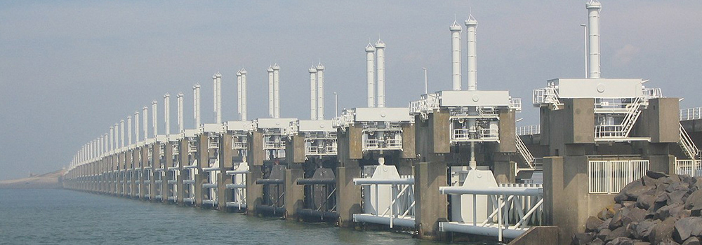
Oosterscheldekering-pohled by Vladimír Šiman via Wikimedia Commons [GFDL or CC BY 3.0]. The Oosterscheldekering (Eastern Scheldt storm surge barrier) between the Schouwen-Duiveland and Noord-Beveland islands is the largest of the 13 ambitious Delta Works constructed after the major flood of 1953 to protect the Netherlands from North Sea flooding.
Supporting reliability research for rural dykes (28 Mar 2017)
Over half of the Netherlands is currently at risk from flooding if coastal defenses fail as only half of its land area is one metre or more above sea-level whilst 65% of the nation’s Gross National Income is reported to be concentrated in its low-lying coastal regions.
In 2008, the Netherlands’ Second Delta Committee presented its concerns of likely sea level rises between 65-130cm by 2100 – exceeding the maximum values previously anticipated and allowed for in the nation’s previous flood defense planning[i]. The Committee recommended a tenfold increase in safety plans, for wide scale sand replenishment[ii] to strengthen the North Sea shoreline, the development of retention basins and the raising of the Ijsselmeer water level to increase retention capacity and freshwater buffer– all at an estimated cost of around €1bn p.a.
RPS supported the first period of a three-year critical research PhD at Technische Universiteit Delft and is providing expert professional input throughout the four-year program. The Reliability-Based Geomechanical Assessment Tools for Dykes and Embankments in Delta Areas (Reliable Dykes) PhD is organised by the Netherlands Organisation for Scientific Research (NWO).
In more recent years, legislation requiring five-yearly evaluations of coastal defenses to ensure they meet safety standards, combined with a growing emphasis on dynamic maintenance (whereby smaller maintenance issues are addressed proactively rather than waiting for the need to reactively address more major issues) has been crucial in improving the condition not only of the defenses themselves but also the strategy and policies for ensuring effective compliance.
Considerable focus has been given to the primary defense network of river dykes and coastal zones and projects to widen the riverbed of main water bodies under the 2006-15 Room for the River program. Less emphasis has been given to the network of non-primary dikes along lesser water bodies in more rural zones. Historically, the condition of the rural dykes has been downgraded in favour of the primary dykes – the main coastal defenses, and maintained in accordance with policies drawn up specifically for the primary dykes.
The RPS-supported study focuses on the country’s rural dykes network which helps to protect approximately 40% of the Netherlands from inundation. Many rural dykes have in the past been constructed with locally available soil materials such as peat which makes them more susceptible to degradation than the stone and concrete used widely to stabilise front line defenses since the nineteenth century. Across the 14000km of rural dykes, 7000km has structural problems relating to peat construction, and 3500km of which is constructed entirely of peat.
RPS Operational Director Reinoud van Oosten has particular professional experience in hydraulic and civil engineering and sits on the User Committee for the four-year program’ he explains that the program helps to obtain new insight in modelling of rural dykes when testing the dykes or making designs for dyke improvements.
NWO’s Applied and Engineering Sciences domain delivers the course through its dedicated program connecting people and resources to technological developments that can help solve societal issues and have economic value. Project supervision is provided by dedicated and experienced field professionals to ensure optimal knowledge sharing opportunities.
The research results will inform industry guidance on rural dykes design and management including the development of probabilistic numeric and risk assessment tools. It includes field tests, validation of the latest probabilistic and numeric techniques, parametric studies and the development of guide and prototype tools.
Notes:
[i] Much of which has its basis in the response to the Great Flood of 1953. A Spring tide and a north north-west storm combined with already high water-levels resulting in widespread dike breaches especially across Zeeland, South Holland and West Brabant. Around 1650sqkm of land was flooded, and over 1800 fatalities were reported relating to the flood.
[ii] Around 12 million cubic metres of sand are replenished each year. The coastal erosion scale is modelled on the 1990 BasisKustlijn (Basic Coastline) measurements.

Heritage Investment (2009)
The conservation of UK heritage is essential to retaining a physical record of British history for future generations. With every moment of a site’s deterioration, another piece of our history is slipping away, never to be recovered. Conservation projects are a very specialized process and local authorities, trusts, and community groups can feel defeated by the prohibitive expense such projects incur.
The Heritage Lottery Fund (HLF) was established by UK Parliament in 1994 to distribute a share of National Lottery money towards the preservation and restoration of British heritage sites, through working with local communities and organizations to support applications and awarding valuable funding for conservation projects.
Such funding was instrumental to the refurbishment of Belfast’s treasured ‘Grand Dame’: Ulster Hall. The huge-scale phased project to restore and upgrade the venue that has seen many legendary events in music, literature, sport and politics since its 1862 opening[1] was made possible through funding from the HLF, Belfast City Council, the Department of Culture, Arts and Leisure, the Arts Council of Northern Ireland, and the Environment and Heritage Service.
Designed by architect W.J. Barre, the building’s Victorian grandeur has been sympathetically and painstakingly restored.[2] Detailed civil and structural engineering has been a key contributor in facilitating the £8.5 million restoration and improvements programme. Extensive underpinning and façade retention of this listed historic building comprised a major element of the design. As well as major refurbishment of the roof, the building, in addition to the main concert hall now provides space for exhibitions and lectures, along with a café. A flexible seating system caters for a 1000 seated/1650 standing capacity with improved disabled access, and state-of-the-art audio-visual systems (including infrared hearing loop technology) with new projection and lighting facilities have been installed.
The largest ever Heritage Lottery Townscape grant to date has been awarded to a project to bring a Welsh harbour town back to its former glory. Following the production of a Regeneration Strategy, the Pembroke Dock Waterfront project has recently been commended at the 2008 UK National RTPI (Royal Town Planning Institute) Awards. The regeneration scheme links modern projects, with a townscape heritage initiative and is being carried forward by the Welsh Assembly Government and Pembrokeshire County Council.
The town’s history shows a bustling and busy military town[3], with its Royal Navy dockyard[1] operating from 1814 until 1926, and having a strong RAF presence from 1930 until 1957. Irish packet boats have landed at Hobbs Point Pier since 1930, and an Irish Ferry Terminal was created in 1979. The key project initiatives include revitalising the existing port and ferry terminal and restoring the historic dockyard buildings, alongside developing a new business park[4] creating 400 new office jobs, and providing a new school. Pembroke’s Napoleonic Martello has already been restored and transformed into a museum as part of the scheme.
With the recent massive influx of inward investment to similar successful regeneration projects[5] appropriate professional consultancy helps to consolidate the regeneration of areas and set a sound commercial benchmark for further investment in years to come.
Notes:
[1] Including the first performances of Stairway to Heaven by Led Zeppelin in 1971, and Whiter Shade of Pale (topping PPL’s most recent chart of the song most played in public) by Procul Harum in 1967, as well as live readings by Charles Dickens during the 19th Century.
[2] A main feature of the restoration has been within the main hall where the metal balustrade to the balconies has been repaired, and the windows have been opened for the first time since they were sealed in the 1980s.
[3] Pembroke’s key periods of growth were in the early (It boasted a population of 11,000 in 1901) and then the later twentieth century which saw the residential redevelopment of the disused Pennar Barracks site.
[4] The new business park will be located at Cleddau Bridge.

Thrills but no spills (2009)
The current economic climate is boosting an unexpected area of service, as more British people swap overseas holidays for local attractions.
As some development projects are struggling to realise completion in an economic downturn, more funding is being injected into the tourism industry, to boost the UK economy by attracting more people to holiday at home.
The value of leisure contracts awarded to the top ten firms in the sector (figures at March 2009) has increased by 17.5%. £1bn worth of contracts were awarded in the last financial year, with £175m worth of leisure contracts awarded in March 2009 alone. This is on top of the industry’s steady growth over the last few years, buoyed by an increasing awareness of carbon footprints, and a more focussed marketing of UK holidays in the national press.
RPS is the top firm in the sector according to figures by monitoring body Glenigan, having worked on £350m[1] worth of contracts last financial year. The Group is well placed to advise the leisure market, offering a comprehensive range of planning, design and environmental services, and is the only planning consultancy recognised by the British Association of Leisure Parks, Piers and Attractions Ltd (BALPPA): the leisure industry’s representative to the government and promoter of safe practice in the industry.
RPS Senior Planning Director, Nick Laister, comments: “We have certainly seen an upturn in the sector, particularly visitor attractions serving UK-based holidays. Operators are generally very confident about the next few years -particularly with the current economic climate and exchange rate forcing people to look closer to home for their holidays, and they are planning their investments accordingly – introducing brand new attractions, and developing new high quality accommodation. With our strong contacts across the industry, RPS has been able to benefit from this upturn.”
Having recently secured permissions for holiday lodge accommodation at Crealy’s Adventure Parks in Devon and Cornwall, and currently preparing applications for a new pirate ship ride and adventure playground at Crealy’s Devon park, RPS is currently working on a resort project at Yorkshire’s Lightwater Valley, and a holiday and retail development at Loudoun Castle in Scotland.
Angela Wright, Managing Director of Crealy says: “RPS’ experience of the leisure and tourism industry combined with their expert knowledge of strategic planning has proved invaluable…RPS has helped us to drive our business forward..[whilst] delivering our famous guarantee of maximum family fun.”
The RPS portfolio of leisure clients also includes Camelot Theme Park, Blackpool Pleasure Beach, and Heritage Great Britain Plc –responsible for Land’s End, John O’Groats and Snowdon Mountain Railway and its Summit Visitor Centre.
Note:
[1] Source: Architects Journal.

All in the detail for Excellence award (2012)
It is one of just seven high-profile schemes entered for Engineers Ireland’s Excellence Award for Engineering Project of the Year 2012 – which will crown the project voted for by the public for the positive benefits and influence it brings not only to the local community, but also to wider society. And RPS staff can vote for it too.
In the first ten days of opening alone, the Titanic Building attracted 40,000 visitors. Standing as the centrepiece of Europe’s largest ever urban waterfront regeneration: the Titanic Quarter development, it covers an impressive 14,000m² and has so far employed over 700 people – almost entirely Northern Ireland people, and many from Belfast itself. Overall, the Titanic Quarter is creating around 25,000 jobs between 2010 and 2025 – forwards – a similar equivalent to the numbers employed by the shipyard at its peak, and not seen since the 1940s.
At 38m high – the same height as the Titanic’s hull, the crystalline building is the stunning gateway to the Titanic Experience: engaging the visitor in a sensitive and comprehensive journey through Belfast’s city and shipyard from the early 1900s; through a first-of-its-kind ride around the ship’s construction using full-scale replicas; lavish fully fitted-out recreations of the Titanic including her engine rooms, saloons, cabins, restaurant and grand staircase; an underwater evocation of the disaster; and a final 3-dimensional reveal of the wreck – seemingly immediately beneath the visitors’ feet. The Experience travels through nine galleries and includes a full museum of photojournalism, artefacts, remnants and memories. Visitors are immersed and engaged with their surroundings using the full cinematic and all-enveloping technology of HD video-projection, 5.1 multi-channel acoustics, full-scale interactive display screens and high-quality, realistic CGI effects – providing an all-encompassing sensory stimulation of sights and sounds and smells.
RPS has been closely involved with the Titanic Quarter project and was appointed to lead engineering services for the development in 2005. We have been involved with the Titanic Belfast building since 2007.
“It is the largest and most intricate Titanic exhibition worldwide, and, as her birthplace, it was essential for us to ensure we provided the full picture of her story: her background and construction, through not only the final disaster, but also the impacts that that had and their aftermath, presenting what is now an international legend in the true representation, without any neglect to what Titanic means to Belfast and our people: then, now and for future generations. It is a beautiful, complex and poignant relationship, and we hope we have come as close as is possible to showing it with the deserved honour and respect, for the community, and all those who visit the Titanic Project,” explains Michael Shaw, RPS Director leading the civil, structural and fire engineering for the project.
Our engineering team are very proud to have been a part of this incredible experience, seeing the completion of such a major project within an absolutely crucial time limit to ensure it was open in time for the centenary. It is extremely satisfying to see the enthusiastic reception the project has received - reflected in the continuing exceptional visitor footfall and in a number of awards and accolades, and we hope it will continue to attract further well-deserved recognitions.
To view the Best of British: read the Titanic Belfast project profile featured in Attractions Management magazine, volume 17
Update:
23 April 2013. Titanic Belfast has welcomed 800,000 visitors from 128 countries in its first year since opening - significantly surpassing previous expectations of tourist footfall.

A project of Titanic proportions (2010)
Belfast’s Titanic Quarter regeneration is a significant major phase in the history of Northern Ireland, bringing new opportunities, new hopes, new homes, and new employment to what was once the city’s busiest area.
Much of Belfast’s economy centred around the city’s shipyards for over 100 years, and during the 1940s the industry boomed. At industry peak, the shipyards were Belfast’s biggest employers –with more than 30,000 Belfast citizens employed at the Harland & Wolff shipyard[1]; The decline began as air travel became more available and popular, and –despite another peak in the 1960s; combined with economic depression and political struggles, the decline continued more sharply from the mid-1970s forward. Since then, a number of regions in the city, and significantly, its shipbuilding hub: the Titanic Quarter, have suffered a long-term industrial decline. However, it is indicative of the solidarity and strength of the city’s heritage that Belfast still has a well recognized marine industry.
The entire regeneration scheme for the Titanic Quarter is on a grand scale, covering 75ha of development land on Queen’s Island at the edge of the city centre, and will deliver a comprehensive mixed-use development providing a realistic estimate of 25,000 new jobs over the next fifteen years. With a £5bn development value, it is acknowledged as one of Europe’s largest ever urban waterfront regeneration projects: delivering 900,000m² of retail, leisure, and office space, together with more than 7,500 homes framing a celebration of Belfast’s industrial heritage, with the Titanic Signature Project at its heart – heading the listed Titanic and Olympic shipways.
RPS is playing a hugely influential role in the scheme for clients Titanic Quarter Ltd (a consortium of Belfast Harbour Commissioners, Department of Enterprise, Trade & Investment, Northern Ireland Tourist Board, Belfast City Council, and East Belfast Partnership) and Port of Belfast, providing civil, structural and fire engineering design and substantiation services (for the Titanic Signature Project, Gateway offices and Arc Apartments), landscape architecture, highways infrastructure assessment and advice, transport advice, and contaminated land assessment and remediation advice.
The whole scheme is overlooked by the twin emblems of the area’s continuing progress and evolution: two listed gantry cranes Samson and Goliath – the treasured giants of Belfast’s skyline. Entering service in 1974 and 1969 respectively, the cranes began work during the shipbuilder’s last peak of real success –a stubborn achievement in a period of low inward investment, and during some of the worst political troubles Northern Ireland has known. Placed on the world’s largest dry dock,[2] the two cranes symbolise much more than just construction: they epitomise the city’s endurance to weather the tides of politics and economy –continually reminding of, and building on Northern Ireland’s rich and complex heritage.
The Big Pour – Titanic Signature Project
The Group’s engineering services have focused on the central Titanic Signature Project, the Gateway Offices and the Arc Apartments. It was an historic moment this month as the foundations were prepared for the £97m Titanic Signature Project with Ireland’s biggest ever single concrete pour in preparation for construction of the building which is expected to attract around 400,000 visitors each year.
The event was attended by retired RPS Ireland: Northern Region Chairman Jonathan Hegan (who is devoting his leisure days to the Titanic Quarter project), as more than 100 workers from Harcourt Construction, and 50 trucks, worked through the night to lay 4200m³ of concrete[3]: 8m below ground level and across a 3,800m² area. Low-carbon concrete was used for the foundations to minimise environmental impact.
Due to open in 2012, the Titanic Signature Project forms a feature link for the key heritage points of Queen’s Island: which include the historic Harland & Wolff offices (built between 1900 and 1919) and the Thompson Graving Dock (built 1903) which was built exclusively for the White Star Liners, and later expanded to accommodate the Titanic and the Olympic. It will house the super-technology Titanic Experience Museum featuring a 50m (164ft) centrepiece model of the Titanic during construction, with an arts centre, theatre and restaurants, and lead to the Titanic slipway which remained in use until the 1960s.
The paving, site-specific street furniture and lighting for the Civic Square surrounding the Signature Project is also designed by RPS, who worked closely with client and contractors to ensure that a high quality of hard and soft landscape public realm was realized throughout the Titanic Quarter scheme, following detailed plans produced by the Group to provide suitable planting and green spaces for the coastal environment that would sit harmoniously with the surrounding landscape and complement Titanic Quarter's development.
Gateway Offices
At the busy intersection of Sydenham and Queen’s Roads, three glossy blocks –covering nearly 14,000m² (150,000 ft²), rise from a once vacant site, and join to form a right-angled triangle. These are the new Gateway Offices: the entrance to the Titanic Quarter, which are already open for business: international financial group Citi have moved into two of the blocks, and Microsoft and Queen’s University Belfast have also taken office space in the development.
The trio of five storey blocks were planned to fit the irregular shape of the site, and frame a central, triangular courtyard. White limestone cladding frames the entrance and approach stairways (echoing the City Hall’s Portland stone), and the courtyard elevations are clad in traditional red brick. The most striking visual effect is perhaps the pure modernism of the vertical window strips and Bauhaus inspired balconies – reflecting 1930s architecture and paving another step in the project’s timeline of design influence.
Inside, the granite floor glides from the entrances into the oak-clad lifts, and shiny steel stairways with stone threads sweep through the layered levels – evocative of a grand liner’s decks. The 25m high triangular entrance spaces feature steel booms and glulam columns to resemble the masts and rigging of tall ships.
Energy sustainability and promotion of green practices were a key consideration from the inception of the Titanic Quarter development. The building achieved a Gold Leadership in Energy and Environmental Design accreditation for its employment of grey-water recycling, geo-thermal water heating, and solar panels. Shallow floor plates are incorporated to attract natural light and ventilation. A semi-basement below provides changing and showering facilities for cyclists alongside the 100 parking spaces.
Arc Apartments
The Arc buildings echo the smooth curves of a watercourse, with a wave skyline graduating from 6 to 10/12 storeys height, concluding in the landmark tower. They are set on piled foundations, with bi-level basement parking beneath, supporting the pure white reinforced concrete slab structure and podium gardens above.
The opulence of the Gateway buildings undulate to the Arc- with glistening limestone floors, walnut panelling, and recessed entrances to the apartments, with subtle brushed steel fittings.
There are 475 apartments, including the penthouses –some on corner suites, and some with balconies. All share the private podium gardens, and all use an inbuilt heat recovery and full ventilation system for energy sustainability.
Corner apartments are fully glazed and all the homes have high ceilings and fully fitted kitchen suites incorporating glossy high-tech features. Waste recycling is encouraged through the provision of three-part recycling bins built in beneath the sinks. The lifts are specifically designed to smoothly accommodate a wheelchair with good turning space, and the layout groups homes in small ‘friendly’ units around landing spaces, mixing size (one, two or three bedrooms) for greater versatility.
Land remediation
Early in Phase 1 of the project, RPS environmental and laboratory assessments found an elevated lead content and small pockets of arsenic in the soil. Trace elements of diesel and lubricating oil hydrocarbons were found in shallow ground, and traces of chromium, copper and oil hydrocarbons were also identified in the underlying groundwater.
The chemicals found are all indicative of the site’s shipbuilding heritage – with toxins arising from original ground-made clinker ash, and from deoxidising and anti-corrosive processes carried out on the steel plates used in hulls. Recommendations from RPS guided the course of the remediation to stabilise the compounds in the soil by adding binding agents to lock in contaminants. The soil can then be examined and reclassified – with much of it expected to be suitable for recycling and re-using on site after treatment.
Titanic transport
The scale of the Titanic Quarter regeneration is colossal, and the plans for leisure and tourism development are impressive. With the creation of so many new homes, and the development of such a large number of new jobs being created in the Quarter, the existing road infrastructure at Phase 1 of the project could only be insufficient to support the inevitable increases in traffic density around Queen’s Island.
RPS prepared and presented a detailed Transport Master Plan in conjunction with the Development Framework for the Titanic Quarter. The Master Plan identified significant deficiencies in the site’s road network, and in the public transport provision serving the Quarter when weighed against the proposed development.
It was acknowledged that development is scheduled to complete at different stages, presenting a case for the phased introduction of extra bus services, as the demand for them is expected to increase. Bus travel will be promoted through a subsidised travel scheme for people living or working in Titanic Quarter, and frequency and capacity of services will increase with the growth of development – with a Rapid Transit Service to be specially introduced to serve the Quarter by the start of Phase 3 of development.
An extensive new network of road access and pedestrian and cycle routes has been planned, which will link with existing infrastructure, and keep traffic impact related to the Quarter at a minimum within it, and around the city. Car parking terms will match those in force for the city fringes, and a new interchange will be constructed at the Sydenham bypass to optimise traffic flow entering and leaving Queen’s Island.
Notes:
[1] Harland & Wolff employed over 50,000 people from the UK at its peak.
[2] The dry dock housing Samson and Goliath measures 556m x 93m.
[3] At an average rate of 250m³ of concrete per hour (or one full load every two minutes).


All the fun of the fair (2009)
It is the promise of the realization of a dream – to restore the 1920s ‘Dreamland’ attraction in Margate, Kent. The Dreamland Trust, chaired by Nick Laister – working with the Princes Regeneration Trust –has secured £3.7m of funding from the Department for Culture, Media and Sport (DCMS), additional to the Heritage Lottery funding secured by the Dreamland Trust earlier in the year.
The funding is a big step towards the Trust’s £12m plans to restore the amusement park, and will facilitate the restoration of the UK’s oldest roller-coaster: the Grade II Listed Scenic Railway which was built in 1920. Nick secured the listing for it in 2002, when it entered the history books as the first British ride to be listed. The restored Scenic Railway will form the centrepiece of a new Heritage Amusement Park on the Dreamland site.
The not-for-profit Dreamland Trust was born from the Save Dreamland Campaign which launched in 2007, after the park’s final 2006 closure[1], and has battled faithfully to ensure the heritage of what was for many years one of Britain’s most visited attractions is preserved for future generations. The campaign was formed by local people following a 2003 announcement by Dreamland’s then owner that the site would become a retail park, and the subsequent purchase of the park by the Margate Town Centre Regeneration Company[2] in 2005.
Despite the fact that the previous owner had stripped and sold many of the park’s assets, and through the near devastating fire[3] –which destroyed a portion of the Scenic Railway’s track and its workshop, and damaged the engine house –in 2008, the Campaign has been successful in acquiring several historic rides to furnish the planned restoration of the park, and expects Phase One works to start next year. Phase One will create the world’s first amusement park exclusively made up of historic rides. It will include the restoration of the Moderne façade of the adjacent Grade II* listed cinema (one of the UK’s first Odeon cinemas) and the cinema’s lower ground floor (which doubles as entrance to the amusement park), as well as the rebuilding of the Scenic Railway and installation of other historic rides. It will all be set in contemporary landscape gardens.
When Southport’s ‘Pleasureland’ amusement park closed in 2006, its incredible collection of historic rides, many of which are the last surviving examples of their type, were scheduled to be bulldozed in the forthcoming site clearance. The Dreamland Trust entered into discussions with RPS client Blackpool Pleasure Beach and Sefton Council to save the rides and give them a new lease of life in the proposed Dreamland restoration project. The rides were donated, and painstakingly examined and dismantled to ensure installation in Margate will be perfect. Other rides have been acquired from Blackpool Pleasure Beach and from Ocean Beach Fun Fair in Rhyl. The rides include the 1922 man-made River Caves, the 1920s[4] Caterpillar, the traditional Haunted Swing and the 1960 Wild Mouse –all from Southport’s Pleasureland.
The site is approximately 17 acres, and at least half of it will be home to the rides (Phase One of the project). The rest of the site will be enabling development, likely to be a mix of residential and retail. Phase Two of the Amusement Park should start in 2012 and will create a live performance and entertainment venue, including exhibition space, restaurants and shops. The project is supported by Thanet District Council, Margate Renewal Partnership, Kent County Council, SEEDA, The Arts Council and English Heritage.
Nick Laister said: “This proposal will create a striking 21st Century tourist attraction that will be a catalyst for the regeneration of Margate that will extend well beyond the seafront. The project has been singled out by the DCMS as the most exciting proposal in the 2009 Sea Change funding round, recognising that it takes its inspiration from the town’s unique seaside heritage, and for that reason has secured by far the biggest share of this year’s £9m grant funding for UK seaside regeneration projects. At RPS, we excel in bringing together often disparate organisations to unlock regeneration opportunities, and I am pleased to have been able to use these skills in what I think represents one of the best examples in the country of the voluntary, public and private sectors working together to the benefit of a local community.”
Nick is involved in a large number of seaside regeneration projects at resorts around the UK.
Further details of the Save Dreamland Campaign and the project’s vision can be found at www.dreamlandmargate.com
Notes:
[1] It was declared closed in 2003, but continued to operate during periods of 2004, 2005 and 2006.
[2] Site owners MTCRC is now one of the organisations working alongside the Dreamland Trust bringing forward this project, and providing the land and £4m of funding.
[3] Confirmed as arson according to contemporary press coverage.
[4] The date of this particular ride – from Pleasureland is unclear – it may date to as early as 1914, or date to around 1922.
[5] Picture reproduced courtesy of Thanet District Council.

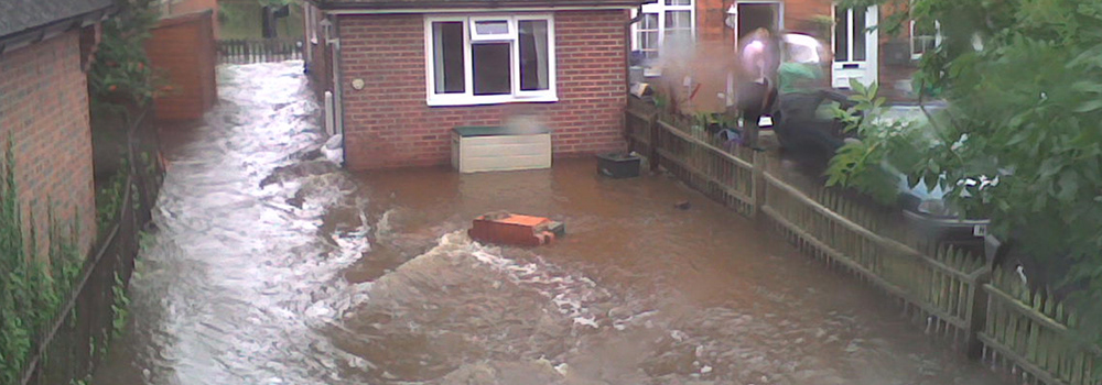
Defending the land (2009)
2007’s flooding was a sharp shock for the UK. What began as a wet washout of a gloomy summer became a three-day war against rising waters, leaving an aftermath of extensive damage that is still under repair.
More than 55,000 homes were flooded in the wettest May to July period since records began in 1776, as 16” (414mm) of rainfall hit the UK. A strong, southerly jet stream combined with uncharacteristically high Atlantic sea temperatures to create a long rainfall beginning in May and culminating in extreme rainfall in late June and late July. By mid-June the ground was saturated, and began to flood.
The rivers were not so much the problem as the drains and sewers: which were soon overwhelmed: around two-thirds of the buildings flooded were flooded by surface waters. Whilst existing flood defences helped reduce the impact, in some areas (particularly those with a lower level of flood defences)[1], they were not sufficient.
As UK population, trade and industry continues to expand rapidly, more developers are looking to floodplains for building opportunity[2], but this brings with it a clear requirement for careful flood risk assessment and planning. RPS Hydrologists work with developers and businesses to help inform decisions for proposed development location, and ensure it is above the appropriate level of risk. RPS experts are also able to help set appropriate flood defences in place for existing built areas.
RPS is providing independent professional opinion for Sitecheck Flood - Landmark Information Group's new flood report for commercial property conveyancing which launched this month. Sitecheck Flood is a significant comprehensive new reporting system bringing together expert opinion and key flood risk data from the Environment Agency, British Geological Survey, Norwich Union and RMS. The data sets include risk from fluvial, tidal, groundwater and pluvial flooding.
Using hydraulic modelling, RPS has recently secured Environment Agency approval for two commercial properties in Brackley, Northamptonshire for the Honda F1 Team. The FRA produced by RPS successfully demonstrated that the buildings would be above flood zone 3 (the 1:100 year plus 30 per cent flood level) and not increase flood risk to third parties.
Particularly complex hydraulic modelling, including mitigation options for on and offline storage potential, was required for the EIA and FRA that RPS has now completed for a mixed-use development in Larkhall, Lanarkshire. As project manager for the EIA (including hydrology, ecology and heritage consultation), RPS experts assessed the risks of downstream flooding from proposed culvert removal and diversion of a tributary watercourse, and co-designed and developed a SUDS[3] system.
RPS is also using hydraulic modelling for a site in Airfield, Midlothian to help inform the proposed site layout of an open cast coal mine by determining the annual probability of flooding,[4] which will help ensure that the development will be above the 1:200 flood plain and will not affect the existing natural flood defences. This includes advising on the diversion of one of two watercourses, which are tributaries of Tyne Water (also running through the site) to ensure no determinable change to the downstream hydrograph.
As the built environment expands, it becomes ever more crucial to not only assess the existing hydrology of a site, but also to accurately forecast potential impact, and develop appropriate mitigation. The floods of summer 2007 came only sixty years after the benchmarked severe floods of 1947,[5] and as Britain settles into what is, so far, another wet summer, we cannot ignore the realisation that whilst ‘flood flows might only be exceeded once in 200 years, this does not mean we have 200 years before the next flood.’[6]
Reviews after the 2007 events quickly identified that better flood defences, a more efficient flood forecasting model, more co-ordinated warning systems and improved public liaison are all key to preventing future severe flooding, and work in these areas is being implemented, with 54 new flood defences built so far, and a multi-faceted programme of co-operation between the Environment Agency, water utilities, Water UK and the Meteorological Office to extend flood research and improve flood forecasting. RPS’ extensive expertise across a range of hydrology services places the Group securely as a significant consultant in a vital field.
Notes:
[1] Some of the worst hit places were West and South Oxford and Oxfordshire, Leeds and Gloucestershire. All are areas where there are significant obstacles to increasing flood defences particularly in the form of conservation areas, and heritage sites.
[2] A number of recently constructed, and partially constructed developments on floodplains were seriously damaged by the 2007 flooding: for example, in west Oxfordshire, the new Riverside Gardens development built on Witney’s water meadows and the not yet completed Aquarius residential conversion of the town’s former blanket factory suffered substantial flooding.
[3] Sustainable Urban Drainage System.
[4] Scottish Planning Policy 7 Planning and Flooding covers the concept of a ‘Functional Flood Plain’ where a site adjoining a waterway has an annual probability of flooding exceeding 0.5% (known as the 1 in 200 year flood inundation envelope – a 1% probability being 1 in 100 year). The policy recommends that built development is not erected within this demarcated floodplain.
[5] In March 1947 heavy rain followed frost and snow. As the temperature rose, surface water levels from rainfall were increased by the melting snow, which the still frozen ground could not absorb.
[6] Environment Agency Review of 2007 Summer Floods.

Hospital updates for better care facilities (2009)
Healthcare is a huge focus of media coverage in these uncertain times. ‘Not enough beds!’ has been a regular headliner for many years, and the shortfall is set to grow. We can only speculate on what exact rise in hospital intake can be expected as ‘flu season sets in later this year, with the swine ‘flu pandemic potentially becoming more serious.
Throughout the UK population there is a substantial long-term demand for improved hospital facilities to meet the existing and future requirements of a rapidly increasing, and ageing population, and to reduce the instances of hospital superbugs, worsened, in part, by overcrowded hospitals.
Forty-three out of forty-nine acute hospitals in Ireland reported concerns to the HPSC[1] that they could not fully follow best practice on tackling MRSA this year due to lack of infrastructure, laboratory resources, and staff. RPS is providing the structural engineering for Enniskillen’s £270m new acute hospital – only the second hospital in Britain to provide an individual room for every patient. Each room is designed for full wheelchair accessibility and has an en-suite.
As part of the DHSSPS’[2] Investment Strategy for Northern Ireland, the socio-economic regeneration plan is a huge project that will not only bring a full complement of patient services but also provide 850 jobs – 180 of which are new. The patient services will include a 24-hour A & E department, critical, maternity, paediatric and outpatient care, and comprehensive diagnostic facilities including radiology and laboratory testing.
The hospital is currently under construction and is a concrete and steel super structure with associated landscaping, car parks, and road access – including a fire brigade access road, and a roundabout. Contracts were signed between the Western Health and Social Care Trust and the Northern Ireland Health Group late last month, and completion is scheduled for 2012.
The planning application decision is expected soon for a £33m Sunderland City Hospital redevelopment scheme to place the hospital’s existing Kayll Road hospital block with a new five-storey ward block, providing a total of 120 new ward bed-spaces and an 18 bed Integrated Critical Care Unit. RPS planning and design experts are providing planning, transport and urban design services and assisting with communications and stakeholder engagement for the project, which is the first stage of a wider vision to bring the acute hospital fully up to date with the latest healthcare facilities.
RPS is providing full Building Services design and supervision for the development of a new Continuing Care Unit at Glanrhyd Hospital near Bridgend. The 19th Century hospital has been in use as a mental health facility for around 130 years, and will continue to operate during the construction process. Given the nature and age of the existing hospital estate, it is a challenging project: RPS’ Mike Caddell says “Working on an operational site of this age always presents a significant challenge, in particular with the integration of new and existing engineering services. Providing the works with minimum disruption to the hospital’s residents will be an essential factor in the project.”
The new 3240m² single-storey unit will provide 42 en-suite bedrooms and associated support facilities with a flexible layout and internal courtyards. The water tower will be retained and encompassed within the building envelope, together with the main service area – including a new electricity substation with a high efficiency dual fuel boiler plant. Alongside this, RPS is also providing Building Services design and supervision services for a 656m² Assisted Recovery day unit providing consulting rooms and occupational therapy facilities and an 876m² Rehabilitation unit accommodating 18 persons and having self-catering facilities. These units are under construction on separate sites in and around Bridgend town.
RPS’ services are well established in the health care field with RPS providing planning services for a number of major hospital projects including Birmingham Children’s Hospital’s new burns unit, engineering and energy services for Newcastle hospital’s new cancer research centre, and recently securing planning consent for two community hospitals in Fareham and Havant.
Notes:
[1] Health Protection Surveillance Centre.
[2] Department of Health, Social Services and Public Safety.

Making history (2009)
Development entails a continual evolution and reshaping of the existing environment and, with each new use of an area of land or a building, a new dimension to its cultural history. Over the course of a few years the changing form of an individual site or property may remain subtle, but, cumulatively, over the course of centuries, there are significant changes in how it is used, and perceived.
In order to learn more about our cultural history and how processes of continuity and discontinuity continue to inform the present day, we must not only preserve a record of more recent history via the existing environment, but also unearth a past that is concealed beneath the ground.
RPS experts in archaeology and historic environment have just completed management of a large-scale project to excavate and record the past uses of a 300ha site in Elstow, Bedfordshire that includes the remains of a huge munitions manufacturing operation from the Second World War. The land is undergoing a new transformation as ‘Wixams’ residential development by Gallagher Estates. The ten-year project began with RPS conducting an EIA for the site.
The Elstow Royal Ordnance Factory operated between 1942-5, employing staff from thirty-three local villages. Comprising more than 250 buildings, it included a factory, filling sheds, fire and police services, medical surgeries, a laundry, 15 miles of railway lines and 16 miles of roads. More recently the site has held warehouses.
A detailed drawn and photographic record was made of the entire factory site whilst an oral history project recorded the memories of former workers during its operation. A full archaeological investigation of the landscape revealed a late Iron Age and Roman ditch enclosed farmstead and a series of Saxon wells.
Working with listed buildings may cover a smaller site area, but brings its own complex workload requiring the preparation of a detailed heritage statement to support any application for works to the property. The accuracy and depth of information provided is under even greater scrutiny when the application is for a high profile establishment.
RPS has prepared and submitted planning application and listed building applications for the internal refurbishment and upgrade of Morton’s Club in Mayfair for client Marlon Abela Restaurant Corporation (MARC). Situated to the north of Berkeley Square, the Grade II listed property was built between 1821-2 and was a private residence until the 1920s when it operated as a casino. It has housed Morton’s – a private members club since 2004. The high-profile club has a world-class restaurant and one of the largest private wine collections in the UK.
The applications seek consent for the upgrade of the restaurant, bar and reception areas of the Club, and the introduction of a night lounge at basement level. Works will include re-cladding the entrance steps with a natural stone, painting the exterior window frames and door frame in black, installing a solid timber entrance door, replacing the modern bar, and laying a stone tiled floor in the reception area. The whole project will provide a subtle upgrade to the existing modern fittings to maintain the quality of the existing design scheme: blending in new modern design while enhancing the historic features of the building.
RPS provides an extensive range of expert historical and archaeological services which complement its planning, design and environmental consultancy services, including: archaeological surveys, heritage statements, listed building services, conservation areas, and building and landscape restoration design.

Check in to the Ocean (2010)
From 2005 until very recently it was empty, and looking considerably like the aftermath of an out-of-hand party. Between 1953 and 1999 it was a lively Butlins where Tarbuck tickled the guests’ humour as a redcoat, followed by a short turn with the Grand Hotel Group. In 1938, however, the smashed windows were brightly lit and the empty halls echoed with fashionable personages including the film star Bette Davis.
The Grade II listed Grand Ocean Hotel is a magnificent piece of Art Deco architecture: the curving wave of a white stucco frontage block with cast glass columns framing the entrance, facing a triangular garden with ornamental water feature. Located in the seaside resort of Saltdean, some five miles to the east of Brighton, the building was designed and built between 1938 and 1939, by Richard H Jones for Ocean Hotels Ltd – an arm of Saltdean Estate Company that had built the Saltdean Lido and developed the adjoining land for housing. The design of the hotel was influenced by nearby De La Warr Pavilion, which had been built in 1935 to the design of Eric Mendelsohn.
When completed in 1939 it provided accommodation for 600 guests across six buildings, with a built-in wardrobe, lavatory, basin, house telephone and electric fire in each of its 411 bedrooms. Public rooms included a 120ft long restaurant and lounge with American-style bar, and dance floor in the main hotel, and staff sleeping quarters were provided above a 150 car garage space.
Now, the official unveiling of the restored building is due to take place at the beginning of February, as the hotel celebrates a new incarnation where new owners check-in for a long stay to enjoy the Grand Ocean’s breathtaking restoration. The hotel is enjoying a new lease of life as a residential development of luxury apartments including affordable housing. 45 one- and two-bed apartments are provided in the listed building, and the less significant dormitory blocks have been replaced with 234 further apartments echoing the white stucco curves of the hotel, and forming a stylish geometric fan design – a popular Art Deco motif.
Most apartments have a sea-view, and all have integrated appliances and under-floor heating. A number of the apartments benefit from private terraces and all apartments can enjoy the Grand Ocean’s beautifully restored ornamental gardens. Principal spaces such as the entrance lobby and main staircase have been fully restored, and a doctor’s surgery for the local area is to be provided in the former dining room.
RPS’ Historic Environment Team based at London Bridge, was initially appointed by developers Explore Living to advise on an emerging scheme for the conversion of the main hotel block to apartments and community uses, in addition to the replacement of the dormitory blocks to the rear. Applications for planning permission and listed building consent were submitted, supported by a heritage statement prepared by RPS which outlined the special interest of the building, and justified the proposals in this context. The proposals were approved by Brighton and Hove Council.
The specialist listed building advice provided by RPS was essential when agreeing the details of the reserved matters and restoration work with the local authority’s planning and heritage officers. Without this advice it may have been problematic for the client to address the detailed requirements of the listed building consents for the site, leading to delays in the sale of the completed apartments.
As the scheme has been implemented, RPS has advised on revisions to the approved design, and has coordinated a number of detailed reserved matters. This has involved developing a close working relationship with the construction and design teams, and with the local authority’s professional staff.
Detailed specialist advice has been provided relating to matters such as the selection of an appropriate Art Deco colour scheme, the restoration and replication of the ornate plaster decoration to the public areas, the replacement of the steel windows and the Marlomeum floor coverings. This included sourcing the correct materials, specialist manufacturers and craftsmen to be used for the works of restoration.
RPS Director, Andrew Dick says “This has been a most rewarding project for the team in that we have been called upon to provide specialist advice on a wide range of heritage issues to the satisfaction of the client and this has been achieved through the establishment of a good working relationship will all of the professionals involved in the project.”

Live and loud – with volume control (2009)
Summer is here, and festival season is getting back into full swing, with the Glastonbury festival only a few days away. Live music, lots of tents, lots of bands, and noise under control, as RPS expert services monitor and manage the sound to make sure that noise does not exceed the licence conditions – improving the neighbours’ festival experiences.
The Glastonbury Festival, which attracts around 180,000 people to Somerset in late June, is the largest outdoor music festival in Europe. There are 15 stages, theatre and cabaret venues and over 300 market stalls providing entertainment. This year’s headliners are Neil Young, Bruce Springsteen and Blur.
Noise is a major community issue, and the target is to reduce the number of complaints and keep disturbance in the surrounding villages to a minimum. A team of 23 experts from RPS’ Brighton and Manchester offices will be providing sound control and advice, working closely with the festival organisers and Mendip District Council to achieve reasonable sound levels and the minimum noise disturbance possible. The team, led by Technical Director David Leversedge, who has been the lead noise consultant for the festival for the past eight years, will cover the measurement and control of off site sound propagation working on a 24-hour basis.
RPS has provided acoustic control services to client Festival Republic Ltd since 2008 and is continuing to provide acoustic services this summer for the Leeds Festival and Latitude, helping to significantly reduce noise complaints. Last year’s team of 7 acoustic consultants from RPS measured music sound levels on and off site during the 10th Leeds Festival to ensure licence conditions were met, resulting in only seven complaints being received about noise.
RPS has a broad experience base in providing sound control services for live music entertainment events and venues both in and out-of doors. RPS acoustic experts have worked with a variety of festival organisers, nightclubs, and major venues including Sanctuary 2008 and Wembley Stadium and will also provide acoustic services for more events and venues this year.

Living with the remnants of war (2020)
As the Netherlands’ third largest city and one of Europe’s greenest urban spaces, The Hague is one of the country’s most popular regions to settle in – attracting people from all around the world, and boasting a strong housing market.
To keep up with high demand for homes in a densely built location, the development of four new apartment blocks in the residential area of Bezuidenhout, uses deep expertise to deliver the project on an especially sensitive site. The former office plot where the apartments will be built sits on land that was impacted by a WWII air strike when off-course allied forces released 67 tonnes of high-explosive bombs on the area. Over 500 lives were lost, much of the city was destroyed, and remnants of the bombs may still remain in the ground.
Unexploded ordnance expert, Liesbeth Brama talks us through the challenges of locating missile remains in a tightly constrained space, navigating 75 years of accumulated rubble deposits, and keeping the neighbours up to date with a very specific take on neighbourhood watch.
Read more here

Material arts (2010)
The recent addition of a new Arts Theatre and Museum at Mossley - near Newtownabbey in Belfast, has completed the redevelopment of a former linen mill. Mossley Mill - under the threat of demolition, was bought by Newtownabbey Borough Council in 1996 and given new life through a phased development transforming it into a major civic facility for the residents of the Borough.
Mossley had been linked with textile related industries since the 1700’s and in 1834 flax spinning was introduced into the area by the Grimshaw family. Edmund Grimshaw began the business and had a mill dam and chimney constructed to provide water and steam power for the mill machinery. Subsequently purchased by the Campbell family in 1859, the complex and the neighbouring village then expanded to include a school, workers’ houses and a sports pavilion. The business later switched to the production of synthetic fibres utilising new manufacturing equipment. By 1978 another buyout moved production away from Mossley and the development fell into decline with the gates finally closing in 1995 and the threat of demolition looming large. However in 1996 Newtownabbey Borough Council bought the property and so kick started a programme of major restoration and conversion.
The first phase of the works was completed in 2000 and involved the complete refurbishment of most of the existing complex to provide a new home for Newtownabbey Borough Council. Work on Phase 2 was commenced in 2008 and completed in 2010. This most recent addition is a new arts theatre which now completes a grand courtyard surrounded on the other three sides by the large blocks of the refurbished mill buildings. Also included in the Phase 2 works was the external refurbishment and “fitting out” of one of the wings of the original mill building (Mossley North). Within the Ground Floor museum that has been created, an original spinning mill sits once more against a backdrop of cast iron columns and beams carrying vaulted brick upper floors and in the midst of an interactive display outlining the story of the site. The upper floors now provide space for office accommodation and the finishes highlight, and are in sympathy with, the original mill structure.
The building is a landmark in the surrounding area offering facilities for a wide variety of civic and community activities for all members of the local community.

The concrete proof (2009)
Concrete has appeared in many structural forms since its standardisation in 1900: through the smooth surfaces of Art Deco architecture, the practicality of post-war housing, the concrete jungle of 1960s-1980s tower blocks, and is now once again enjoying a more widely popular focus, as a new generation of designers celebrate its versatility and strength focussing on sleek, and stylish modern exteriors.
Above all, concrete is one of the most versatile and resilient building materials, especially in the designs of the last twenty years, where steel skeletons reinforce pre-cast concrete panels. Many modern office and residential blocks use steel frame floors with concrete infill to maximise the strength of a building that covers several storeys. Employed effectively, concrete is a cost-effective, flexible and sustainable material.
RPS’ award-winning structural engineering designs for concrete buildings have secured much acclaim including a research centre for the University College of Cork (securing the Concrete Society of Ireland's 2007 Sustainability Design Award) and the Caladh Mór sheltered harbour development in Inis Meaín, which won the Irish Concrete Society Award 2009.
The Braid Museum and Arts Centre in Ballymena recently secured the Engineering Excellence award from the Association for Consultancy and Engineering, a commendation in the 2008 RIAI Irish Architecture Awards and was overall winner in the RICS Northern Ireland Awards for Excellence in the Built Environment as well as winning the individual category of Building Conservation.
Contributing to the urban regeneration of Ballymena, the Braid Museum[3] provides a new and exciting modern extension to the existing Town Hall, standing on a site that has been the hub of local civic life for many generations. RPS provided the civil, structural and fire engineering for the project – including the structural design, and the refurbishment modelling for the town hall to provide a new auditorium and stage area with fly tower.
The foundations comprised traditional pad and strips over the majority of the footprint with a basement provided over part of the site which was constructed using secant piled walls and designed to a Category 4 structural integrity as defined in BS 8102. The superstructure comprised reinforced concrete beams and columns supporting a mixture of in-situ concrete and precast slabs. Reinforced concrete was chosen as the main structural material to assist with acoustic damping between the various sections of the building and also to help provide thermal mass to minimise the amount of energy required to heat and power the building as well as its versatility in providing an economical structural solution to a complicated building form.
The museum offers contemporary conference, tourism and civic facilities with disabled access throughout, including a large main theatre with associated dressing rooms and flexible spaces for workshop and performance use. Described on the Qype online review site as 'a welcome addition to Ballymena, .. a really positive change [which] improves the image of the area', the success of the new centre clearly marks it as the right answer to the civic regeneration of the town, introducing new, modern facilities while improving and restoring the heritage value of the existing listed Town Hall.
Loughborough University’s new multi-storey car park provides a welcome space-saving solution to balancing the requirement for development land to improve campus buildings, whilst maintaining sufficient car parking facilities. As part of the University’s East Park Campus development plan, the new multi-storey car park replaces several surface-lined car parks, freeing these areas for much needed redevelopment of university buildings which are outdated and do not sufficiently meet the university’s needs.
The car park uses 500 tonnes of galvanised steel with precast concrete floors and staircases. RPS provided the architectural and CDM services for the hardwearing structure, which is designed for long service, and effective low maintenance. It uses an innovative feature to ensure the building height is kept to a minimum while providing maximum parking space. Universal column sections are employed for both columns and beams and are joined with moment connections and splices to reduce floor depth without any loss of strength.
RPS provides expert professional services for engineering projects, including civil, structural, and mechanical engineering, design, and planning services.

OpenHydro to be granted seabed installation in UK (2010)
OpenHydro has been announced by the Crown Estate as one of the six successful bidders to be granted seabed lease development rights on the UK seabed. The Crown Estate owns the seabed around the UK and selected from 42 energy companies bidding to install devices to harness wave and tidal power in the Pentland Firth and around Orkney.
The successful operation of such devices could generate enough power to supply half a million homes by 2020. The UK Government envisages that large-scale deployment of wave and tidal power-generation technology beyond 2020 can contribute significantly to its policy to reduce current carbon emissions by 80% by 2050. Focusing on this, the Government has recently issued The Marine Energy Action Plan setting out an agreed vision for the marine energy sector up to 2030.
The announcement is an exciting moment for RPS which, together with fellow project members McLaughlin & Harvey, has been working in close co-operation with OpenHydro since 2005 – working on engineering design and procurement, and developing the unique deployment and retrieval processes that are required for the tidal turbine’s installation.
The OpenHydro turbine was trialled in Orkney in 2006, and then tested in the Bay of Fundy’s Minas Passage in Nova Scotia (Canada) in 2009, securing great acclaim for its efficiency and innovative installation method which significantly reduced engineering and transport time. The technical skill in the engineering and installation of the tidal-turbine won it the NI Construction Employers Federation award in 2009.

Water power! (2009)
Supply sustainability is essential to the utilities sector, with renewables being key to the long-term delivery of greener reliable power and water services. Hydropower is the largest renewable source of electricity, and the balance between water and power is a particularly delicate focus in continuing to suitably meet increasing demand for supply in Ireland.
Ensuring that losses from water supply schemes are absolutely minimised is an essential necessity at every point in any programme of supply, including pre-planning stages. RPS has assessed ten water supply options for Dublin City Council as part of a Strategic Environmental Assessment (SEA) to meet targets to provide enough drinking water for the estimated 2.2m population the Dublin Region[1] is expected to have by 2031.
One of the options explored by RPS water experts is to abstract raw water from Northern Lough Derg on the River Shannon. The Shannon is Ireland’s largest river, and has been used for hydroelectricity generation since the earliest stages of twentieth century hydropower in 1929. Under the option, raw water would be pumped into a ‘cutaway bog’ site near Portarlington where it could be stored and treated, then pumped to supply the Dublin Region when needed, using 125km of raw water and treated water pipelines.
Lough Derg’s water levels are managed within a narrow operating band (480mm) to facilitate hydro-power generation for the Electricity Supply Board (ESB). Ninety five per cent of the lake’s outflows are diverted to Ardnacrusha for power generation, and the proposed abstraction of water would require a minor 1-2% reduction in the generation output. The ESB and water authorities in Ireland work together to maintain a good sustainable balance between water and power supplies, whereby the ESB is compensated for such generation losses.
RPS has successfully demonstrated in its assessment that the external storage facilities proposed in this option would hold at least two months average supply and also have the capability of supplying treated water to Midlands Local Authorities from Portarlington, not only providing substantial benefits in terms of increased water supply, but also reducing compensation costs to ESB through the use of the storage facility which potentially can relieve up to three months’ compensation payments.
Harnessing the potential of lakes and reservoirs is not the only option for renewable power generation using water. Seabed installed tidal devices are also a prime option. The Irish Government has announced a target of 500MW of tidal power generation connected to the national grid by 2020 under its National Strategy for Ocean Energy.
RPS has been working with OpenHydro since 2005. In this time the company has assisted in the design of subsea gravity base structures and a pile mounted test facilities in Orkney, Scotland as well as developing unique deployment and retrieval systems.
The test facility at the European Marine Energy Center (EMEC) in Orkney is the first grid-connected energy device that operates on tidal flow in the UK. This and the gravity base design and deployment has recently won the NI Construction Employers Federation 2009 award, which acknowledges the highly efficient deployment method developed by the RPS/McLaughlin & Harvey project team, working with the client to reduce installation time from a matter of weeks to just a few hours.
Most recently RPS have designed and procured the fabrication of a 400ton gravity base structure and deployment frame for the installation and trial of OpenHydro’s pioneering 10m diameter, one-megawatt commercial scale turbine . This Turbine was successfully deployed on the gravity base in the Bay of Fundy’s Minas Passage –about 10km west of Parrsboro, Nova Scotia in Canada, on 12 November as part of the government’s target for 25% renewable electricity by 2015.
Devising the method involved the design and procurement of a bespoke installation vessel and a 350tonne steel subsea structure with recovery equipment and sensors, to ensure perfect installation in minimal time. The subsea structure used a test platform, set on 37m of long piles, fitted into 8m deep sockets in the bedrock. A subsea cable connects the OpenHydro turbine to the National Grid.
Northern Scotland is generally noted as the optimum location for hydropower generation in the UK and Ireland because of its mountainous landscapes and strong tidal currents. The turbine has been operating at the EMEC test facility in the Falls of Warness, Orkney, in 20m of water with tidal velocities exceeding 8 knots, since its 2007 installation, and the client has now signed major contracts with Nova Scotia Power (Canada) and EDF Energy (France).
This is a major step to OpenHydro’s target of deploying farms of subsea tidal turbines across the world – silently and invisibly creating a reliable flow of green and renewable energy.
RPS Ireland has more than 30 years experience in renewable energy and has worked on a range of renewable projects for sustainable power generation including the design and supervision of wave energy projects, various tidal energy projects and the resource determination for wind, wave and tidal developments.
Note:
[1] The Dublin Region covers the administrative regions of Dublin City, Dun Laoghaire-Rathdown, Fingal and South Dublin as well as significant parts of Counties Wicklow, Meath and Kildare.

Joined-up heating plans (2010)
Dublin City Council is planning to install Ireland’s largest District Heating (DH) network in the city, initially fuelled by waste. The Waste to Energy facility (WTE) is set to deliver heating to thousands of homes and businesses across the city while diverting up to 600,000 tonnes of waste from landfill each year.
The realisation of a DH system for the city, using waste as fuel, will reduce the overall primary and final energy consumption of Dublin, provide the advantages of greater security of supply than the conventional heating systems currently used in Dublin and lower costs for energy production. Ultimately it will provide considerable flexibility in fuel supply as it is expected that other heat sources will connect in the future.
The District Heating network planned for Dublin City is based on best international District Heating experience. The network will be modern, highly efficient and designed to give individual customers value for money and full control of their heating and carbon footprint contribution.The network is currently at conceptual design stage, but some initial pipe-work has already been installed to support the system, which will incorporate 3.5km of pipes in its first phase.
As essential services are being installed in the Liffey Services Tunnel, crossing underneath the River Liffey, DH pipes are also being put in place – to ensure that the potential customers in the Dockland regeneration areas north of the River Liffey can be linked with the heat generation facilities in the south of the city. At the Liffey Services Tunnel DH installation and the newly constructed Spencer Dock mixed-use development on the north quays of the River Liffey, eleven blocks are joined by a network of pre-insulated DH piping. The newly constructed ISO14001 accredited Conference Centre Dublin (CCD) is also enabled for connection to the new DH network.
Perhaps the most crucial factor in ensuring the benefits of DHC (District Heating and Cooling) are realised to their full potential is the establishment of a consistent and effective framework of legislation guiding cities and countries worldwide. The project consultant is currently contributing to Euroheat & Power’s Ecoheat4EU project which is funded by the Intelligent Energy Europe Programme, and which aims to promote and support the use of good legislative mechanisms to establish this framework in Europe. DHC data in Ireland is being gathered, assessed and disseminated for the project, which also targets the UK, France, Spain, Germany, Italy, Norway, Finland, Denmark, Sweden, Croatia, Lithuania, Romania and the Czech Republic.
Despite the current lull in the construction industry, DH remains a vital component for Dublin’s long-term energy future. The sustainable success of DH as an energy option is clearly demonstrated in Copenhagen which has operated a DH system for almost 100 years. Copenhagen’s DH network was further improved following the 1970s energy-crisis, backed by the development of a comprehensive heat management framework, and the city’s network now serves about half a million people in the city, and contributes, with recycling, to diverting 97% of the city’s waste from landfill.
In the UK, significant emission reduction have been achieved already with recent DH networks such as Birmingham City achieving a combined annual emission reductions of 11,600t of carbon dioxide per annum with its District Heating System.
Ireland's National Climate Change Strategy 2007 – 2012 aims to reduce Ireland’s greenhouse gas emissions by over 17 million tonnes (Mt) of carbon dioxide equivalent in the period 2008-2012 through a balanced mix of energy sustainability projects and energy efficiency measures.

Flying high at Trafford Park (2010)
It has been the fastest and most efficient tunnel build to date in Airkix’ experience[1]. As planner, architect and engineer, and CDM Co-ordinator, RPS managed the full design process, ensured all safety and fire regulations were satisfied, devised the initial facilities maintenance plan, and was very tempted to have a go themselves!
The Manchester wind tunnel is Airkix’ second indoor skydiving facility, and an inevitable expansion after the runaway success of their Milton Keynes experience (also designed and engineered by RPS), which was a first in Britain.
Recently opened on the Trafford Quays site (next to the Chill Factor real-snow indoor ski slope), the tunnel is magnificent – with a 14’ (4.27m) diameter, and a1600HP force. At 4-storeys (75’ or 23.86m) high, the £3.5m facility follows the same formula as the Milton Keynes tunnel, but with a glossier and more high-tech finish courtesy of four-years progress in skydiving simulation technology. The experience is complemented by a viewing gallery, café and bar upstairs for the less adventurous. The upstairs also boasts a conference room – giving the facility extra appeal for business team-building events. A reception area, and staff offices and facilities are provided on the ground floor.
As such a unique planning project, both facilities have been an exciting challenge for RPS, not least to satisfy the local authority on the design and visual appearance of the unusual structure. RPS worked closely with Manchester Metropolitan Borough Council to ensure a decision was achieved within just eight weeks. The positive result was further helped by RPS’ PPS6 Leisure Assessment which supported the application.
RPS’ innovative design incorporated the use of pre-manufactured components for quickest construction, optimising site operations time and costs for the client. The foundations of the building are the work-force – a wide, 16’ (5m) deep pit housing the lower turning vanes and other machinery.
Above the piling, the skin of the structure is made from steel sheets –welded on site. All materials of the external skin are specified to closely complement the Chill Factor ski-slope, with the external structure of the tunnel evoking a feeling of weightlessness. Construction time was further optimised by partially assembling the Return Air Towers and arranging the decks (which were supplied in sections) on another area of the site during piling and welding works. The heating and cooling for the building is provided by a highly efficient air source heat pump which recovers waste heat to be re-used in the back-of-house areas.
Created specifically to accommodate the indoor wind-tunnel, the building was effectively created from the inside out. RPS Associate Director, Kester Purslow explains: “RPS’ integrated architecture and engineering services aided the co-ordination of the design process, helping us to deliver our second key project for Airkix on time and to budget. Following the success of the first project in Milton Keynes, we were delighted that Airkix again chose RPS as their design partner.”
The Airkix indoor skydiving experience facilities are amongst the most popular experiences for extreme sport gift voucher retailers, and have been noted by Red Letter Days as ‘the most successful single location attraction that we offer’.
Note: [1] Source: Airkix building progress diary at: airkix.com/manchester/progress


Grand designs in engineering (2009)
Mixed-use developments are the key focus in delivering a comprehensive and consistent revitalisation to urban areas. Even more so than in previous years, the longevity of such developments is vital. A well-planned proposal will provide much needed community facilities, and promise a good, sustainable economy through visitor attractions and business opportunities.
Developer Oakmoor Deeley has appointed RPS as Building Services Consultant for the £70m Belgrade Plaza redevelopment in Coventry. The development is on a grand scale – doubling the size of the original square, extending and refurbishing the multi-storey car park (MSCP), and providing hotel, retail, catering and residential space. When all is completed, three hi-tech multi-storey buildings will provide the main facilities, including two hotels (one three-star and one luxury four-star), casino, restaurants, and a mix of residential apartments including affordable accommodation and university accommodation.
The stunning architectural and engineering design for the former Leigh Mills multi-storey car park secured a Judges Special Award at the British Park Awards. With five additional vehicle decks, the 24-hour car park defies the concrete stereotype of MSCPs – featuring a well-lit dramatic glass tower, housing two scenic & one passenger lifts, a high-class reception area, and conveniences.
The £1m transformation of the square uses revolutionary new surface materials, and has specific grassed and landscaped areas with new seating and a water-feature as well as suitable space for open-air performances adjacent the iconic Belgrade Theatre. A bronze recasting of Coventry’s treasured Bryan Bailey memorial[1] will ensure the sculpture continues to enjoy centre-stage in the square for generations to come.
As well as mechanical and electrical engineering services for the scheme, RPS provided advice regarding acoustics for the development. This included initial noise surveys and reports to support the planning application, followed by detailed design advice for the construction elements of the casino, hotel and residential accommodation.
RPS’ comprehensive consultancy services for mixed-use developments make the Group a number one choice for many major projects which have included the multi-million pound Wolverton Park scheme, Belfast’s highly-acclaimed Titanic Quarter, Mountwise Development in Plymouth and Roath Basin in Cardiff which provides facilities for the BBC amongst others.
Note: [1] First Director of the Belgrade Theatre – the 1962 fibreglass cast by Norelle Keddie was a focal point of the square but the materials had not weathered well.

Midden mapping in the sand (2015)
Modern Stockton Beach is an extremely popular tourism destination, attracting up to 4000 visitors a day at the peak of summer and until more recently has hosted up to 200 dune campsites in good weather. Stretching 32km (20 miles) from Newcastle Harbour, Stockton to Anna Bay, Port Stephens, the beach is mostly hard surface but hosts the largest continuous mobile sand dunes in the southern hemisphere: up to 30m in height, the dunes move around 4m (13ft) north each year[i], and at the top of these sand dunes is where many tourists are aiming – to view the Aboriginal heritage sites of Stockton Bight (1.4m – or almost half – of all Australia’s tourists who took part in Aboriginal heritage experiences last year visited New South Wales).
Whilst the tourism is good for business it also leaves its footprint on the ecology and the heritage of Stockton Bight. The long-impacting combination of tourism (including heavy vehicle carriage from permit vehicles driving on the beach and quad bike tours in the sand dunes) and regular storm events, arguably alongside impacts from artificial construction[ii], the sand mining industry[iii] and an eradication programme tackling the Bitou Bush[iv] previously planted to stabilise the dunes.
Australia’s east coast suffers many East Coast Low (ECL) pressure systems (around 22 per year identified by the Bureau of Meteorology) including remnants of tropical and extra-tropical cyclones. The ECLs are difficult to pinpoint and develop rapidly in offshore surface troughs. Since a 2012 storm surge swept behind the frontal dune severely damaging dune areas including some heritage sites to the extent that the dunes have remained closed to campsites for human safety and environmental protection since, concerns over the identification of the heritage sites and protection of the dunes have been at the fore. This has since been followed by the declaration of a natural disaster caused by an ECL earlier this year when winds reached around 100km/h and waves were recorded up to 10m in height.
Mindful of this, the NSW Office of Environment and Heritage on behalf of the Worimi Conservation Lands Board engaged RPS for a pilot project to help identify sensitive buried Aboriginal landscapes and map palaeosoils (ancient land surfaces) under the Stockton sand dunes. The project aim is to help record and thus be better equipped to manage the preservation of Stockton’s sensitive heritage and to pinpoint at risk areas. Most of the beach falls within the boundaries of the Worimi Conservation Lands stretching over 4000ha[v].
As the first ecosystem in New South Wales to be managed by an Aboriginal Co-management committee structure[vi] – a joint committee of Traditional Owners and Contemporary Managers, Stockton Bight is not only unique within the State but is also managed by a committee with an exceptional understanding of the regions ecosystems. New South Wales has the largest indigenous population level in Australia and is home to some of the highest national concentrations of Aboriginal rock art and engraving sites.
Stockton Bight is traditionally the home of the Maaiangal clan of the Worimi tribe and for thousands of years the nomadic tribes tended to the Stockton or ‘Burrinbingou’ landscape carefully – assigning members a ‘totem’ of a local species to specially protect. The protector could not hunt nor harm the totem and was entrusted to take particular care of its wellbeing. Fishing and hunting limits were set and hunting seasons ordered and rotated in conjunction with the species’ most populous phases.
The Bight hosted periodic hunt/gather camp visits leaving middens to mark the site. These often mostly comprised pipis[vii] and whelk shell remnants –marking clan boundaries and marking ‘used’ sites to guide sustainable land-management. Fire-stick farming/cool burning was practised in designated areas in cooler weather on damper ground – restricting the burn area and boosting the next season’s vegetation growth in particular for those phoenix species relying upon fire for propagation: banksias, wattles and eucalypts.
Some of the numerous middens scattered across the beach and dunes, exposed and covered with the movement of tidal winds, are up to 12000 years old. The 1990 Dean-Jones study of the Bight found around 70 Aboriginal heritage sites – mostly middens, but the Committee has been able to locate 116 more since. One section of the beach is an established midden conservation area.
RPS is using Ground Penetrating Radar to conduct the project. This is probably the most effective of the least intrusive options available to carry out the task. The Ground Penetrating Radar (GPR) was able to successfully map middens and archaeological anomalies as well as show where buried landscapes occurred.
The project tests the efficacy of several methodologies with a view to identifying the best approach and then extending the coverage area in the future.
Further reading:
Coastal Sand Dunes- Stockton Bight Coastal Sand Dune Ecosystem (A geophysical study of the Stockton Bight ecosystem)
Special Climate Statement 44 – extreme rainfall and flooding in coastal Queensland and New South Wales
Explainer: the wild storms that lash Australia’s east coast – The Conversation/University of New South Wales April 21 2015
Notes:
[i] The dune movement is mostly by a combination of longshore drift and saltation.
[ii] Besides key urban development phases around the 1960s, the man-made sea-wall at the mouth of the Hunter River, at the southern end of Stockton Bight forms a barrier to longshore drift sediment flow from replenishing the southern beach and dunes exacerbating coastal erosion at the southern end. However, it is also an important safety feature for shipping and protecting the port.
[iii] Sand-mining by private business for use in construction and road-salt, hydrocarbon extraction and for replenishing other major tourist beaches – often overseas (Stockton sand has been shipped to Hawaii to replenish key tourist beaches). Vegetation is cleared across a wide area marked for mining some weeks before mining begins. After the area has been mined the tailings are shaped and vegetated so that they can begin to become part of the landscape again.
[iv] Bitou Bush is first recorded in Stockton in 1908 – presumed to have been dumped by ships. It proved to be very effective vegetation to help stabilise the dunes and was consciously planted to that end between 1946 and 1968. By 1982 it had been declared a noxious weed and an eradication programme by the NSW National Parks and Wildlife Service (NPWS) began. There has not been a replacement vegetation establishment programme.
[v] Worimi National Park covers 1826ha, Worimi State Conservation Area covers 1042ha, Worimi Regional Park covers 1568ha – 1800ha of this total conservation land is forest.
[vi] The Committee was formed in 2007. The lands were previously managed by Newcastle City Council – the State Government now leases the land from the Committee.
[vii] Plebidomax deltoides (formerly classified as Donax deltoides). ‘Pipi’ is a regional name for these edible saltwater clams – also known as ‘Cockle’ in southern states or Yugari/Eugarie in southern Queensland. Not to be confused with the New Zealand ‘Pipi’ which is Paphies australis.

The 350,000 tonne paper trail (2012)
The trains have been running near Milton Creek in Kent, UK for 145 years now, since the first narrow gauge was laid in 1867 to transport timber to the paper mill in Sittingbourne and RPS has now secured planning permission to allow more than 350,000 tonnes per annum (tpa) of recycled freight along the line.
Just eight months ago, RPS’ planning application on behalf of E.ON and DS Smith paper, to establish a Sustainable Energy Plant (SEP) 1.5km away at Kemsley paper mill was unanimously approved by Kent County Council, and our latest success – on behalf of E.ON and Ridham Sea Terminals Ltd – facilitates the smooth transfer of waste fuel from dockside to SEP without placing significant impact upon the highways infrastructure.
The SEP is due to start construction next year, and will complement the existing CHP plant which provides the energy for Europe’s largest paper mill, which produces 800, 000 tonnes per annum (tpa) of paper exclusively from recycled materials, and has been operating since 1924[1].
The project will add to existing operational rail infrastructure at Ridham Dock to deliver new rail sidings and a new by-pass rail line to enable train unloading without blocking the line, which will join to the existing line private branchline that meets the mainline and serves the mill. It will also provide office accommodation, car parking spaces, loading/unloading and container storage and quarantine facilities, as well as the necessary security provision – using muted colours for the office building and security gatehouse to minimise visual impact, and harvesting rainwater for greywater use on site. RPS’ team from the Leeds and Newark offices provided planning and design services.
Once the refurbishment is completed – by 2015, the clients will be able to handle up to 180 twelve-tonne containers per day at the site, operating 24/6 for 50 weeks per year. Around 417 train runs will be possible per year – using trains of up to 30 wagons (620m length) with a capacity of 1080 tonnes (3 x 12 tonne containers per wagon).
By siting the facility at Ridham Dock, the project provides the widest potential of options for freight transport – as around 80% of the 450,000tpa throughput to the mill can then be transported by rail, and there is also opportunity to transport by barge using the adjacent dock – removing a considerable volume of potential short-trip HGV freight traffic from the public highway.

Waste Transfer Station proposed for Boroughbridge (2007)
The planning application for the transformation of a former railway goods yard, at Milby Lane, in Boroughbridge, has been submitted by RPS on behalf of AV Ogden Holdings.
The 1.5 ha site is located in a bustling industrial section at the edge of the market town, featuring a concrete plant and a food-processing factory. Since its demise as an operative goods yard for the rail industry, the site has been used for coal storage, repair and maintenance of plant equipment and machinery and road haulage by a number of operators. If the planning application is successful, then it will provide a new waste transfer station and recycling facility capable of processing 50,000 to 100,000 tonnes of commercial and industrial waste each year.
North Yorkshire County Council is currently replacing its adopted Waste Local Plan with a new Minerals and Waste Development Framework. The County Council is currently undertaking public consultation on its Preferred Options for sites and has identified the Milby site as one of the possible locations for waste management. Considerations taken into account while selecting the sites included proximity to national/internationally designated sites, the reuse of previously developed land, land within industrial areas and other matters such as traffic impact, landscape impact, archaeological impact and amenity impacts.
The Milby Lane site meets these criteria as it is a former railway goods yard in an industrial location, does not give rise to any impacts upon environmentally sensitive sites, and can provide a much needed resource in central North Yorkshire.
In preparing the planning application, detailed considerations included the detailed design of the proposed facility, traffic impacts, noise impacts and an assessment of the air quality impacts. The site lies within the buffer zone of the 1322 Battle of Boroughbridge: however, given the previously developed nature of the site, discussions with North Yorkshire County Council’s Archaeologist confirmed there were not likely to be any impacts upon historical features.
The proposal offers significant benefits in the reuse of previously developed land, which is not readily available throughout the county, and the provision of much needed waste management facilities for the waste types envisaged. The development provides a modern purpose built waste management facility, thereby minimising the environmental impacts of the development.

Revitalising Manchester’s inner-city ‘Cotton-Town’ (2010)
Plans for the redevelopment of a derelict retail site in Manchester’s Ancoats region have secured approval subject to reserved matters, as part of the Regional Spatial Strategy for North West Manchester.
In the north of inner-city Manchester, Ancoats was a thriving industrial centre of cotton weaving, foundries, and flint-glass manufacture from the late eighteenth century until the 1930s and has sometime been termed the world’s first industrial suburb. Mill development expanded rapidly during the nineteenth century and Ancoats held the city’s largest population by 1815.
By the 1850s the area had a population of more than 53,000[1] and was densely packed with slum accommodation. During the First World War, Ancoats turned some focus from mill machinery to aircraft manufacture, but through the 1930s and as the Second World War progressed a national slump in cotton manufacture and depopulation left the region’s brittle economy severely moth-eaten. This was further compacted by slum-clearance in the 1960s and 1970s – leaving the region in a spiralling decline of industry, living quality, and population.
Following the closure of the famous 1939 black-glass Daily Express offices in 1989, the City Council took action to reverse Ancoats’ fortunes. Land surrounding the Rochdale Canal was made a conservation area, and a number of buildings were listed. The first organisation to specifically regenerate Ancoats was formed (spawning further regeneration groups), and after some over-speculation in the 1990s, 2000 onwards has seen a sure-footed advance in the area’s regeneration – including the landmark Islington Wharf residential development, and the new Metroline link –with a stop on Pollard Street, which is currently under construction.
The site, at the junction of Great Ancoats and Pollard Streets, currently holds two non-food retail units with car parking and soft landscaping. The units have been empty for some time and have attracted vandalism and antisocial behaviour. The site was identified by Royal London Asset Management as a prime location for a mixed-use development to benefit local residents and attract people from outside the area.
The application provides for three new buildings with frontage to both streets, with associated car parking and landscaping. The existing units will be replaced with new commercial and retail space with a hotel and office accommodation above. The new development will blend an influence of the area’s industrial heritage with a modern interpretation, and a sustainable focus.
Building one – in grey brick with a fourth storey green sedum[2] roof, will provide a six-storey 150-bed hotel with a ground floor reception and café opening onto Pollard Street, providing up to 552m² of commercial and retail use located on the ground floor and a mezzanine level which will be accessed from its four-storey Great Ancoats Street frontage. The second, five-storey, building will feature glazed curtain walling and have a 45º frontage to Great Ancoats Street, with up to 2563m² of offices above a maximum 654m² area of commercial and retail space.
Phase One of the scheme will also include an access footpath and cycleway between the two buildings and 47 parking spaces with 5 motorcycle and 65 bicycle spaces at the walled rear of the development where the existing parking is located. New trees will be planted along the Great Ancoats Street frontage and behind the car park, and 10 nesting boxes will be installed to encourage wild birds.
Phase Two is planned to deliver a further 5872m² unit providing office and retail space and up to 45 further parking spaces. Transport Assessments and Reports have satisfied the Planning Committee that the existing vehicular access from Pollard Street is sufficient for access and egress during Phase One, but a further exit is proposed at Phase Two stages which will provide left-turn only egress onto Great Ancoats Street.
Both units are designed to achieve a minimum BREEAM rating of Very Good through a combination of solar thermal panels[3] for hot water (30m² for offices, and 170m² for the hotel), water-efficient taps/showers, use of high-performance double-glazing and fluorescent/LED lighting throughout the scheme, and a VRF[4] system for air-conditioning and heating. The hotel will use less than 30%glazing, and the office less than 55%, while the southwest of the development will benefit from an external shading screen. The scheme’s energy performance is designed to exceed requirements by 25%, and realize a feasible energy contribution of up to 10%.
With a potential ‘Excellent’ BREEAM achievement for the offices, and a strong focus on sustainable delivery to benefit the region emphasised in the plans, and client commitment to public realm investment, the development is an exciting chapter in the revitalisation of a busy community.
Notes:
[1] A target population for the area of 15,000 by 2010 was set in 2000, as a comparison to Ancoats’ population at its 1851 peak of 53,737.
[2] Green succulent with fleshy leaves and small star-shaped flowers. Sedum is a popular alternative to grass for green roofs for its hardiness.
[3] Decorative metal screens will be used to conceal the rooftop solar hot water array.
[4] Variant Refrigerant Flow Systems can provide separate air-conditioning or heating (2 pipe), or the two simultaneously (3 pipe) by connecting an outdoor air-conditioning unit to a series of indoor fan coils in an integral system. Many incorporate compressors that respond exactly to changes in cooling or heating demand. The systems are ideally suited for large developments of separate rooms, and reduce energy consumption while providing high quality heat recovery.

Monitoring advice ensures clear head for heights (2015)
RPS’ advies- en ingenieursbureau team in the Delft office was recently contracted by Volkerrail to conduct an investigation into workplace exposure to welding fumes during the renovation of Galecopper bridge in Utrecht, Netherlands.
The investigation examined the extent of exposure to the fumes among the welding and construction employees and was performed on site at the 300 metre long steel suspension bridge during the works.
As a part of a program of overall civil and structural engineering improvements to the bridge the work involved raising its centre to meet the modern Rijnvaart Height Standard so modern ships could pass beneath it more safely. As one of the country’s major thoroughfares, the bridge remained in almost constant use during the renovations and RPS was tasked with the constant monitoring of the bridge to detect any potential signs of structural movement. A working floor was installed under the bridge to successfully perform the immense task of raising the bridge’s centre by 1.5 metres (giving 70cm more clearance for passage height).
The Dutch state body responsible for social and employment affairs: Inspectie SZW is tasked with ensuring employers and employees comply with the labour protection laws and decrees and combating labor market fraud. Inspectie SZW had established a violation during the renovation work and wanted to suspend work activities having found that the volume of welding fumes in the air at the work-site were too high and personal protection for the workers could subsequently be inadequate.
By sampling and recording an exhaustive program of welding fume measurements (more than 200), RPS was able to furnish Volkerrail with a reliable picture of the exposure patterns for the welders working inside the welding area under a variety of conditions. In this way Volkerrail could optimize the source and room ventilation present on site and improve the working conditions for the welders and construction employees.
Inspectie SZW highly appreciated the process, findings and resultant actions from the survey and described them as exemplary in the field of such renovation work. The previously proposed suspension of work activities was confirmed as no longer necessary and no further sanctions were imposed allowing the renovation works to still complete within the planned time period and budget.

Klotz Associates receives recognition for largest skatepark in North America (2015)
Klotz Associates is getting lots of attention for their work on the design of the North Houston Skatepark and Dylan Park, the largest skatepark in North America. A park on the same site with playground equipment for special needs children was also part of the design. In addition to local and national press, executives from the X Games have toured the site to evaluate the potential for holding future events there. RPS Klotz Associates provided the civil engineering and overall project management.
The awards that the park has received to date are listed below:
*2015 ACEC Texas Engineering Excellence Gold Medal Award in Special Projects for the North Houston Skatepark and Dylan Park
*2015 ACEC Engineering Excellence Awards – Honor Award for the North Houston Skatepark and Dylan Park
*2015 North Houston Association Environmental Impact Award for the North Houston Skatepark and Dylan Park
*2015 American Public Works Association Texas Chapter Public Works Project of the Year, Structures, $5-25 Million for the North Houston Skatepark and Dylan Park
In North America’s largest skate park paired with a park without limits, innovative drainage creates unique green spaces. Greenspoint, a north Houston area with 87% minority population and modest to low-income households, offered limited free recreation choices for youth. The Greater Greenspoint Redevelopment Authority, which generates public amenities, started planning a public park in 2009 to fill this recreational void. When they asked area teenagers about activities they desired in a park, the overwhelming response was “skateboarding.” The Authority also wanted to provide a recreational area specifically designed for special needs children. The 10-acre recreational area was conceived as two parks in one — the world-class championship North Houston Skatepark and a complementary “park without limits,” named in memory of a local child.
Innovative Design Applications
The team kicked off the project by orchestrating a series of charrettes with an advisory committee of skateboarding enthusiasts, eliciting their ideas about desired features. Backyard-style pools, a simple but deep egg bowl, areas that emulate street skating and a snake run connecting them all were features requested by the advisory committee. The skateboarders also asked for a competition-scale full pipe, 20 feet in diameter.
Carving out a barren floodplain site to accommodate these intricate features as well as the accessibility requirements of Dylan Park presented a formidable challenge. Assembling all of these features within a site plan that satisfies agency requirements for stormwater, drainage and detention systems required an iterative process among the engineers, skate park designers and landscape architects that led to a unique drainage solution.
Bordered on three sides by city streets and with a county drainage channel on the fourth side, the entire site is located in a 100-year floodplain. The engineers had to design a detention and drainage system that would carry stormwater off the site without flooding the streets or overloading the drainage channel. A commonplace solution would be to design one large detention pond. Recognizing that the Authority wanted to incorporate green spaces into the project, the engineers devised a unique drainage scheme more akin to a golf course.
Nine separate detention ponds are scattered around the site, providing multiple opportunities to inject green space throughout — a rarity in skate parks where concrete prevails. The ponds hold water during rainfall events before gradually releasing collected water into the drainage channel. Klotz Associates enhanced the detention ponds’ functionality by incorporating bioretention cells with engineering soils that filter water. The resulting water that outfalls to the drainage channel is scrubbed of impurities, improving downstream water quality.
A Complex Site Plan
Balancing skateboarding features, aesthetic needs and technical engineering requirements was a complex exercise throughout the design process. Many of the skate park features created undulation in the site. The client also wanted berms and a grassy banked viewing area instead of permanent bleachers. Because the site is located in a floodplain, flood control regulations require stormwater mitigation to assure any changes in elevation will not be impede the flow of water and therefore potentially flood nearby properties. As part of collaborative design, the skate park designers laid out features for optimal sequencing of skate elements by degree of difficulty while the civil engineers analyzed site grading for effectiveness of the stormwater system, drainage and detention.
Existing wetlands also affected complexity in site planning. Both parks were designed around conditional wetland areas, so that no wetlands mitigation was required. The landscape architect incorporated native plantings to improve the appearance of these areas without negatively impacting the wetlands.
Paving and Special Surfaces
Specifications for surface materials proved another complex aspect of the project. The skatepark designer specified “skateable concrete” to achieve a glassy-smooth finish. This required thicker concrete with a different water-to-cement ratio than ordinary sidewalk concrete. Plans specified five different colors of skateable concrete, including aqua green, to give the backyard-style pools a retro 1970s feel.
Construction of the skate bowls also entailed complexity. To achieve the best skating experience, the number of joints to create the bowls was minimized. Contractors hand-finished the concrete, massaging it to smooth perfection. Dylan Park also incorporated special surfaces, with sandblasted concrete for aesthetics and purple and blue poured-in-place rubber for safety surfaces.
A Focus on Aesthetics
By incorporating detention ponds and green space throughout the parks, Klotz Associates set a precedent for a more eco-friendly and aesthetically pleasing approach to skate parks that diverges from the standard sea of concrete. The team applied creativity in designing the parking lot as egg-shaped with a detention pond in the middle — demonstrating that not all surface parking has to look ordinary.
Social, Economic and Sustainable Development Considerations
In transforming a featureless site into an urban oasis, the team delivered an important community asset. While the skate park is targeted toward skateboarders, families with younger children can picnic on its grassy observation bank. Seniors can interact with their skateboarding grandchildren under one of the canopied rest areas. The lower inclines of the beginners’ skate area can host wheelchair games.
Dylan Park has ADA-compliant ramps, tables, benches and playground equipment, plus open grassy areas for unstructured play and paved trails. The park facilities, combined with multi-sensory features, delight children of all abilities, from sight-impaired and hearing-impaired to autistic and wheelchair-bound.
“A lot of the kids in this area don’t have the funds to play tennis or golf or enroll in Little League. They can go to a skate park with a skateboard and a helmet, and they’re set. They have a safe environment to skate in instead of ravines or empty shopping centers.” Sally Bradford, Greenspoint Redevelopment Authority Executive Director
Community Engagement
The team facilitated active community engagement throughout the process. Charrettes with the advisory committee resulted in the request for a Texas-shaped bowl for the 20-foot-diameter full pipe. This feature provides visual interest from the ground and to airplanes on the flight path to George Bush Intercontinental Airport. The team also held two rounds of public meetings — the first to get feedback on preliminary ideas and the second to review refined plans, which overwhelmingly met community approval.
Integral Artwork
Klotz Associates incorporated artwork commissioned by the Authority into park plans. Because Dylan loved butterflies, artist Dixie Friend Gay incorporated them into the gate and a mosaic of Dylan at his park’s entry. The mosaic is also tactile, providing sensory experience for the sight-impaired. The skate park entry sports an edgy armadillo-themed gate.
Seattle artist Andrew Carson designed a colorful standing mobile for a quiet area within Dylan Park, to appeal to autistic children. Skateboard Hall of Fame inductee and artist Steve Olsen crafted a bronze skateboarder statue for the skate park.
Sustainable Project Elements
Sustainable design is incorporated into multiple aspects of the project — the bioretention cells that improve water quality, wetlands mitigation, a retaining wall of gabions-wire cases with rocks inside that filter water and reduce run-off, grass pavers on the access driveway and energy-efficient LED lighting. Carving the deep skate bowls into the site required moving a substantial amount of soil. The team devised ways to reuse excavated soil for skate park features, the viewing hill and berms, eliminating the environmental impact of hauling soil off site.
Completing the Project
Client Engagement
The Klotz Associates team worked closely alongside Greenspoint Redevelopment Authority Executive Director Sally Bradford, maintaining active engagement with the client’s board members and the local community. The end result more than meets the client’s goal to create a park without limits and fill a recreational void. As the largest skate park in North America, the park has attracted inquiries from all over the U.S., including Alaska, plus the Netherlands and Chile. A YouTube video of a drone flight over the park has racked up 93,000 hits.
Budget and Schedule
Greenspoint’s Tax Increment Reinvestment Zone #11 is funded by five taxing agencies — the City of Houston, Harris County, Lone Star College, Aldine Independent School District and Spring Independent School District. The Authority sought the support from all five agencies to move forward into construction.
Originally slated to go out for construction bids in 2010, the park was put on hold while the Authority worked through concerns expressed by the City of Houston about safety and ongoing maintenance costs. When these concerns were resolved and the project received approval in 2012, construction in Houston was booming and construction costs had escalated substantially beyond the $5.5 million budget originally developed in 2009. Because of the overwhelming public acceptance of the project, Bradford was able to get the Authority’s board to approve the additional funds to get the park constructed. The 2012 bid came in at $6.5 million, construction began in January 2013 and the final costs came in at the bid amount. The project was completed in August 2014.

Upstream Battle: helping to Keep Scotland Beautiful (2020)
A Glasgow Water Services team are no strangers to handling tricky drainage and waterways. The colleagues recently rolled up their sleeves to look out for environmental wellbeing and safety, helping the Upstream Battle® campaign to Keep Scotland Beautiful.
Upstream Battle, in partnership with Recoup, focuses on tackling the issue of waste along the full length of the River Clyde and its tributaries, raising awareness and inspiring positive action because ‘It’s estimated that up to 12.7m tonnes of plastic gets into the sea every year – that’s a truck full of litter a minute…Many initiatives that tackle marine litter are targeted at cleaning up our beaches or trying to remove litter from the sea once it's there. But, as 80% of all marine litter comes from land, we also need to face this problem upstream, where litter is washed into gutters, blown into streams or carelessly discarded.’ [Upstream Battle campaign]
Walking along the Clyde Walkway from Cuningar Loop to the Clyde Gateway Bridge in Glasgow’s east end, the team bagged plenty of rubbish discarded along the route, ready for pickup by the local council, leaving the community cleaner and stopping that rubbish from entering the Clyde and eventually the ocean.
Walking along the Clyde Walkway from Cuningar Loop to the Clyde Gateway Bridge in Glasgow’s east end, the team bagged plenty of rubbish discarded along the route, ready for pickup by the local council, leaving the community cleaner and stopping that rubbish from entering the Clyde and eventually the ocean.

Pulling out of St Erth station, Cornwall, UK
Connecting rail and road with award-winning scheme (2019)
A specialist team was engaged to support the delivery of an award-winning multi-modal transport hub for Cornwall County Council. Designed to enable sustainable transport in West Cornwall, the hub addresses road congestion issues and supports sustainable commuting by connecting rail, road, pedestrian and cycle routes around St Erth railway station. The project involved a complex development site presenting health, safety and environmental challenges and the RPS team used combined geotechnical, environmental and mining skills to identify and deliver a bioremediation solution.
The project recently received CEEQUAL’s Exceptional Achievement Award for best practice demonstrated in achieving evidence-based sustainability. In particular, the judges commended our ‘hard work in finding solutions to [the] challenges’, which ‘minimised the financial and environmental consequences of the remedial work'.
Cornwall’s rural St Erth station plays hosts to two very busy rail lines - the Penzance to London Paddington commuter route, and the St Ives line - a valuable year round local commuting line heavily used by tourists during the summer season. A natural apex for Cornwall’s train and road traffic flow, St Erth was key to a deliverable travel plan that could reduce the pressure on the region’s transport network while enabling more sustainable travel options for all or part of commuter journeys.
Completed upgrades to the small, rural station with few amenities have significantly improved access around a busy commuter centre and popular tourist area.

Le Shuttle on line for Occupational Health (2014)
RPS’ Occupational Health team in the UK has expanded its service delivery offering to the rail industry with the award of the Eurotunnel contract.
Opened in 1994, the Channel Tunnel, the vital link between the United Kingdom and the continent, has been used by more than 300 million passengers. The rail Shuttle transport system carries 2.5 million cars (Le Shuttle) and 1.5 million trucks every year, making it by far the world leader in piggyback transport. High-speed passenger trains and rail freight trains also run through the Tunnel.
RPS was awarded the three year occupational health contract in September 2013 and started delivering service to the UK employees at Eurotunnel’s head office near Folkestone in Kent from October. The team of two Occupational Health Advisors and one Occupational Health Physician work from a purpose built clinic at the Eurotunnel site and are supported by the RPS clinic based in Cornhill. RPS now offers day to day services including rail medicals, surveillance, drug and alcohol services and sickness absence support.
The award has added yet another well known household name to the Occupational Health portfolio, enhanced RPS’ rail experience and has opened further opportunities within the sector.